Super Rapid Scan images of lake-effect snow bands
The GOES-13 (GOES-East) satellite was placed into Super Rapid Scan Operations (SRSO) mode on 11 December 2013, to provide bursts of imagery at 1-minute intervals in support of the OWLeS project. McIDAS images of GOES-13 0.63 µm visible channel data (above; click image to play animation) showed multiple lake-effect snow (LES) bands over Lake Superior, Lake Michigan, and Lake Huron (with a larger dominant band over the northern portion of Lake Huron). Large single-band LES features had also formed farther to the east over Lake Erie and Lake Ontario, but their presence was masked by bands of layered high clouds over that region.
Prior to the beginning of the SRSO period, a comparison of the 18:23 UTC Suomi NPP VIIRS 0.64 µm visible channel image with the corresponding false-color “snow-vs-cloud discrimination” Red/Green/Blue (RGB) image (below) could be used to get a qualitative indication of which LES bands might be glaciating — snow and ice on the ground (as well as clouds whose tops were comprised of ice crystals) appeared as varying shades of red on the false-color image. Surface METAR data showed that cold surface air was flowing southeastward and eastward over the still-unfrozen waters of the western Great Lakes.
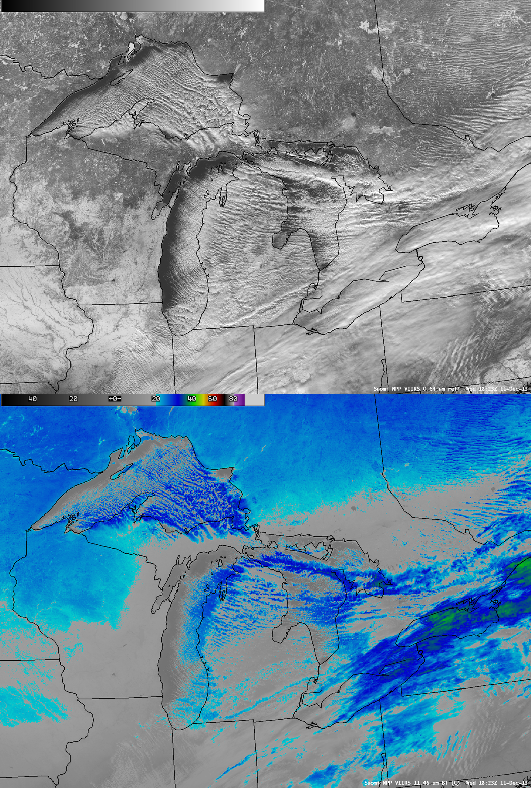
A comparison of the 18:23 UTC Suomi NPP VIIRS 0.64 µm visible channel and 11.45 µm IR channel images (below) indicated that many of the cloud bands exhibited IR brightness temperatures in the -20 to -30º C range (cyan to dark blue color enhancement), with the coldest IR brightness temperatures of -35º C associated with the most organized bands in eastern Lake Superior and northern Lake Huron. The patches of layered high clouds farther east over Lake Erie and Lake Ontario had cloud tops as cold as -40º C (green color enhancement).


