Snow/sleet/ice on the ground in Texas and Oklahoma
In the wake of a strong cold frontal passage, a series of disturbances left swaths of snow, sleet, and ice (from freezing rain) across parts of Texas and Oklahoma during the 05 December – 06 December 2013 period. Snowfall accumulations were as high as 5 inches in Texas and 6 inches in Oklahoma; sleet accumulations reached 3-3.5 inches and ice accruals were as great as 1.0 inch in Oklahoma and 0.4 inch in Texas.
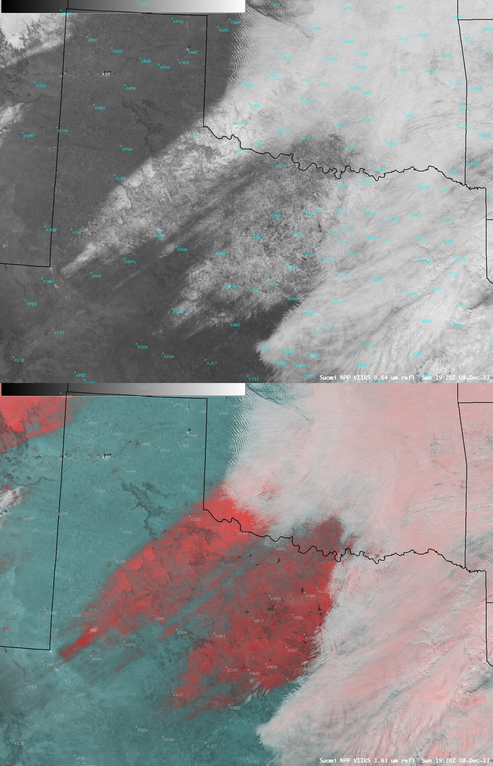
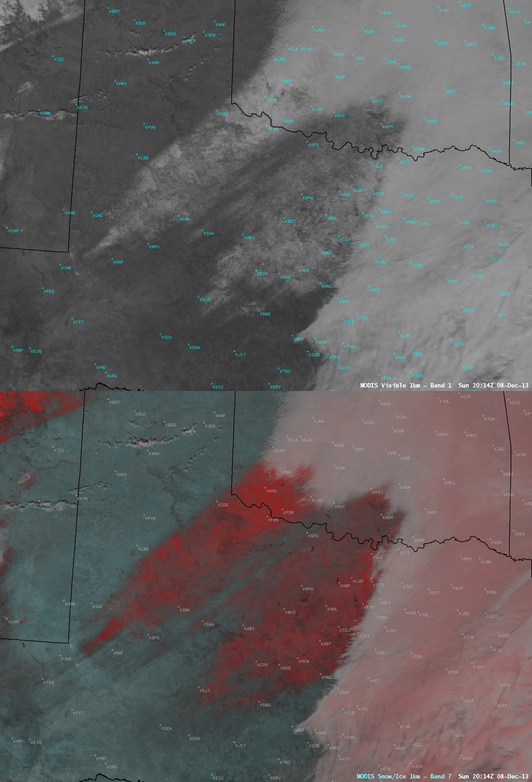
After clouds finally began to clear the region on 08 December, areas that still had snow/sleet/ice on the ground could be seen in comparisons of visible channel and false-color “snow-vs-cloud discrimination” Red/Green/Blue (RGB) images from Suomi NPP VIIRS at 19:20 UTC or 1:20 PM local time (above) and from Aqua MODIS at 20:14 UTC or 2:14 PM local time (below). Areas where the ground remained covered with snow/sleet/ice appeared as darker shades of red on the false-color RGB images (in contrast to supercooled water droplet clouds, which appeared as shades of white, and ice crystal clouds, which appeared as shades of pink to light red).
===== 10 December Update =====
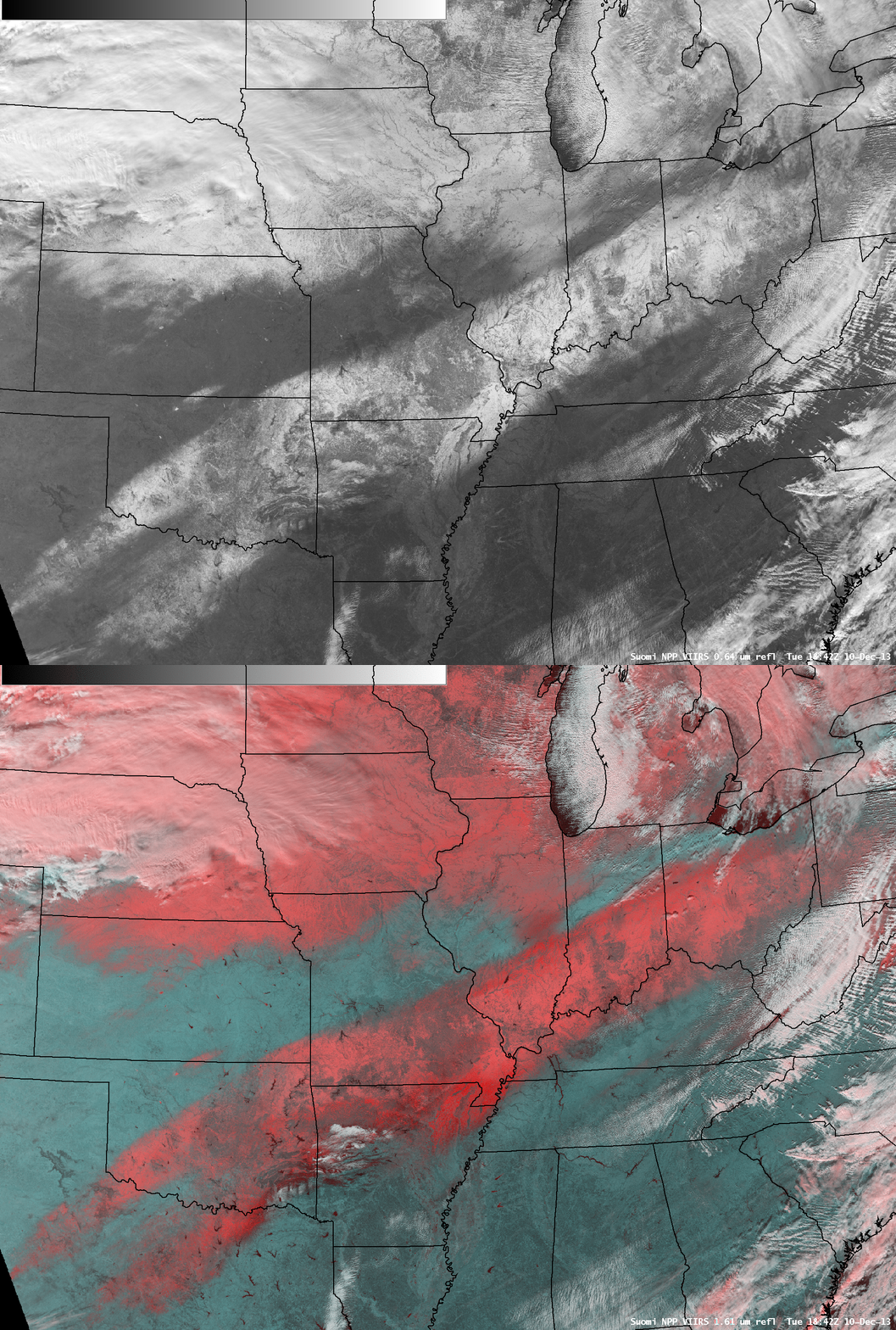
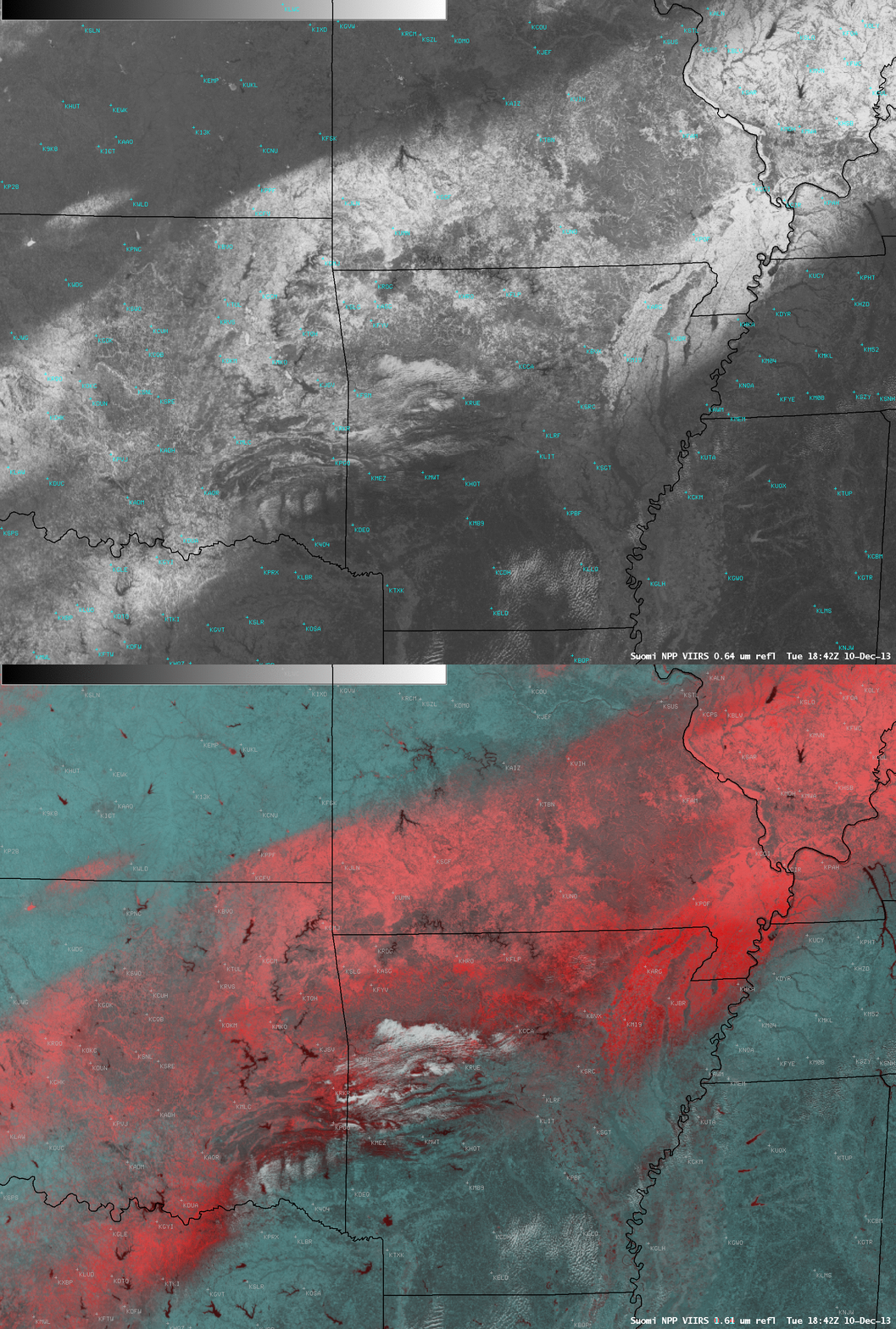
On the afternoon of 10 December enough clouds had cleared across the central US to reveal the large swath of snow/sleet/ice that still covered the ground from Texas to Ohio, as seen in a comparison of Suomi NPP VIIRS 0.64 µm visible channel and false-color “snow-vs-cloud discrimination” RGB images at 18:42 UTC or 12:42 PM local time (above). Note the darker red appearance of the southeastern edge of the swath over parts of Texas, Oklahoma, Arkansas, and Missouri — since sleet accumulation and ice accrual (from freezing rain) are stronger absorbers of radiation than snow cover at the 1.61 µm wavelength used in the creation of the RGB images, those areas appear darker. Ice acrual from freezing rain reached 1.25 inches in southeastern Oklahoma and west-central Arkansas, and sleet accumulations were as deep as 2-3 inches in Arkansas.
A closer view (centered on northern Arkansas) is shown below. For additional details on the sleet and freezing rain aspects of this winter storm, see the event summaries posted by the National Weather Service forecast offices at Norman OK, Tulsa OK, and Little Rock AR.


