Mesoscale vortex over western Lake Superior
McIDAS images of GOES-13 0.63 µm visible channel data (above; click image to play animation) revealed the well-defined circulation of a mesocale vortex over far western Lake Superior on 28 November 2013. During the day, this mesovortex was slowly migrating southward toward the Apostle Islands of Wisconsin. As much as 7.5 inches of snow was reported north of Bayfield in far northern Wisconsin, likely a result of enhanced snowfall rates associated with the passage of the mesovortex.
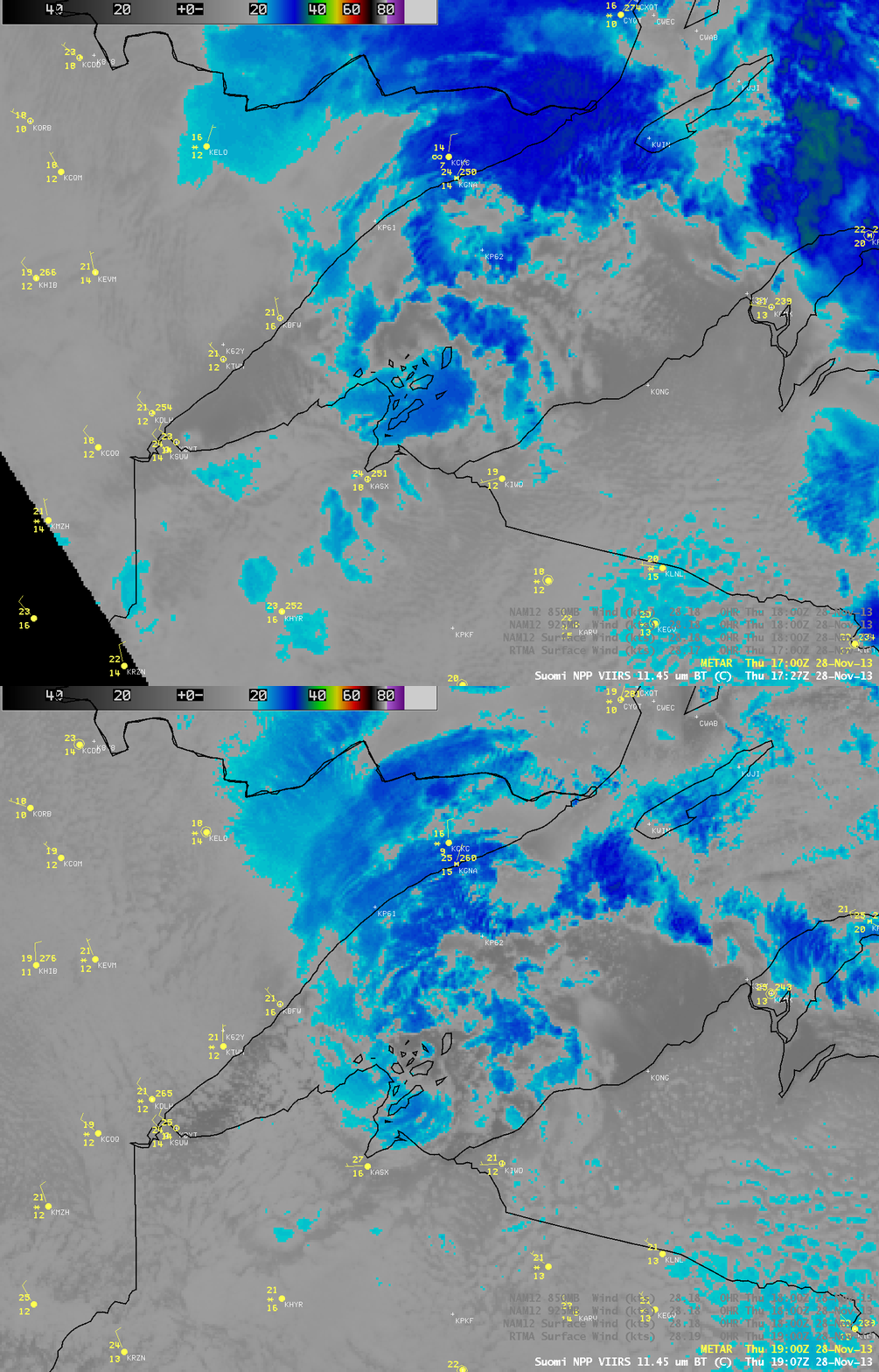
AWIPS images of VIIRS 0.64 µm visible channel data from consecutive overpasses of the Suomi NPP satellite at 17:27 and 19:07 UTC (above) showed better detail in the structure of the mesovortex; the corresponding VIIRS 11.45 µm IR images (below) indicated that cloud top IR brightness temperatures were generally in the -25 to -30º C range (darker blue color enhancement), suggesting that cloud glaciation was likely.
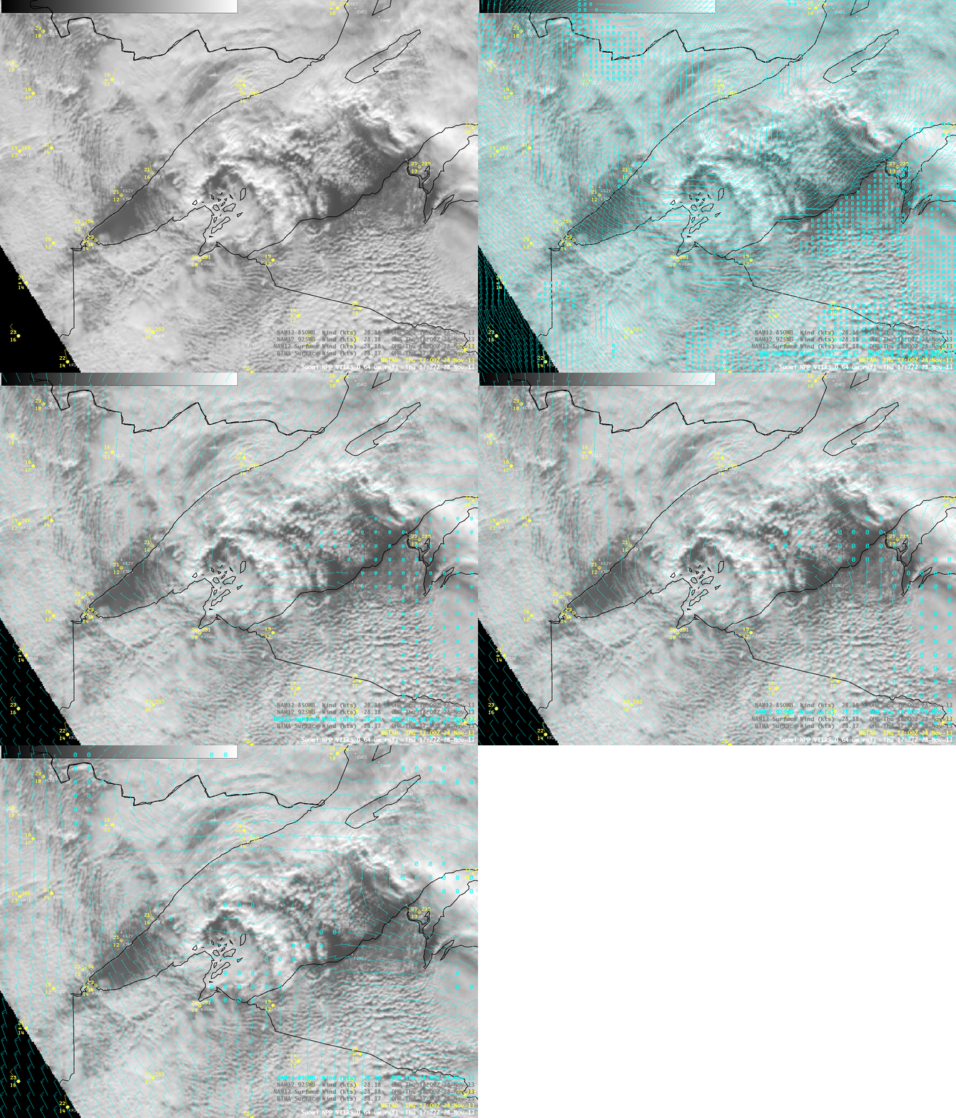
A comparison of the 17:27 UTC VIIRS visible image with the 17 UTC RTMA surface winds and the 18 UTC NAM12 surface, 925 hPa, and 850 hPa winds (below) showed that neither the RTMA nor the NAM12 wind fields did a good job of locating the actual center of primary mesovortex circulation — demonstrating the value of satellite imagery for a more accurate diagnosis of such small-scale features.


