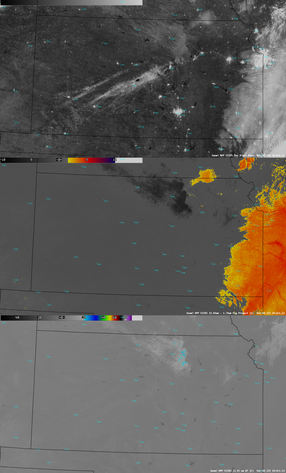
Mesoscale bands of snow cover in Kansas
Parts of Kansas received up to 5-6 inches of snowfall on 18 October 2013 (NWS Local Storm Reports). The following night, after the clouds associated with the storm system had moved eastward, the southwest-to-northeast oriented bands of snow cover could be clearly seen on an AWIPS image of Suomi NPP VIIRS 0.7 µm Day/Night Band data at 08:33 UTC or 3:33 AM local time (above). Due to ample illumination from a Full Moon, the bands of fresh snow appeared quite bright, as did the back edge of the stratus cloud deck that covered far eastern Kansas and western Missouri (which showed up well on the IR brightness temperature difference “fog/stratus product” image). A thin patch of mid-level clouds was also moving over north-central Kansas — the 11.45 µm IR brightness temperatures of that cloud feature were generally warmer than -20º C (cyan color enhancement).
After sunrise on the next day (19 October), GOES-13 0.63 µm visible channel images (below; click image to play animation) showed that the bands of snow cover melted rather quickly, due to the relatively high October sun angle.


