Super Cyclone Phailin (02B)
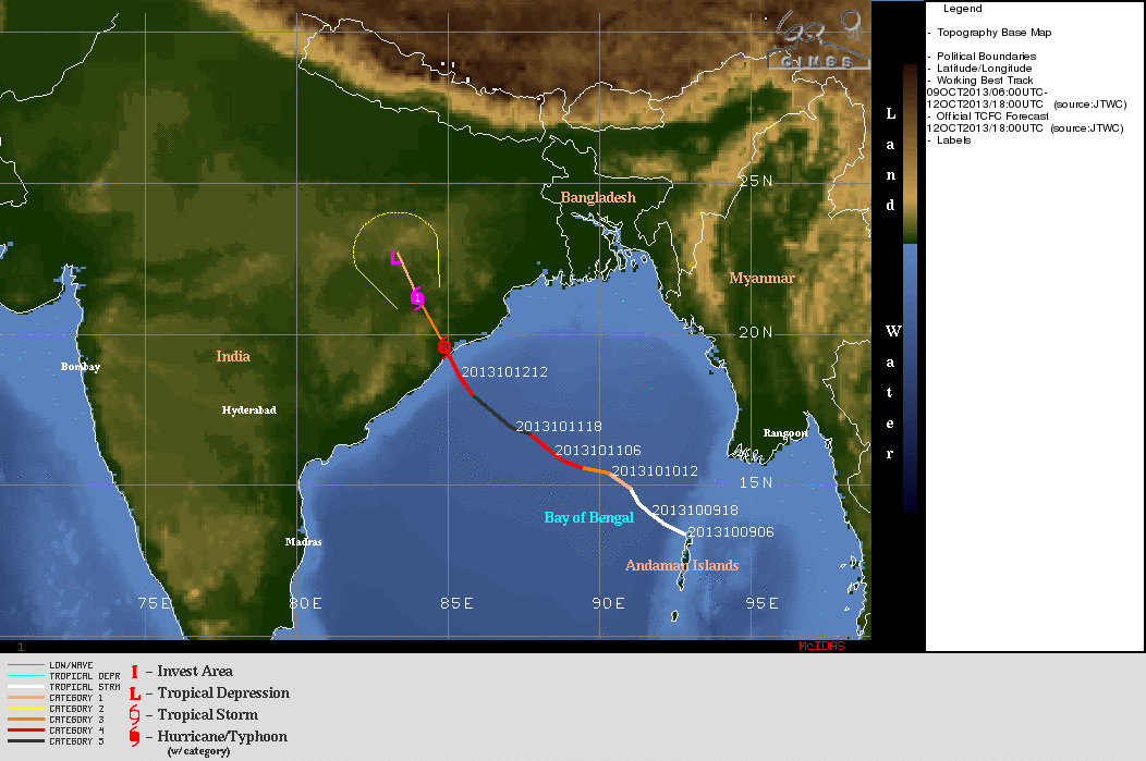
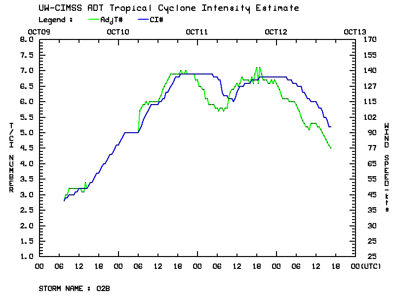
As seen on the Cyclone Phailin (02B) track map from the CIMSS Tropical Cyclones site (above), the storm formed near the northern Adaman Islands on 09 October 2013. As Phailin tracked northwestward across the Bay of Bengal, it underwent a period of rapid intensification on 10 October, as indicated by the Automated Dvorak Technique (ADT) intensity estimate plot (below). Phailin reached Category 5 intensity near the middle of the day on 10 October.
McIDAS images of EUMETSAT Meteosat-7 11.5 µm IR channel data (below; click image to play animation) showed the expansive area of very cold cloud tops exhibited by Phailin, with IR brightness temperatures in the -80 to -90º C range (violet to darker purple color enhnahcement).
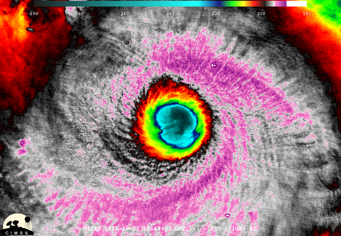
A McIDAS-V image of 375-meter resolution Suomi NPP VIIRS 11.45 µm IR channel data (below; courtesy of William Straka, CIMSS) offered a more detailed look at the structure of the eye and eyewall region of Phailin at 11:43 UTC on 11 October.
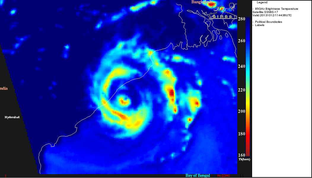
DMSP SSMI/S 85 GHz microwave data (below) suggested that Phailin was undergoing an eyewall replacement cycle prior to landfall, which likely accounts for its drop in intensity to a Category 4 storm (Phailin warning text issued at 15 UTC on 12 October).


