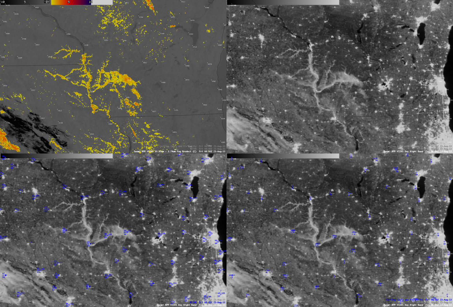
River valley fog in southwestern Wisconsin
A comparison of AWIPS images of Suomi NPP VIIRS IR brightness temperature difference (BTD) “Fog/stratus product” and 0.7 um Day/Night Band images (above) revealed the formation of nocturnal river valley fog across parts of southwestern Wisconsin and the adjacent Upper Mississippi River Valley region at 08:00 UTC or 3:00 AM local time on 23 August 2013. Overlays of METAR surface reports and cloud ceiling/surface visibility indicated that the fog was restricting visibilities to 1/4 mile at a few locations.
A comparison of the 375-meter resolution (projected onto a 1-km AWIPS grid) VIIRS BTD “Fog/stratus product” image with the corresponding 4-km resolution GOES-13 BTD Fog/stratus product (below) demonstrated the advantage of better spatial resolution for detecting these fine-scale river valley fog features.


