Unusual late-season Nor’easter
An unusual late-season nor’easter storm produced heavy rainfall (as much as 6.14 inches at Whiting, Maine) and heavy snow (as much as 13.4 inches at Mount Mansfield in Vermont and 34 inches at Whiteface Mountain, New York) during the 24 May – 26 May 2013 period. McIDAS images of GOES-14 6.5 µm water vapor channel data (above; click image to play animation) displayed some interesting storm structures during the 25-26 May timeframe.
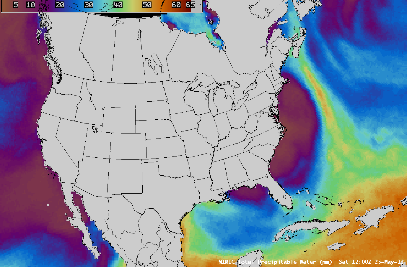
AWIPS images of the MIMIC Total Precipitable Water product (below; click image to play animation) showed that a long atmospheric river was transporting abundant tropical moisture northward, which was then wrapping inland around the storm circulation.
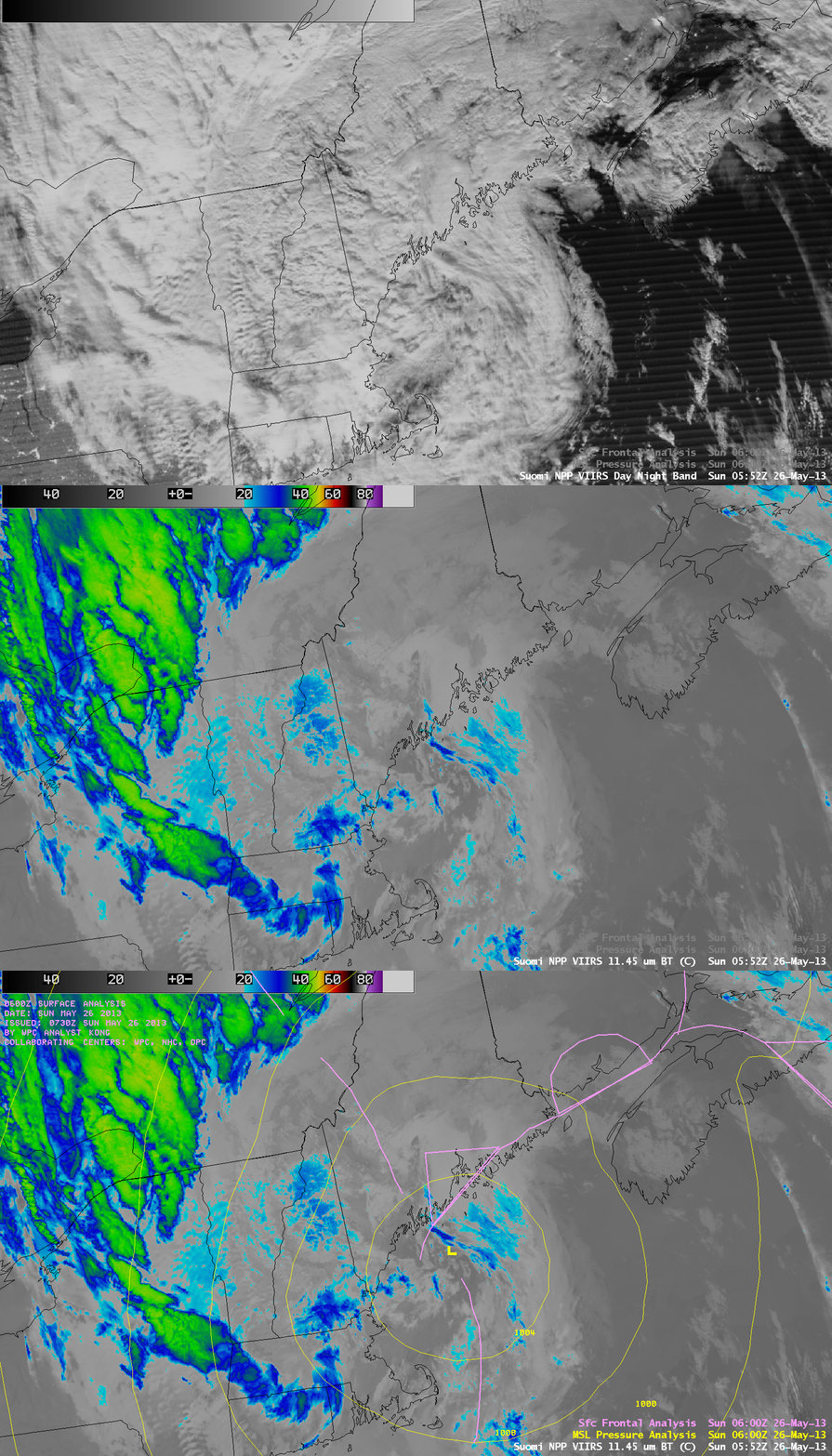
A comparison of 1-km resolution Suomi NPP VIIRS 0.7 µm Day/Night Band and 11.45 µm IR channel images at 05:52 UTC or 1:52 AM local time on 26 May (below) showed cloud features associated with the storm as it was centered just off the coast of Maine. Strong northerly/northwesterly winds along the back side of the storm (gusting as high as 102 mph at Mt. Washington, New Hampshire) were producing bands of orographic waves clouds over parts of Vermont and New York. This example helps to highlight the “visible image at night” capability of the VIIRS Day/Night Band (given ample illumination by moonlight).


