Tornado outbreak in the Dallas/Ft. Worth area in north Texas
An outbreak of tornadoes across the Dallas/Ft. Worth area in north Texas on 15 May 2013 produced up to 16 tornadoes (NWS summary) which were responsible for 6 fatalities. Hail as large as 4.0 inches in diameter and a wind gust as high as 80 mph also accompanied these severe thunderstorms (SPC storm reports). A McIDAS image comparison of GOES-15 (GOES-West) and GOES-13 (GOES-East) 0.63 µm visible channel data (above; click image to play animation) showed the rapid development of convection across the north Texas region, with the storms exhibiting a number of overshooting tops. The locations of Granbury (G) and Cleburne (C) were noted on the images, where EF-4 and EF-3 tornado damage occurred.
A similar comparison of GOES-15 (GOES-West) and GOES-13 (GOES-East) 10.7 µm IR channel images (below; click image to play animation) showed the cold cloud top IR brightness temperatures associated with these storms, which were as cold as -63 C (darker red color enhancement) in the vicinity of Granbury and Cleburne around the time of the tornadoes.
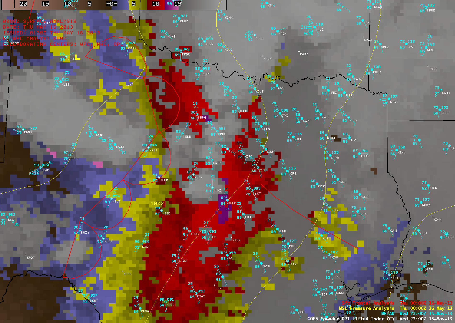
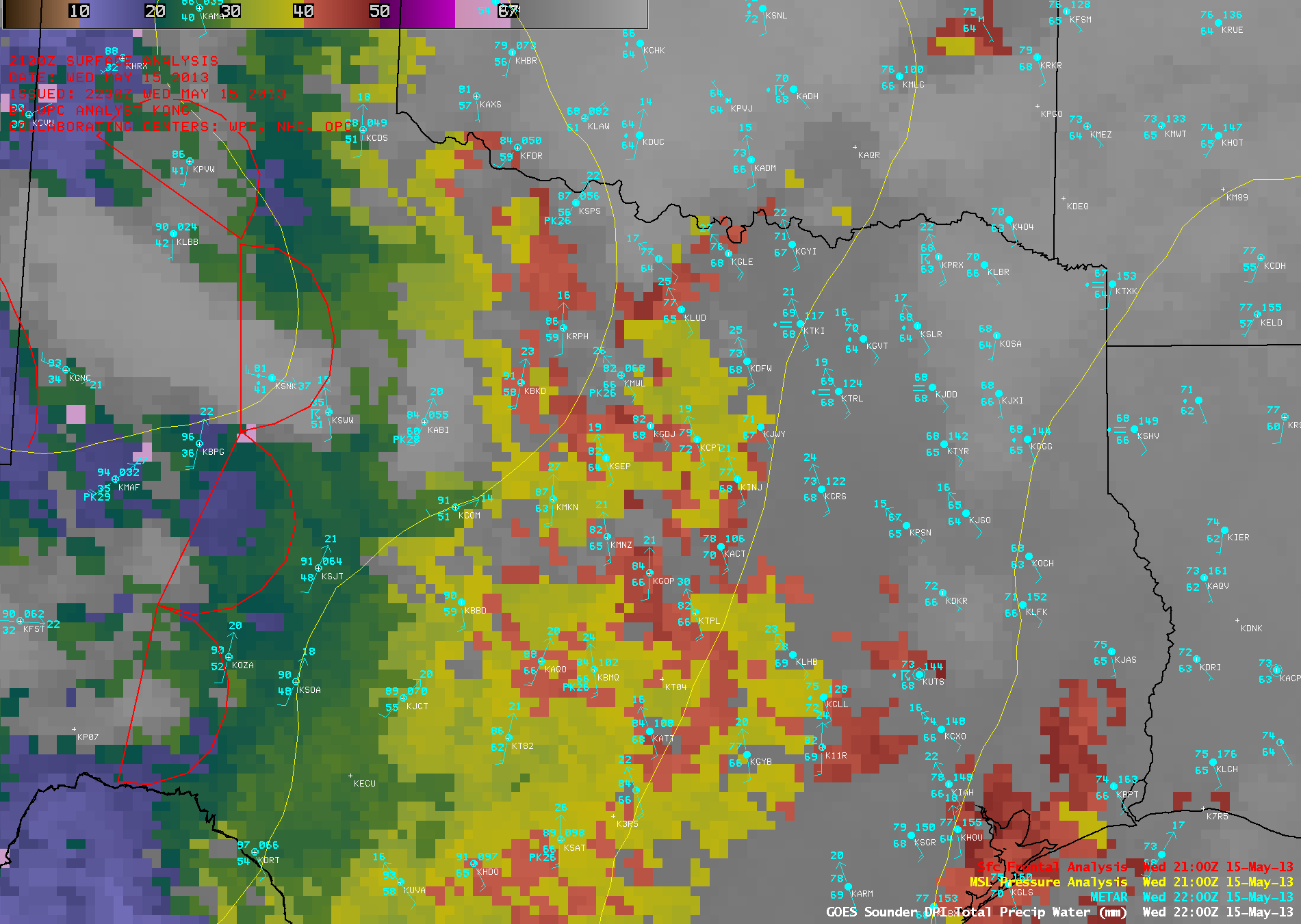
These storms developed along an axis of instability and moisture that was located to the east of a dryline that was bulging eastward across north Texas — the GOES-13 sounder Lifted Index (LI) derived product images (above; click image to play animation) revealed LI values as low as -12.4 C (dark purple color enhancement) at 23:00 UTC, and the GOES-13 sounder Total Precipitable Water (TPW) derived product images (below; click image to play animation) showed that TPW values were as high as 46.7 mm or 1.84 inches (darker red color enhancement) at 22:00 UTC. METAR surface reports are plotted on the sounder images (Granbury is station identifier KGDJ, and Cleburne is station identifier KCPT).


