Convective Downbursts and Heatbursts in Wisconsin
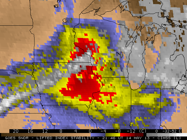
Strong convection in the late afternoon/early evening produced wind damage and heat bursts over southern Wisconsin late in the day on May 14, 2013 in a region where severe convection was not considered likely. GOES Sounder data did an excellent job of depicting the instability that developed in the late afternoon. The animation above shows strong destabilization starting shortly after 1800 UTC, and persisting as the convection moved through southern Wisconsin.
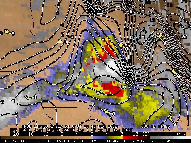
The instability associated with this convective event was very localized, and easily slipped in between the radiosonde stations. This is therefore another example of the benefit of the GOES Sounder DPI products: Not only do they provide hour-by-hour coverage, so that an evolving situation can be monitored, but they can show mesoscale features that are poorly sampled by conventional radiosonde data. The above image shows the 2346 UTC 14 May GOES Sounder DPI LI over the upper midwest; superimposed upon the image are the Lifted Indices computed from radiosondes and the LI computed from the GFS model. The strongest instability is not well sampled by the radiosonde network.
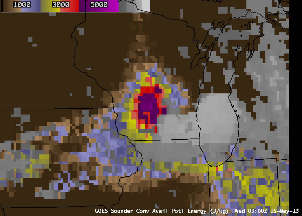
Convective Available Potential Energy (CAPE) can also be used to diagnose the potential for convection. In regions where CAPE values are large, convection can grow explosively. The AWIPS screen capture of CAPE computed from the sounder, above, shows values exceeding 4000 J/kg even after the convection has passed!
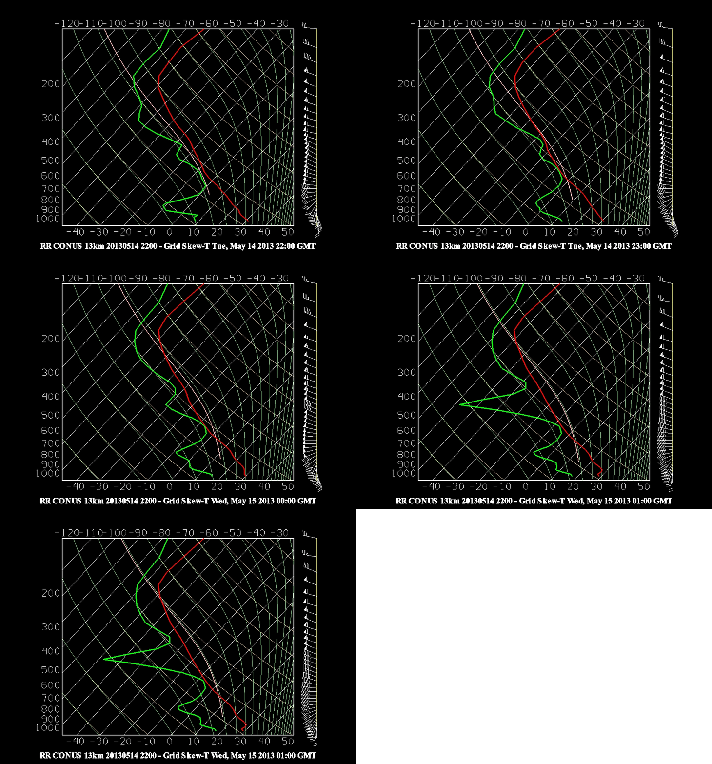
Visible imagery from GOES-13, above, shows the development of the convection as it moves into the area of diagnosed instability. The Microburst Windspeed Potential Index (MWPI) predicts maximum wind gusts that might occur given the thermal profiles associated with developing convection. Attributes that promote downbursts are steep mid-level lapse rates (to enhance convective instability) and abundant dry air (to enhance evaporative cooling). The two animations below (created using McIDAS-V and this bundle) show a maximum in MWPI (with values near 50 — the relationship between MWPI and convective gusts is here) developing over southwest WI as the convection develops. (Data are from the Rapid Refresh model run at 2200 UTC on Tuesday 14 May). The animation of model soundings over Madison (bottom) indicates strong destabilization and mid-level drying, two components that enhance the potential for microbursts. (McIDAS-V animations courtesy of Ken Pryor, NOAA/NESDIS)
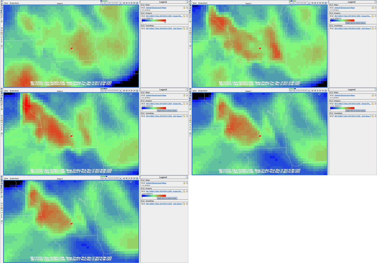
Microbust Windspeed Potential Index (MWPI) from 2200 UTC 14 May-0100 UTC 15 May over Wisconsin. Data from Rapid Refresh Model
GOES Sounder DPI products are available here. YouTube videos of the convection, obtained from the cameras on the roof of SSEC, are available here (looking east) and here (looking north).


