Thunderstorms in Kansas
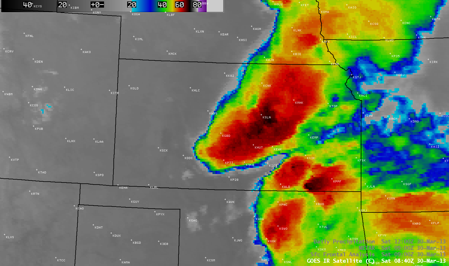
AWIPS images of 4-km resolution GOES-13 10.7 µm IR channel data (above; click image to play animation) showed clusters of strong to severe thunderstorms that moved across Kansas during the overnight (pre-sunrise) hours on 30 March 2013. Brief “enhanced-V” storm top signatures could be seen with a few of the stronger thunderstorms. There were numerous reports of hail, as large as 2.5 inches in diameter (SPC storm reports).
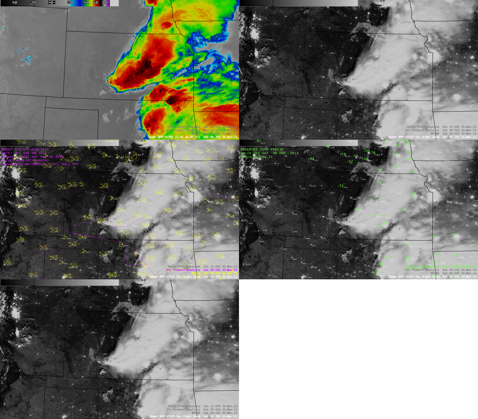
A more detailed view of the storms at 08:39 UTC or 3:39 AM local time can be seen on a comparison of 1-km resolution Suomi NPP VIIRS 11.45 µm IR channel and 0.7 µm Day/Night Band images (below). With ample illumination from a nearly-full moon (Waning Gibbous phase, 86% of full), the Day/Night Band provided a “visible image at night” which showed shadows from numerous overshooting tops. The coldest cloud-top IR brightness temperatures with these storms were -77º C along the Kansas/Oklahoma border and -75º C in central Kansas. Other features of interest on the Day/Night Band image included: (1) an arc of cloud bands associated with a low-level thunderstorm outflow boundary near Dodge City, Kansas (station identifier KDDC), and (2) the darker signature of swaths of wet soil from the thunderstom rainfall (which included 0.83 inches at Catharine and 0.60 inches near Hays) — since much of the Great Plains region was experiencing extreme to exceptional drought, these darker wet soil areas stood out against the adjacent very dry soil.


