Severe thunderstorms produce hail and damaging winds across Florida
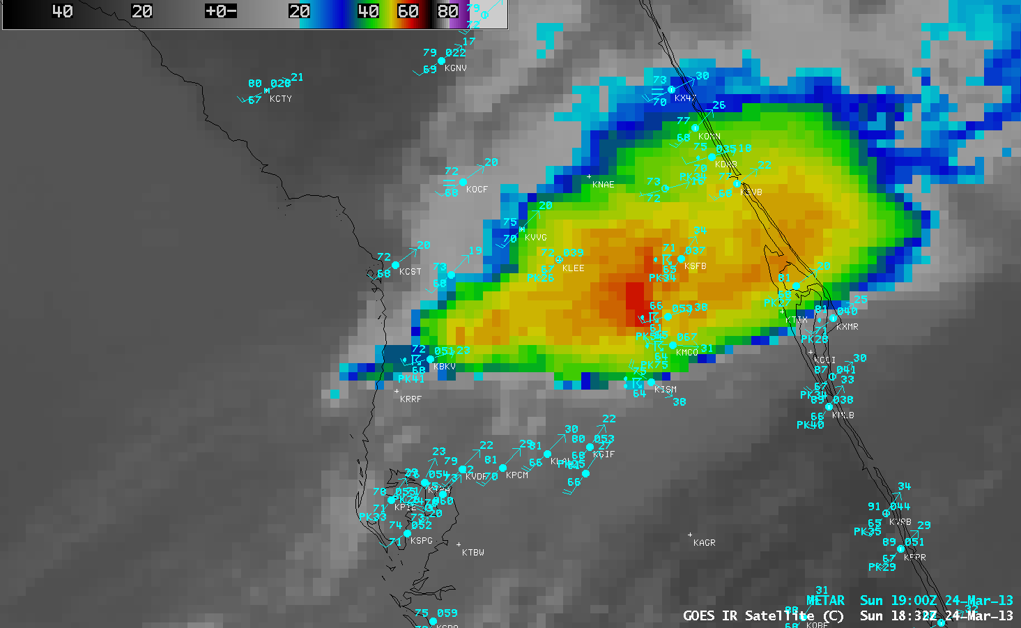
AWIPS images of GOES-13 10.7 µm IR channel data (above; click image to play animation) showed a band of strong to severe thunderstorms that moved eastward across central Florida during the afternoon hours on 24 March 2013. These storms produced a few reports of hail up to 1.0 inch in diameter, as well as a number of damaging wind reports which included a gust to 75 knots or 86 mph at Orlando International Airport at 18:40 UTC or 2:40 PM local time (SPC storm reports).
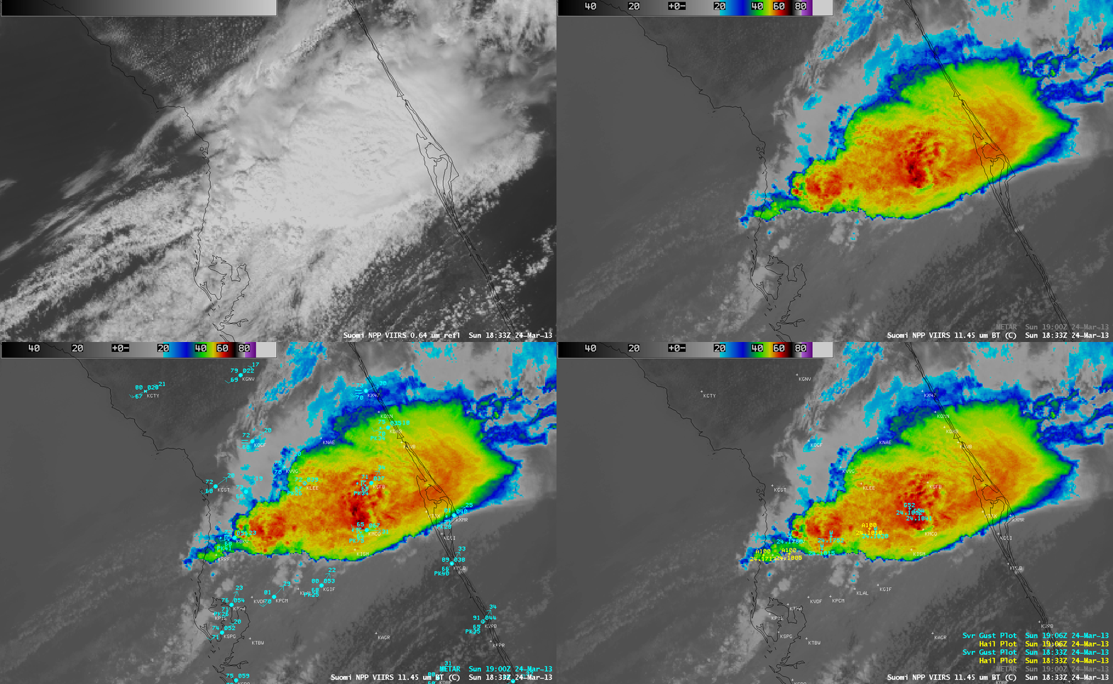
1-km resolution Suomi NPP VIIRS 0.64 µm visible channel and 11.45 µm IR images with overlays of surface METAR reports and SPC storm reports (below) revealed that there was a cluster of overshooting tops with cloud-top IR brightness temperature values as cold as -67º C (darker red color enhancment) that appearaed to be associated with the reports of high wind gusts at the surface.

Suomi NPP VIIRS 0.64 µm visible channel and 11.45 µm IR channel images (with overlays of surface reports and severe weather reports)
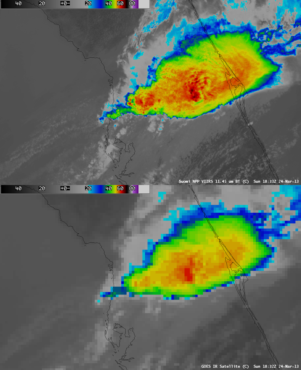
A comparison of a 1-km resolution Suomi NPP VIIRS 11.45 µm IR image with the corresponding 4-km resolution GOES-13 10.7 µm IR image (below) demonstrated the advantage of higher spatial resolution for aiding in the identification of the location and magnitude of the coldest cloud-top IR brightness temperatures (-67º C with VIIRS, vs -60º C with GOES). In addition, the effect of parallax was evident on the GOES-13 IR image, with features being displaced to the northwest.
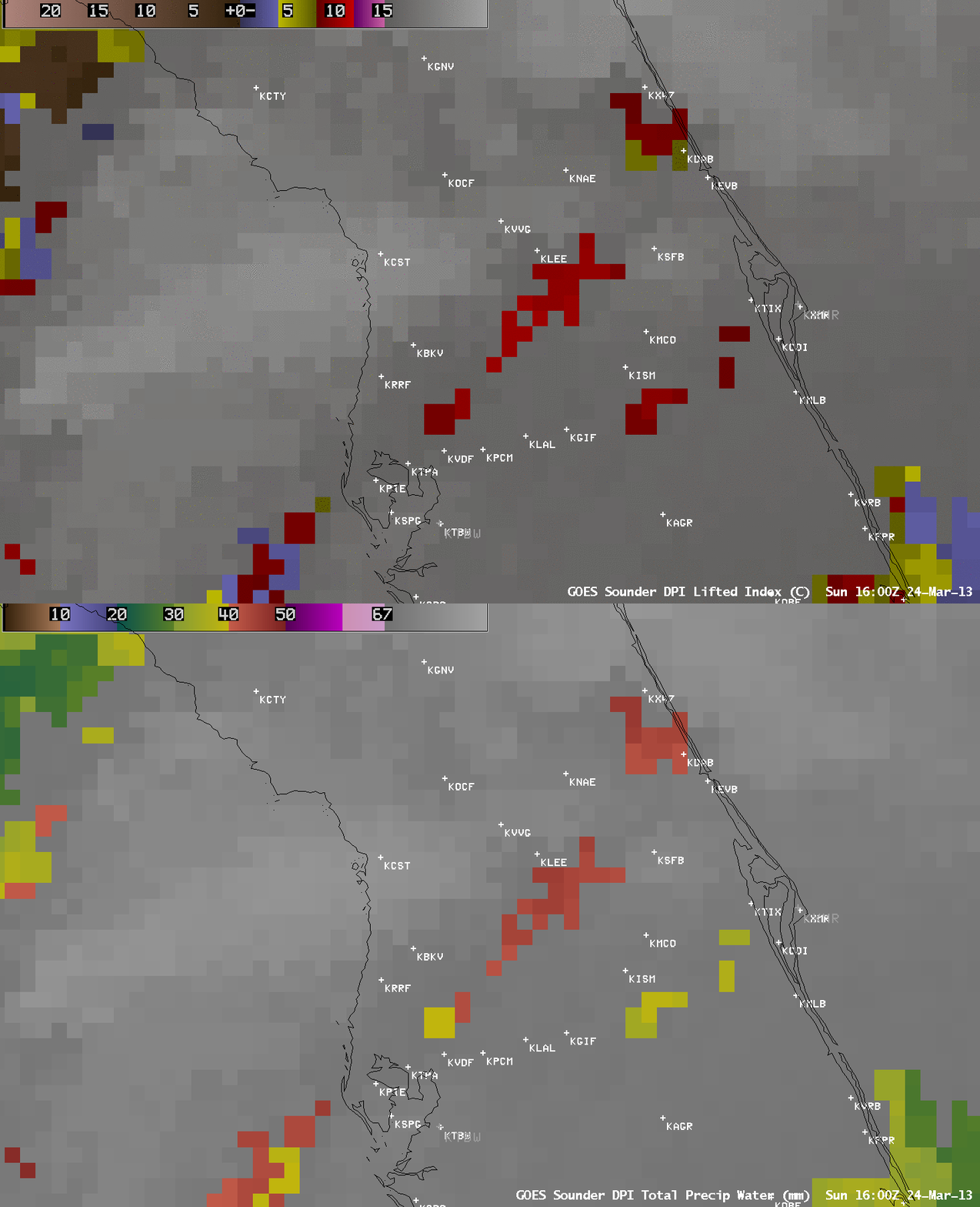
GOES-13 sounder Lifted Index (LI) and Total Precipitable Water (TPW) derived product images (below) indicated that moisture (TPW values as high as 45 mm or 1.78 inches) and instability (LI values as low as -10.4º C) were in place in the pre-convective environment across central Florida at 16:00 UTC or 12:00 PM local time.


