“Cooling pond effect snow” in northern Illinois
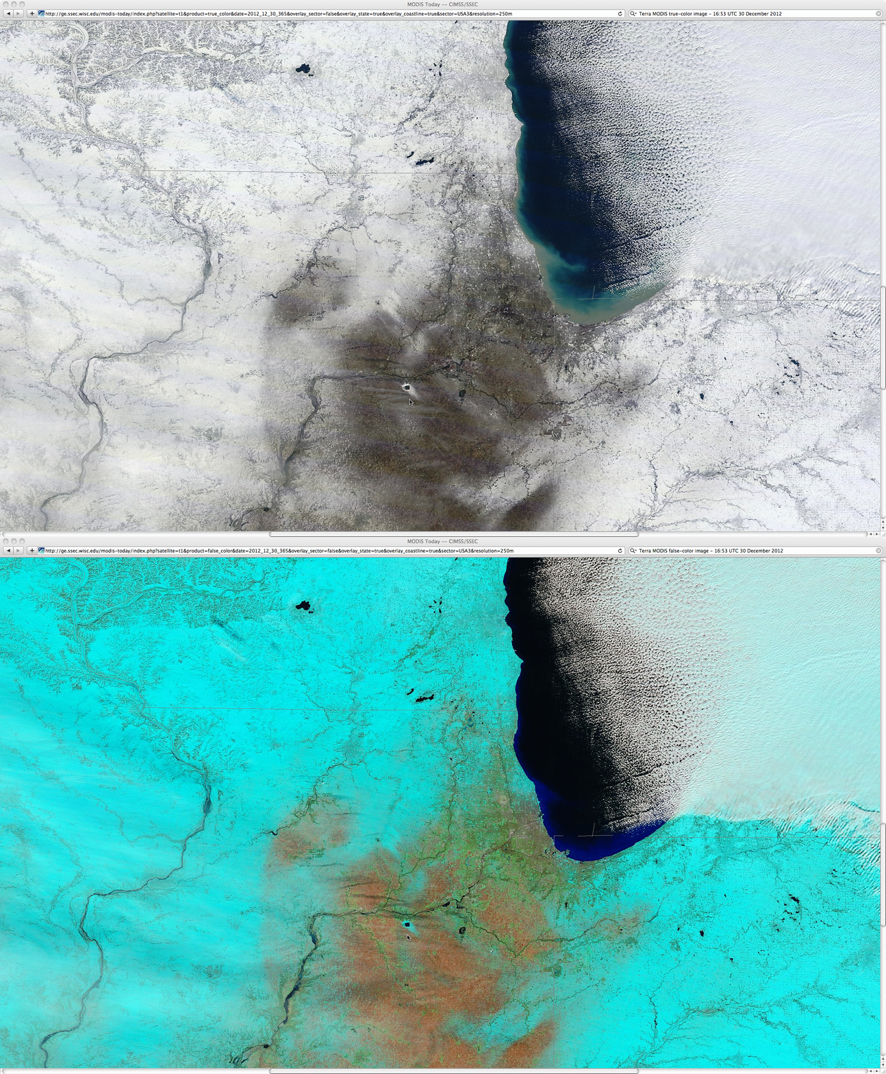
A comparison of 250-meter resolution MODIS true-color and false-color Red/Green/Blue (RGB) images from the SSEC MODIS Today site (above) revealed an interesting snow cover feature (snow appears as white on the true-color image, and cyan on the false-color image) surrounding a small body of water in northern Illinois (just north of the cursor) on 30 December 2012.
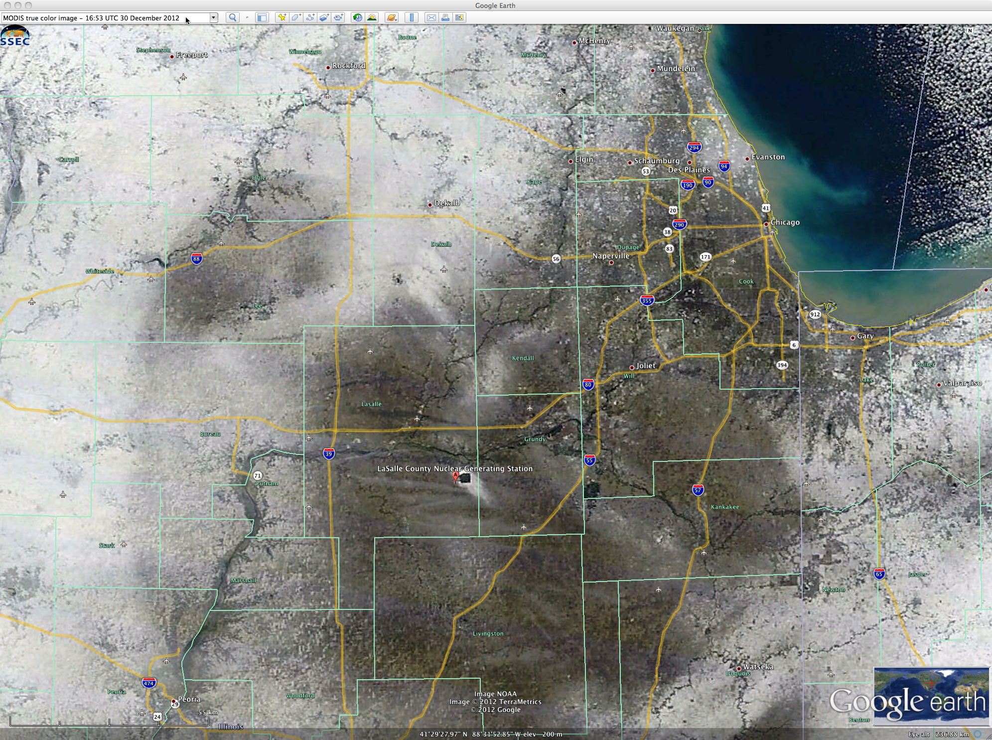
A closer view of that area using Google Earth (below) indicated that the small body of water was the cooling pond of the LaSalle County Nuclear Generating Station.
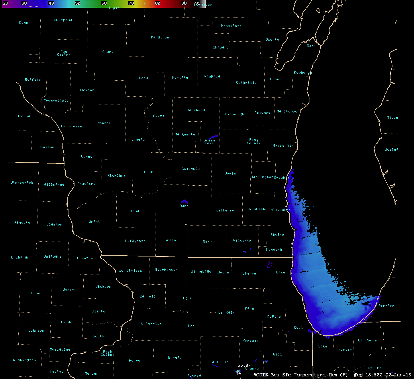
An AWIPS image of the MODIS Sea Surface Temperature (SST) product (below) showed that SST values were as warm as 55.8 F in the cooling pond — so the flow of colder air (which was generally in the 20s to 30s F) from a variety of directions produced “cooling pond effect snowfall” immediately downwind of the pond.


