Snow cover over the northeastern US and southeastern Canada
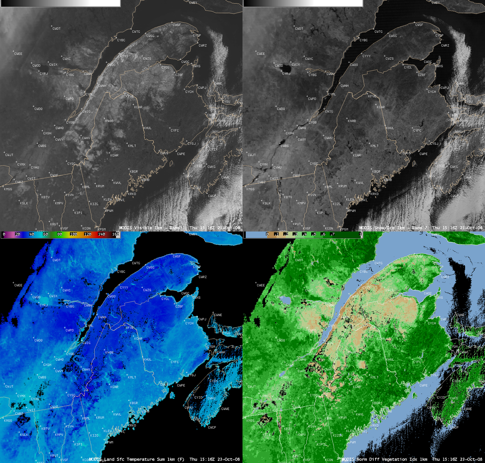
AWIPS images of the MODIS visible channel, 2.1 µm near-IR “snow/ice channel”, Land Surface Temperature (LST) product, and Normalized Difference Vegetation Index (NDVI) product (above) showed an area of snow cover over parts of upstate New York, Vermont, New Hampshire, and Maine in the northeastern US, as well as Quebec and New Brunswick in southeastern Canada on 23 October 2008. Snowfall amounts over that region were generally in the 2-6 inch range (NOHRSC), with as much as 7 inches reported at Killington in Vermont. This snow cover was also very evident on true color imagery from the SSEC MODIS Today site.
Some items to point out on the AWIPS MODIS imagery above:
- the snow cover appears as brighter shades of white on the visible image, as do the cirrus cloud features over the far northwestern corner of the image and the stratocumulus clouds found over the eastern and southeastern portions of the image
- the snow cover appears darker on the 2.1 µm near-IR “snow/ice channel”, since snow (or ice) is a strong absorber of radiation at that wavelength
- the LST values were about 10º F colder over the snow cover (upper 20s to low 30s F, darker blue colors) compared to adjacent bare ground areas
- NDVI values over the snow cover were also significantly lower (0.1 to 0.2) compared to the adjacent areas that still had green vegetation in place
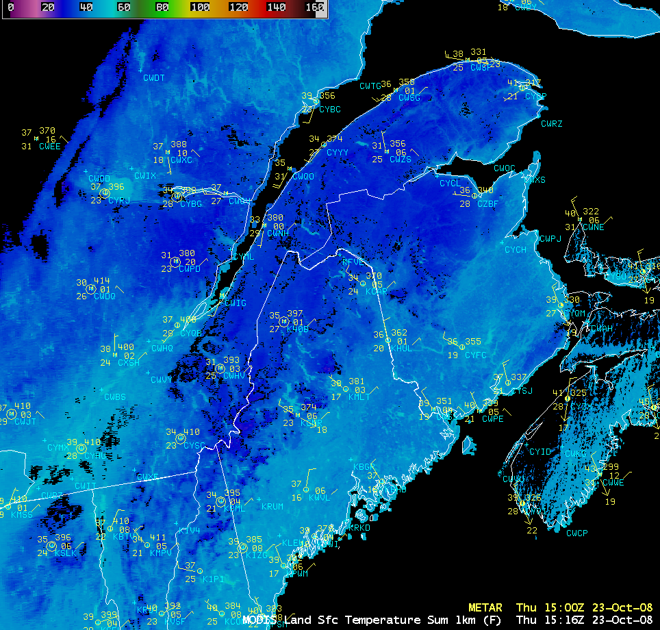
Even though the MODIS LST values over the snow cover were about 10º F lower, the actual instrument shelter air temperatures reported across the region were only a few degrees F colder over the areas with snow on the ground (below), in part due to the relatively high October sun angle.
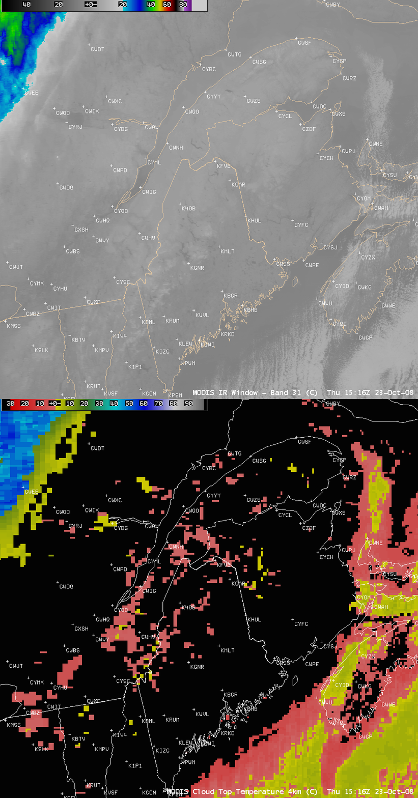
As an aside, an examination of the patch of thick cirrus clouds in the far northwestern corner of the images helps to demonstrate the value and accuracy of the MODIS Cloud Top Temperature (CTT) product (below). The coldest brightness temperature seen on the MODIS IR window channel image in the vicinity of the cirrus feature was -45º C (darker green enhancement), while the MODIS CTT product indicated temperatures as cold as -57.8º C (darker blue enhancement) over that same patch of cirrrus. Looking that the 12 UTC rawinsonde report from Maniwaki, Quebec (CWMW), assuming that the tops of the cirrus were in the 33,000-35,000 foot range, the air temperatures at those altitudes were around -55º to -58º C (closer to the coldest MODIS CTT value).


