Meso-vortex over Lake Superior
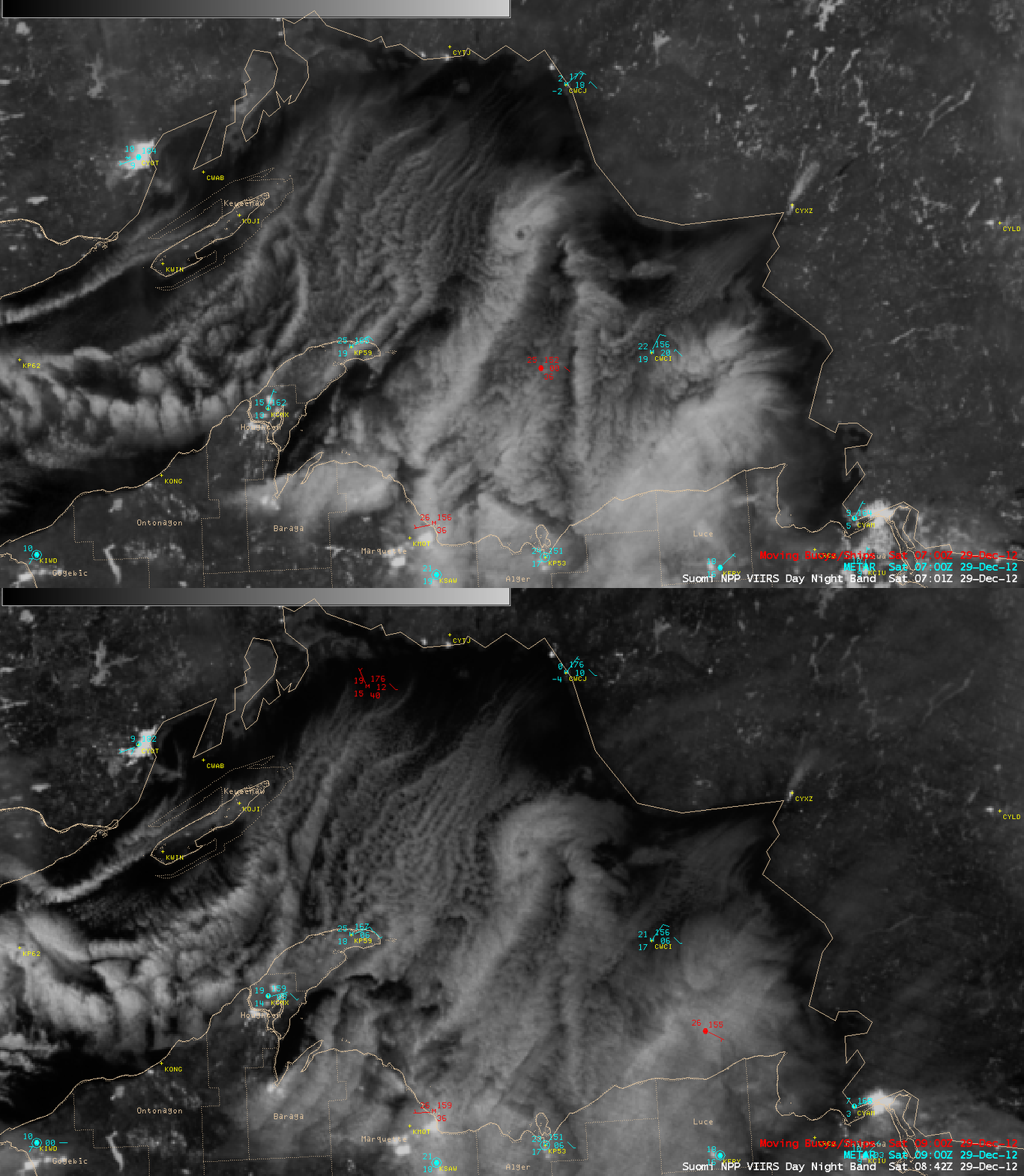
AWIPS images of 1-km resolution Suomi NPP VIIRS 0.7 µm Day/Night Band data (above) served as “visible images a night” to reveal the formation of a mesoscale vortex that was moving southward over the northern portion of Lake Superior (northwest of Caribou Island, station identifier CWCI) at 07:01 UTC (2:01 AM local time) and 08:42 UTC (3:42 AM local time) on 29 December 2012.
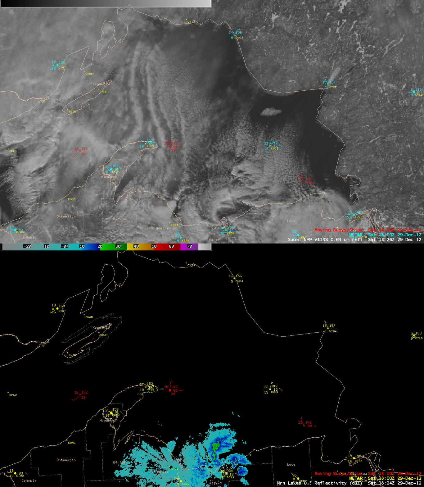
During the following afternoon, a comparison of a 1-km resolution Suomi NPP VIIRS 0.64 µm visible image at 18:26 UTC or 1:26 PM local time with the corresponding 0.5 degree radar reflectivity (below) showed the meso-vortex as it was approaching the coastline of the Upper Peninsula of Michigan near Munising (station identifier KP53).
=============================================
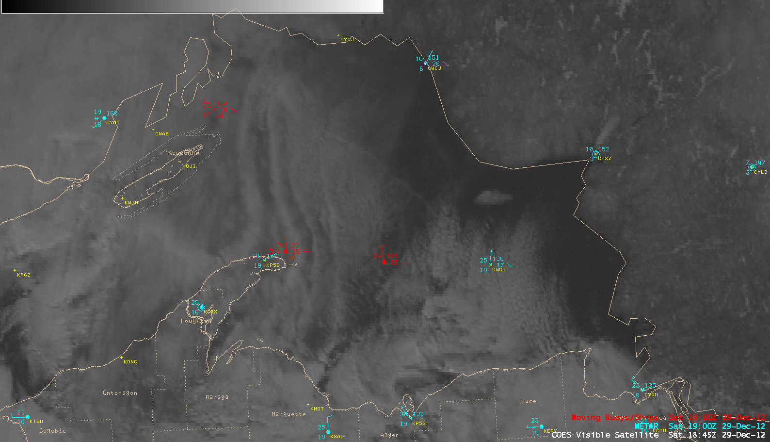
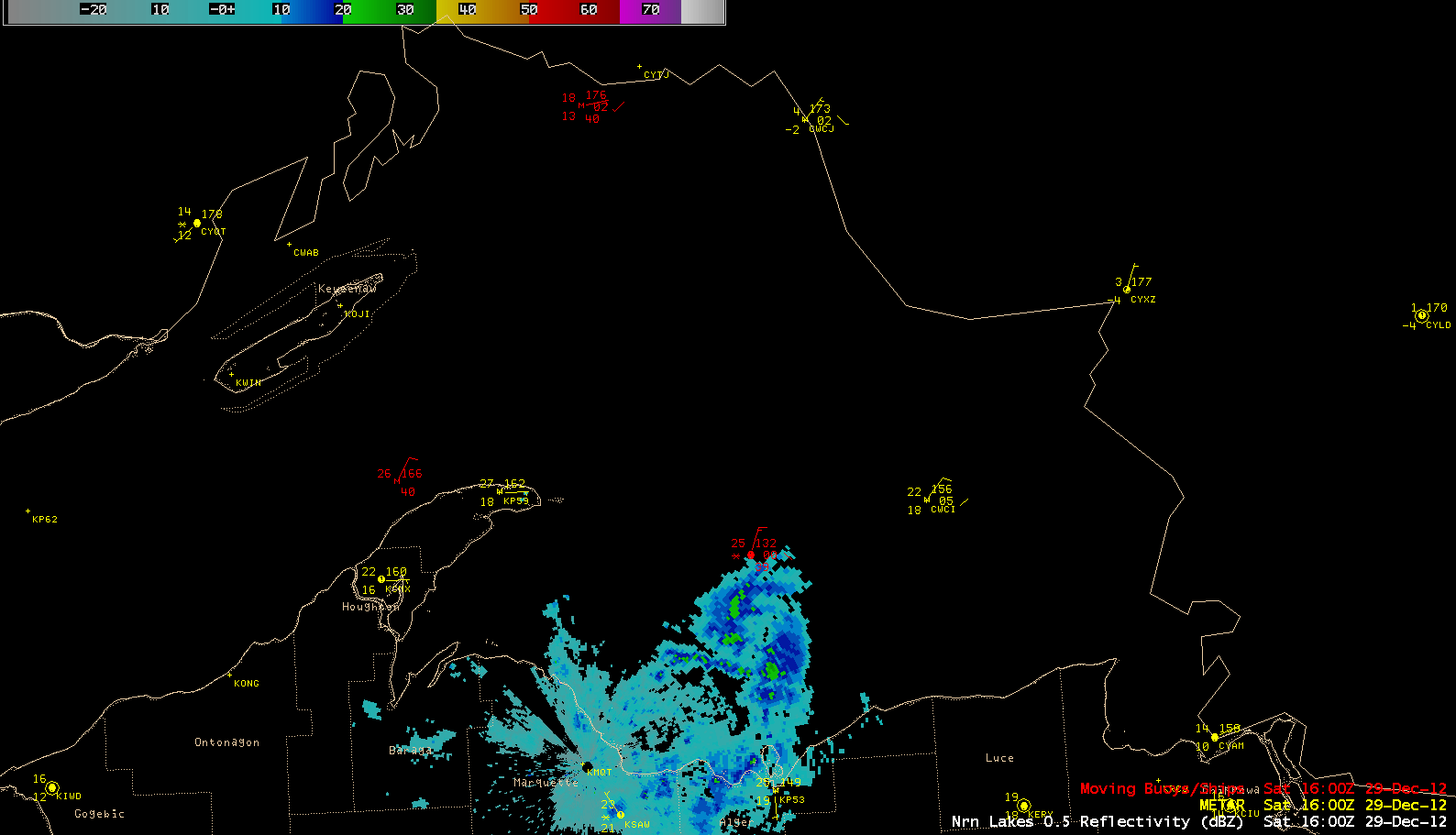
1-km resolution GOES-13 0.63 µm visible channel images (above; click image to play animation) and the 0.5 degree radar reflectivity from Marquette, Michigan (below; click image to play animation) showed the meso-vortex as it moved southward across Lake Superior and moved inland over the Upper Peninsula. Note how the surface winds at Munising became northeasterly at 13 knots as the meso-vortex reached the coast.


