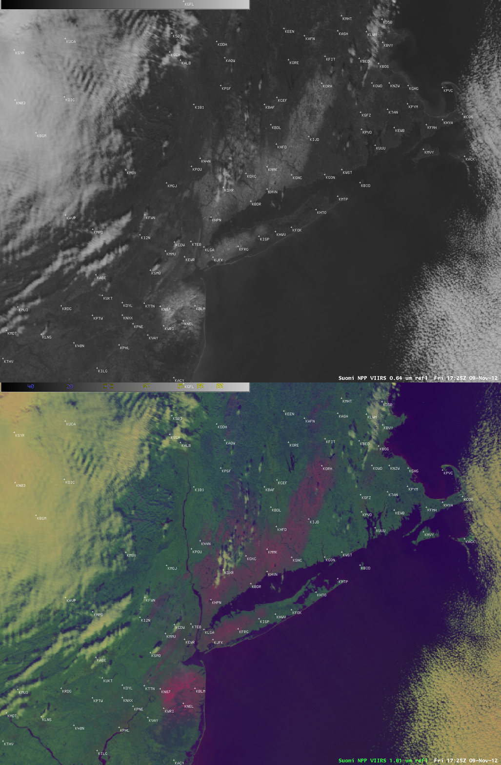
Satellite views of snow cover produced by a strong early season Nor’easter
The first Nor’easter storm of the 2012-2013 winter season (as seen on 07 November 2012 MODIS images) produced snowfall amounts as high as 13 inches in parts of New Jersey and Connecticut (HPC storm summary). After the clouds had cleared in the wake of the departing system, the areal extent of the remaining snow on the ground — which ranged from 1-6 inches at some locations across New Jersey, New York, Connecticut, and Massachusetts — was shown in an AWIPS comparison of 375-meter resolution (re-projected onto a 1-km AWIPS grid) Suomi NPP VIIRS 0.64 µm visible channel and false-color Red/Green/Blue (RGB) images at 17:25 UTC (12:25 PM local time) on 09 November 2012 (above). In the false-color VIIRS RGB image, snow on the ground was enhanced in shades of pink.
Note to National Weather Service forecast offices: as a part of our participation in GOES-R Proving Ground activities, CIMSS is able to provide a limited set of VIIRS imagery for display in your local AWIPS (via LDM feed).
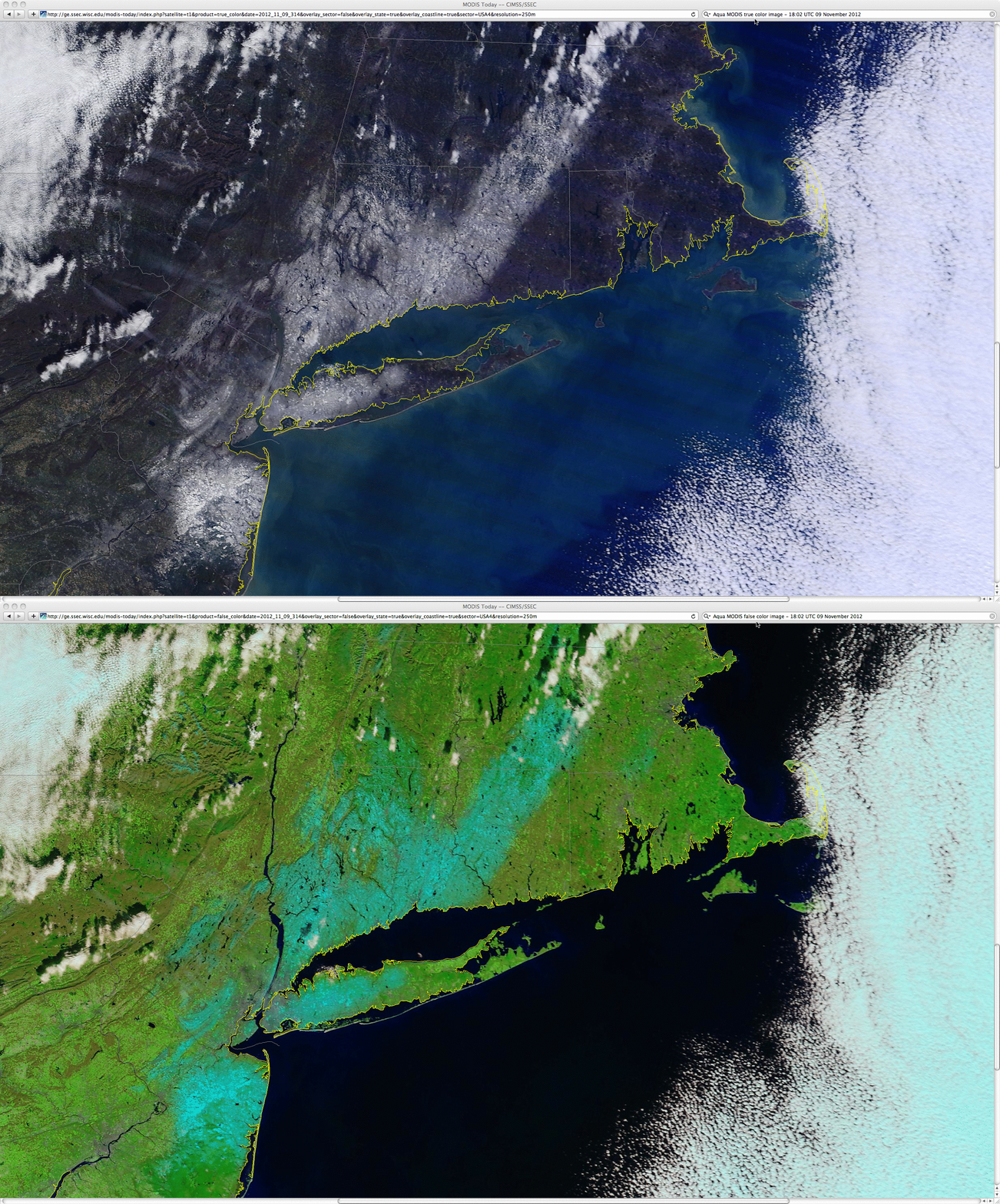
Additional detail could be seen in 250-meter resolution MODIS true-color and false-color RGB images at 18:02 UTC (1:08 PM local time) from the SSEC MODIS Today site (below). In the MODIS false-color RGB image, the snow cover appeared as shades of cyan.


