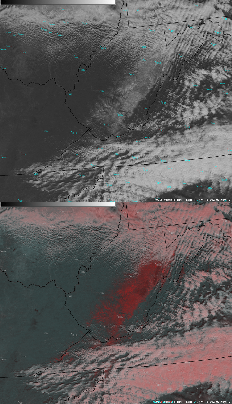
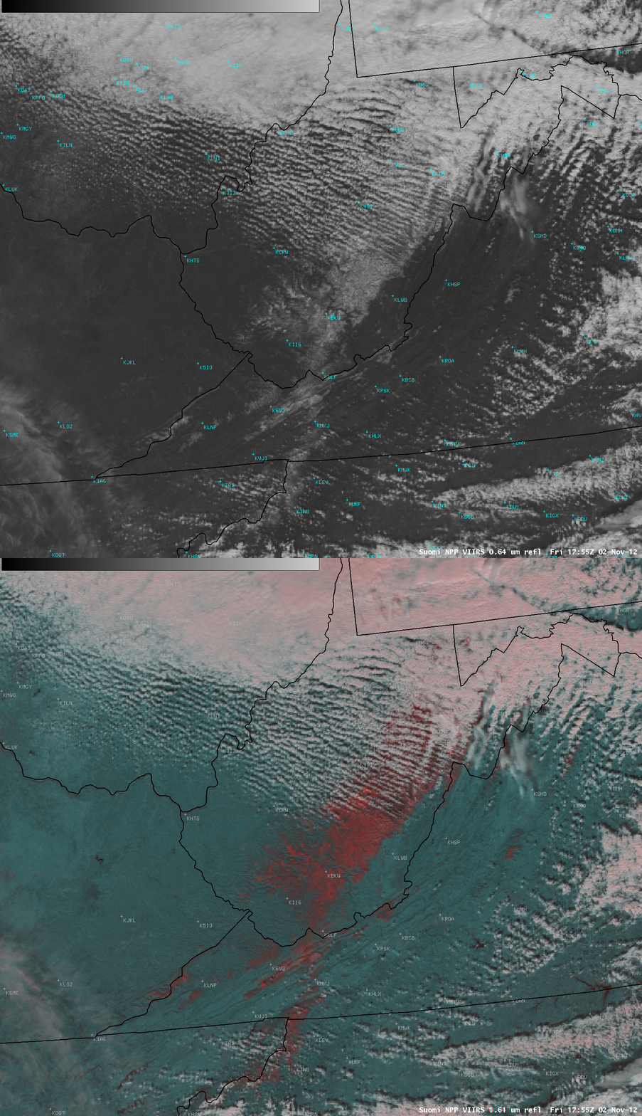
High-elevation snow cover remaining from “Superstorm Sandy”
Cold air and upslope flow on the western side of Hurricane Sandy contributed to some very impressive snowfall totals across parts of the central Appalachian Mountains in the eastern US (HPC storm summary)| HPC snowfall contour map). Once some of the cloud cover began to clear from the region on 02 November 2012, a comparison of AWIPS images of visible channel data and false-color Red/Green/Blue (RGB) composites from MODIS at 16:09 UTC or 12:09 PM local time (above) and again at 17:55 UTC or 1:55 PM local time (below) revealed the extent of the remaining high-elevation snow cover. On the false-color RGB images (created using the 2.1 µm “snow/ice channel” on MODIS, and the 1.61 µm “snow/ice channel” on VIIRS as the Green and Blue components of the image composites), snow cover appeared as the darker red features (which also appeared white on the corresponding visible images).
Data from the National Operational Hydrologic Information Center (observed snow depth | model-derived snow depth) indicated that some sites still had a snow depth in excess of 20 inches on on the morning of 02 November.


