Satellite detection of wet ground surfaces
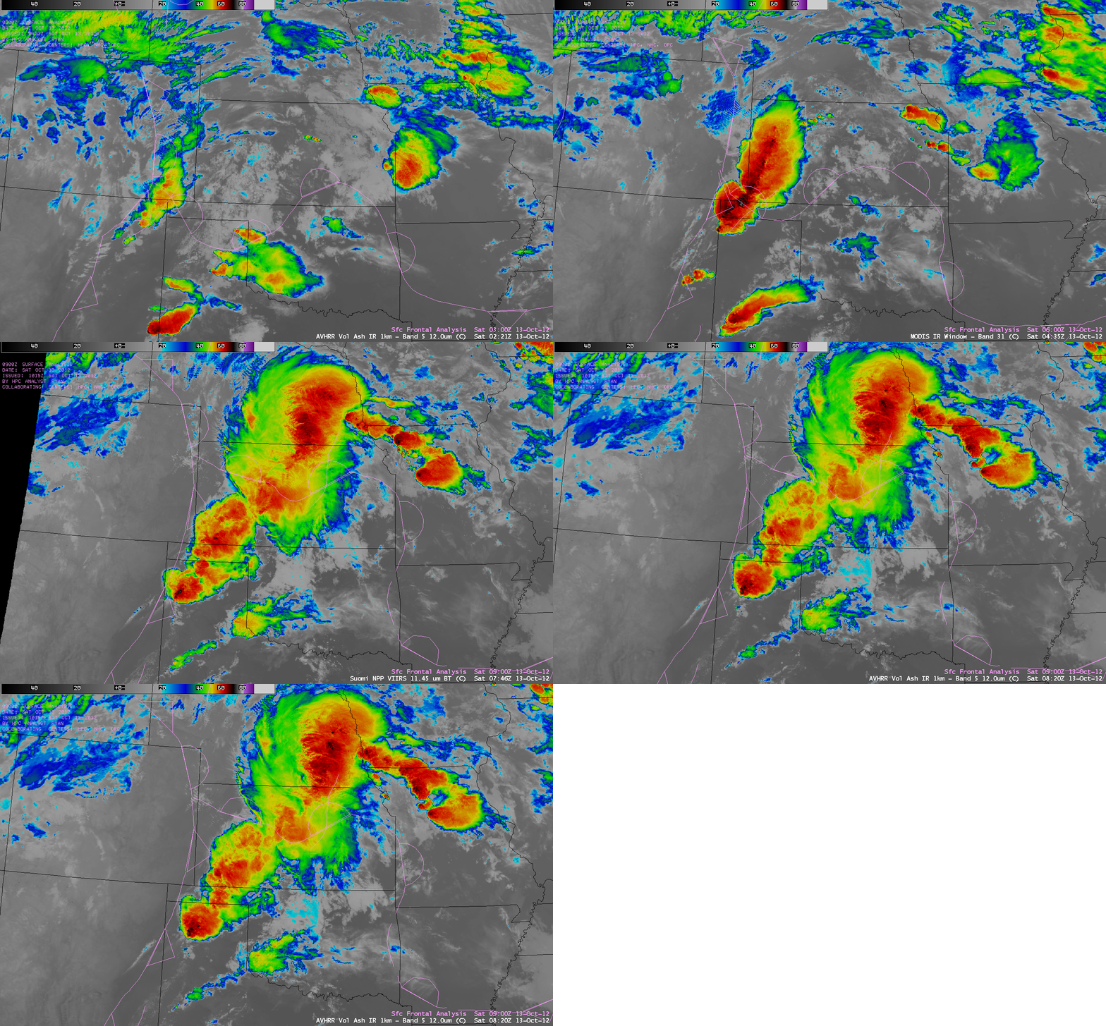
Much of the central US had been experiencing prolonged severe to exceptional drought conditions during the latter half of 2012, leaving the soil surfaces very dry. A sequence of Suomi NPP VIIRS 11.45 µm IR, MODIS 11.0 µm IR, and POES AVHRR 12.0 µm IR images (above) showed snapshots of a number of large mesoscale convective systems that were moving northeastward from New Mexico and Texas across Kansas and Nebraska during the pre-dawn hours on 13 October 2012 — and these storms produced much-needed widespread rainfall, with some locations receiving 1-2 inches (including 1.97 inches at Clayton, New Mexico and 2.30 inches at Sublette, Kansas).
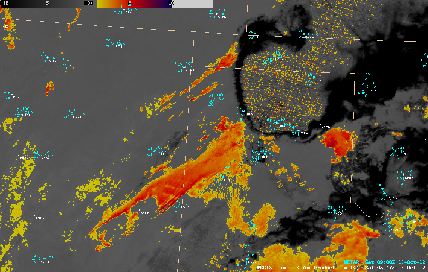
A night-time MODIS 11.0 µm – 3.7 µm IR difference “fog/stratus product” image (below) showed swaths of low clouds over the wet ground surfaces across parts of northeastern New Mexico and the Texas and Oklahoma panhandle regions, immediately in the wake of the passing convective cells.
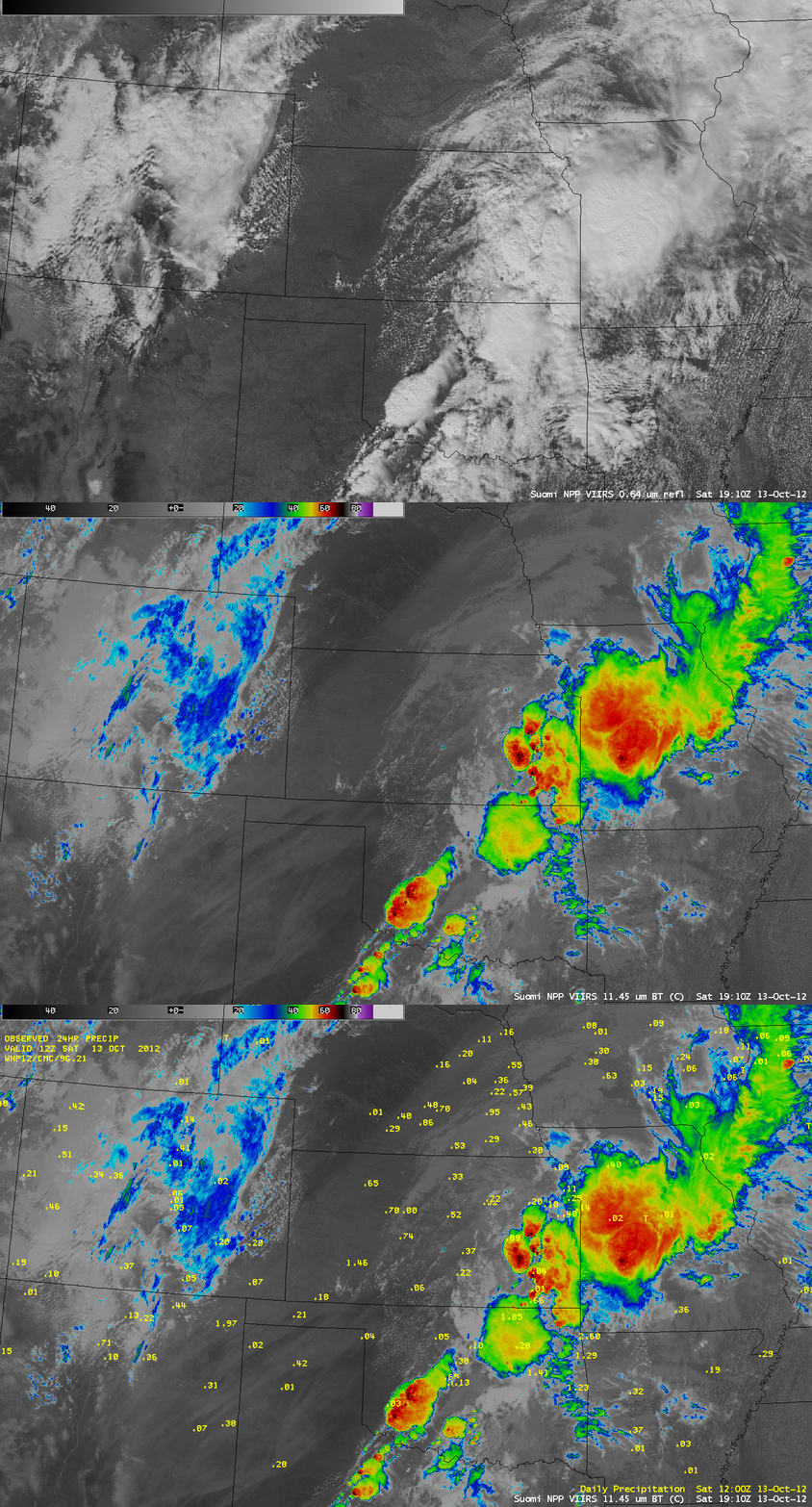
During the following afternoon, the swaths of wet ground appeared notably cooler (lighter gray color enhancement) on Suomi NPP 11.45 µm IR imagery (below), since the surrounding dry soil surfaces were able to heat up much more quickly.
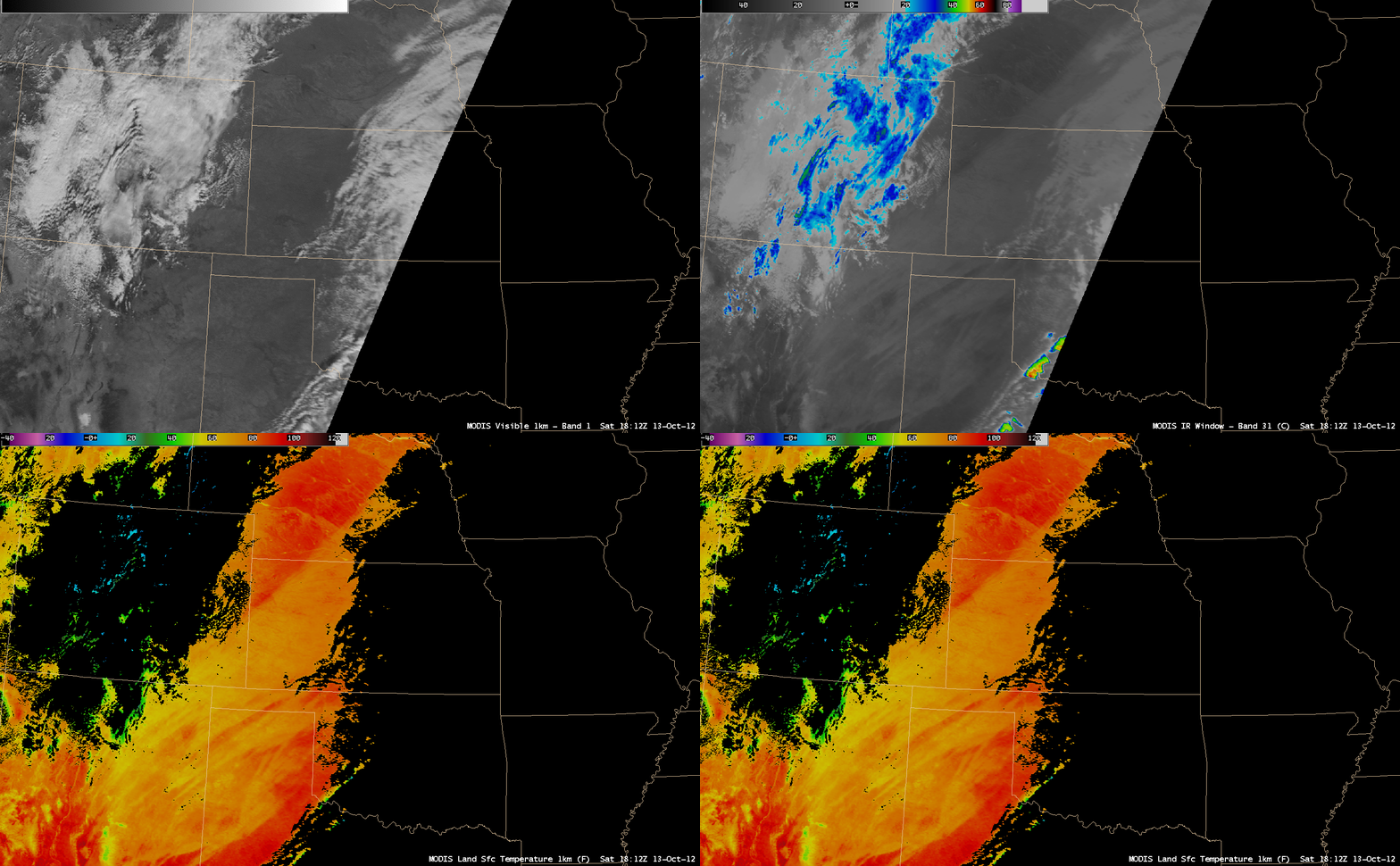
The MODIS Land Surface Temperature (LST) product (below) showed that LST values over the moist soil areas were generally in the 60s and 70s F (lighter orange color enhancement), compared to the much warmer LST values in the 80s and low 90s F (darker red color enhancement) over the adjacent dry soil surfaces.


