Aurora Borealis signature seen on VIIRS Day/Night Band imagery
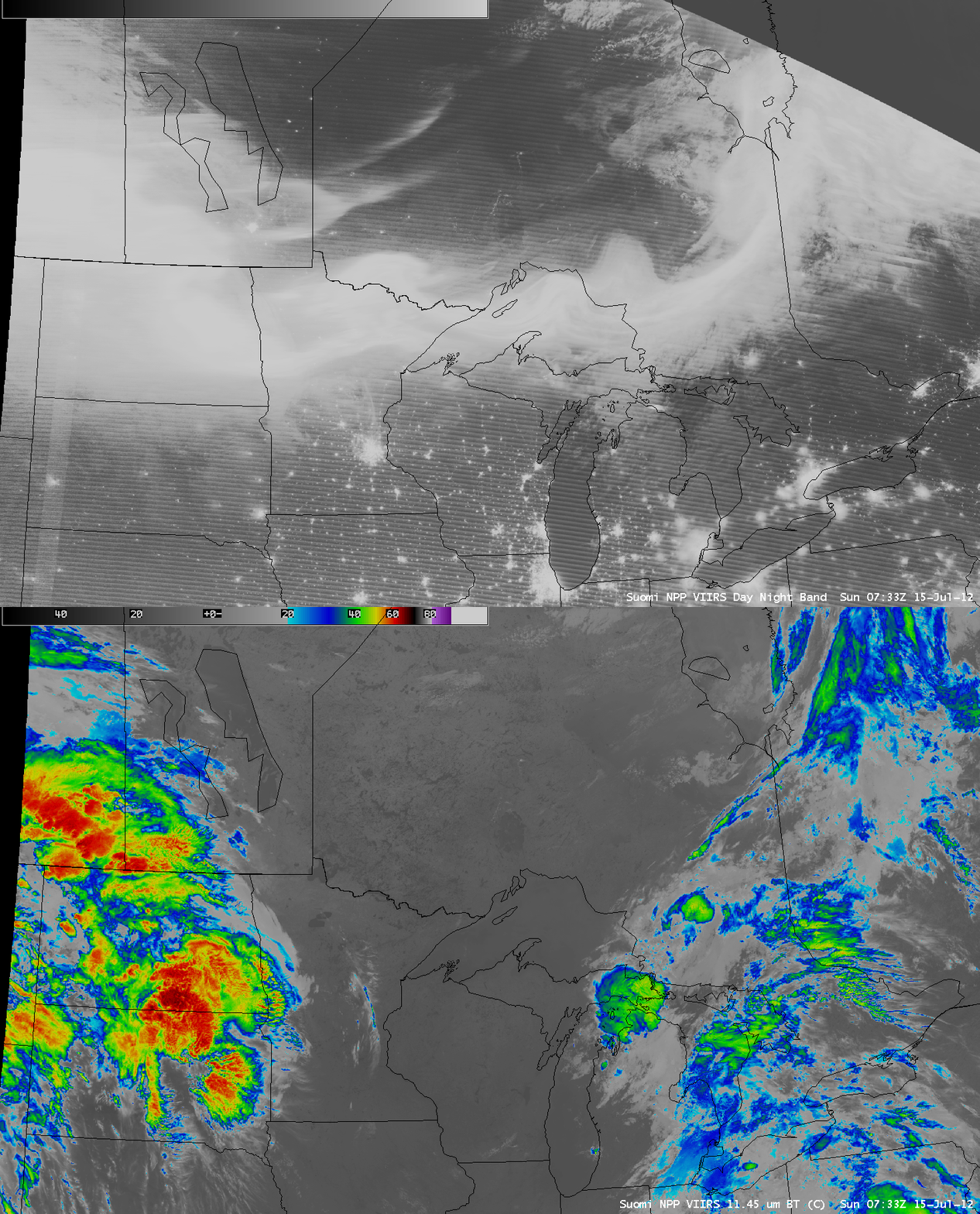
An AWIPS image of Suomi NPP VIIRS 0.7 µm Day/Night Band (DNB) data (above) revealed the bright signature of the Aurora Borealis along the US/Canadian border region at 07:33 UTC (1:33/2:33 AM local time) on 15 July 2012 (NOAA Space Weather Prediction Center auroral oval map). While the corresponding VIIRS 11.45 µm IR image did show some areas of clouds (particularly over North/South Dakota and southern Manitoba/Saskatchewan), there was very little cloud illumination from the waning crescent phase of the Moon (only 9% of the moon was visible) — so the vast majority of the bright DNB signal was from the Northern Lights activity.
A few of the smaller bright spots seen on the DNB image across parts of eastern Manitoba and western Ontario were due to flames from wildfires that were burning in that region, as seen in a comparison of VIIRS DNB and 3.74 µm shortwave IR images (below). The larger fires exhibited a small “hot spot” (yellow to red color enhanced pixels) on the shortwave IR image.
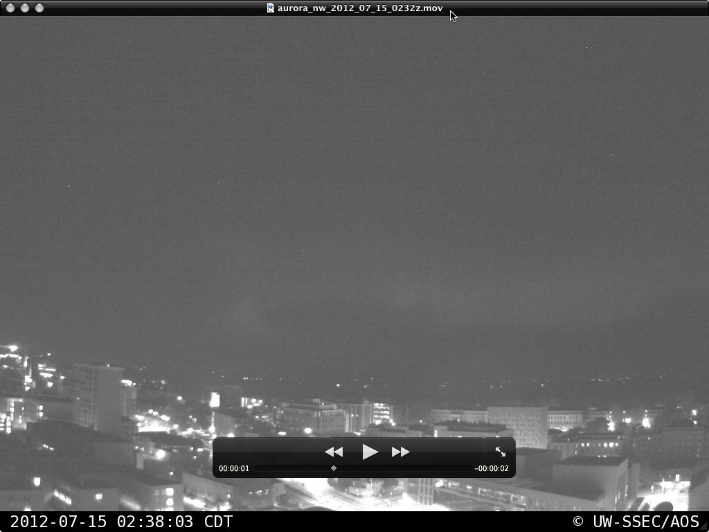
Brief glimpses of the Aurora Borealis activity could be seen from the northwest-facing camera on top of the SSEC/AOS building on the University of Wisconsin – Madison campus (below; night-time images provided by Pete Pokrandt, AOS).
===== 16 July Update =====
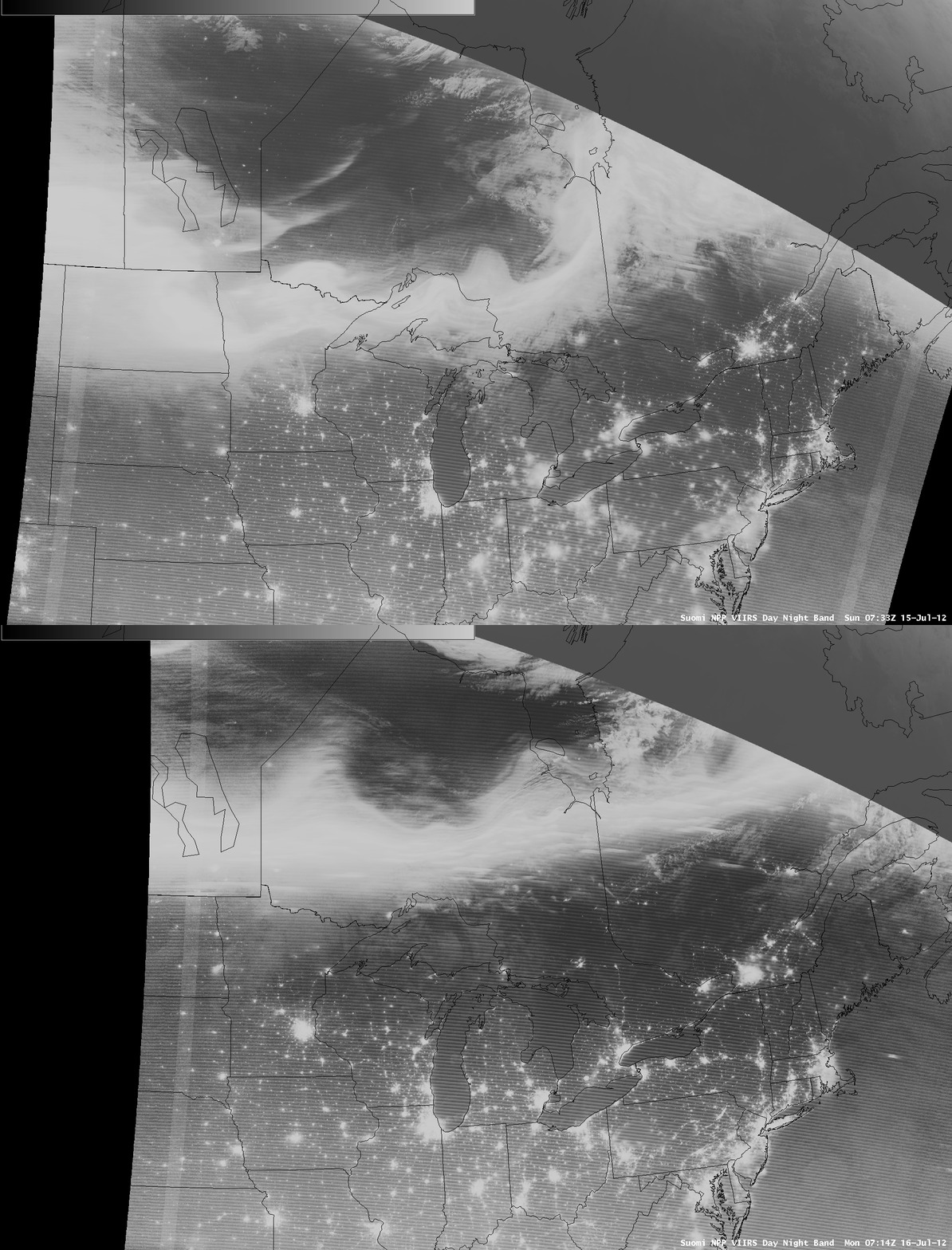
The bright auroral oval was again seen on VIIRS Day/Night band imagery the following night, at 07:14 UTC on 16 July. A comparison of the 15 July and 16 July DNB images (below) shows that the auroral oval was retreating northward on 16 July, as the impact of the geomagnetic storm triggered by a Coronal Mass Ejection (CME) from the sun was beginning to subside.


