Fires and thunderstorms as viewed by VIIRS
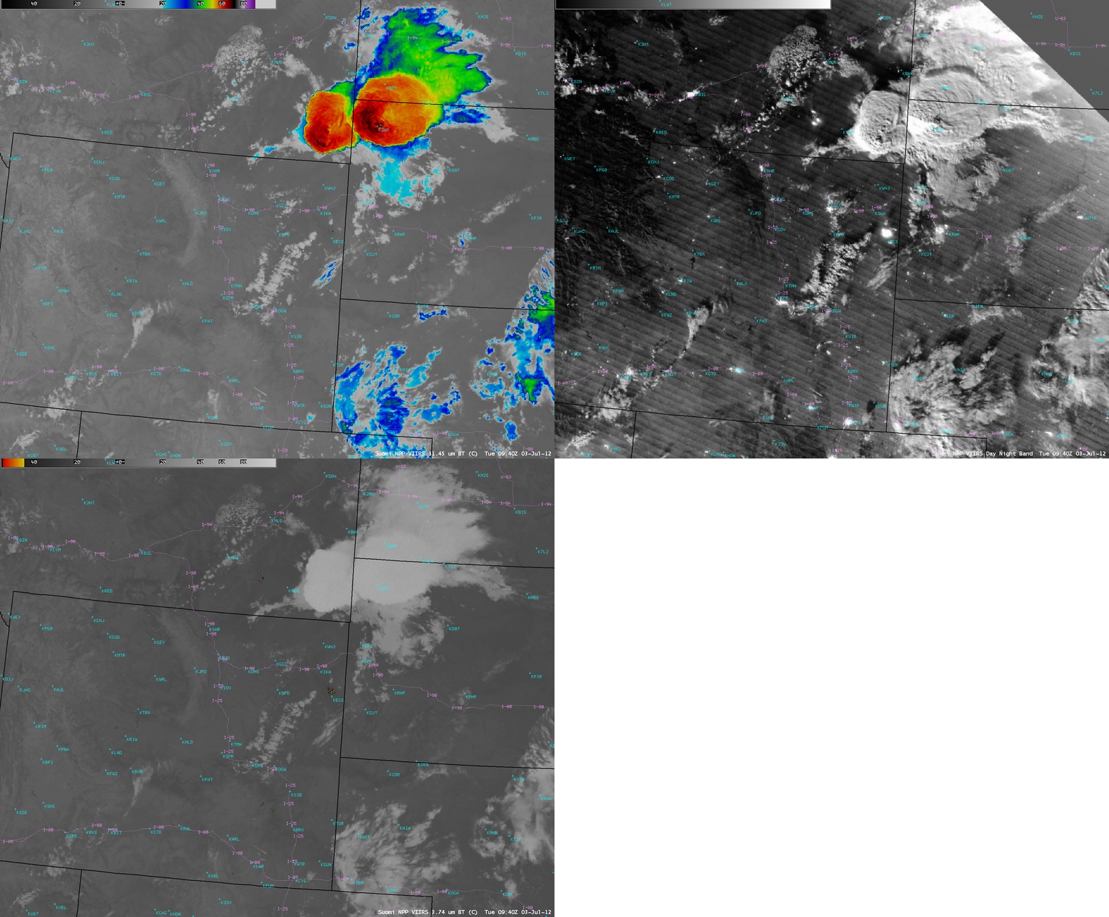
A comparison of AWIPS images of Suomi NPP VIIRS 11.45 µm IR, 0.7 µm Day/Night Band, and 3.74 µm shortwave IR data (above) showed (1) a pair of strong thunderstorms over the Montana/North Dakota/South Dakota border region, with cold cloud top IR brightness temperatures and excellent illumination of the overshooting tops and other cloud features due to the full phase of the moon, and (2) a few wildfires that were burning, with the largest ones being located in southeastern Montana and northeastern Wyoming. The wildfires exhibited “hot spots” (black to yellow to red color enhancement) on the shortwave IR image, and also appeared very bright on the Day/Night Band image due to the large areas of flames.
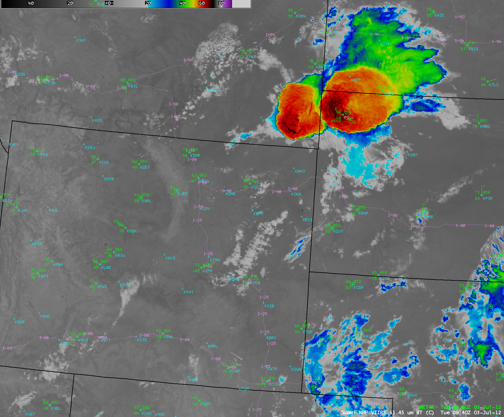
METAR surface reports plotted on the VIIRS IR image (below) revealed that Buffalo, South Dakota (station identifier K2WX) had a wind gust of 48 knots (55 mph). Hail of 2.0 inches in diameter was reported from this storm 25 minutes earlier at 09:15 UTC.
A comparison of the 275-meter resolution (projected onto a 1-km AWIPS grid) Suomi NPP VIIRS 11.45 µm IR image with the corresponding 4-km resolution GOES-13 10.7 µm IR image (below) demonstrates (1) the obvious advantage of higher spatial resolution, with better details seen in the storm top structure; the coldest cloud top IR brightness temperature on the VIIRS image was -77 C, compared to -63 C on the GOES image, and (2) the significant geo-location displacement of the GOES-13 image features, due to the problem of parallax with such a large satellite viewing angle (which is about 60 degrees for this region from the GOES-13 satellite).


