Snow cover and cold temperatures in mid-June
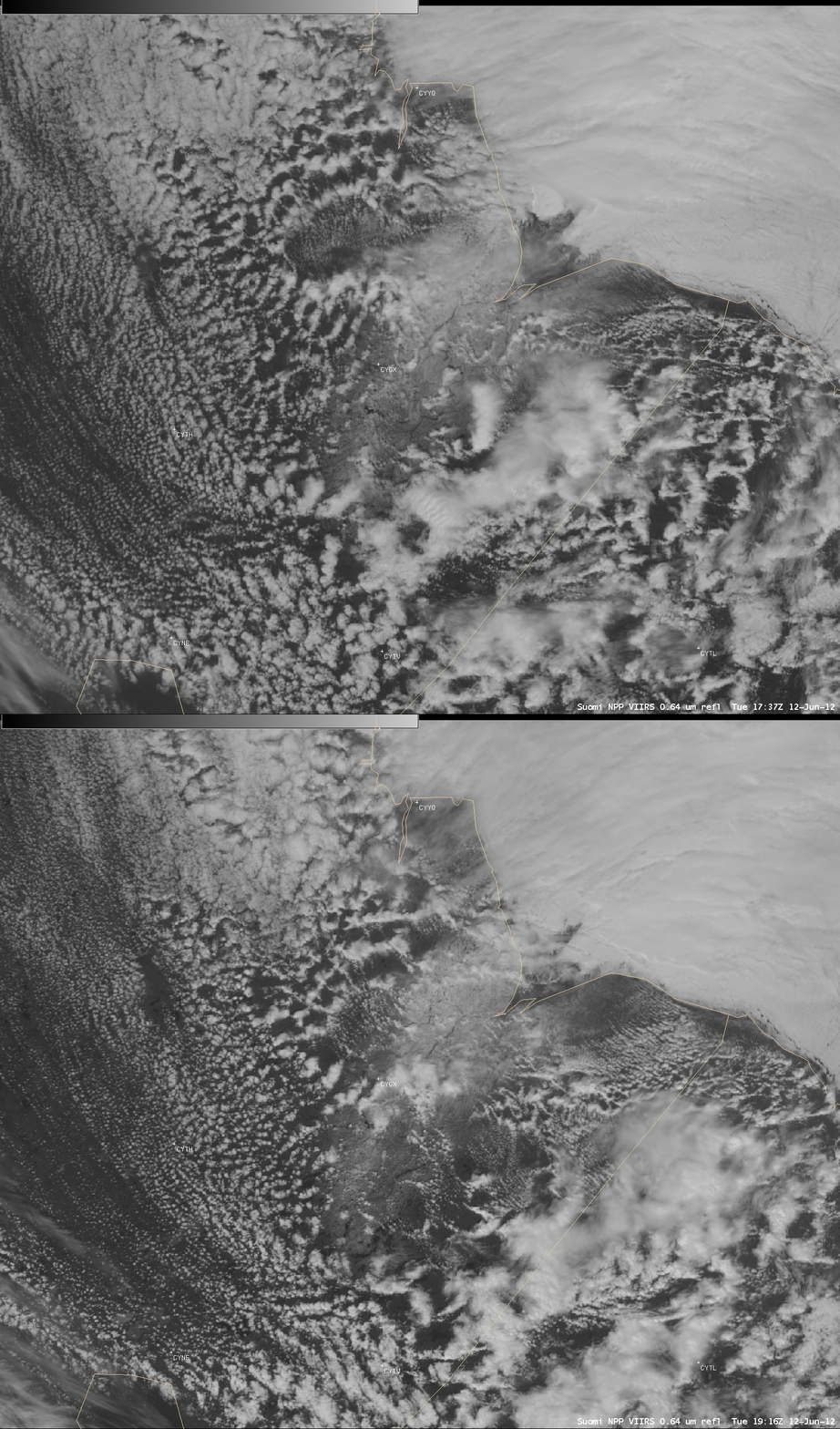
Parts of far northeastern Manitoba, Canada received significant snowfall on 11 June 2011, with 20 cm (7.9 inches) falling at Gillam (station identifier CYGX). On the following day (12 June 2012), Suomi NPP VIIRS 0.64 µm visible channel images (above) revealed that the remaining snow cover could be seen through the patches of clouds that were moving over that region.
A comparison of the 17:37 UTC (12:37 PM local time) Suomi NPP VIIRS 0.64 µm visible channel image with the corresponding 1.61 µm near-IR “snow/ice channel” image (below) confirmed that the brighter patch seen on the ground in the visible image was indeed snow cover (which shows up as a much darker shade of gray than the surrounding bare ground areas).
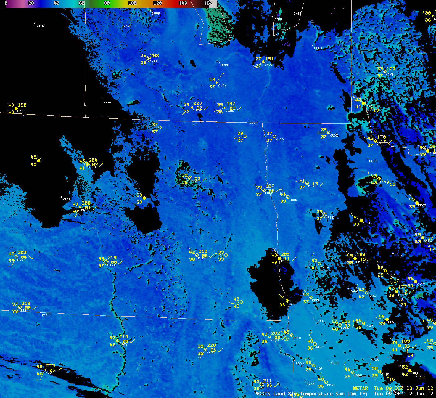
Farther to the south, a MODIS Land Surface Temperature (LST) product image at 09:06 UTC (4:06 AM local time) on 12 June (below) showed widespread areas from far southern Manitoba into parts of North Dakota, South Dakota, and Minnesota that exhibited LST values at or just below freezing (32º F or 0º C, darker blue color enhancement). The coldest overnight lows that morning were 32º F at Langdon, North Dakota and Warroad, Minnesota.


