Smoke and View Angle
GOES-East imagery of a fire that has been burning over western New Mexico for the past week shows a plume of smoke extending eastward from the fire, and spreading out over southeast New Mexico and parts of Texas and Mexico. It is difficult indeed to find the edges of the plume with the image.
Contrast that to the GOES-West image above, from the same time. The two images underscore the difference that view angle makes in viewing smoke from a fire: smoke is far more visible with a low sun angle.
View-angle differences for fire detection are less important. In this case, both the GOES-East and GOES-West similarly charaterize the fire temperature.
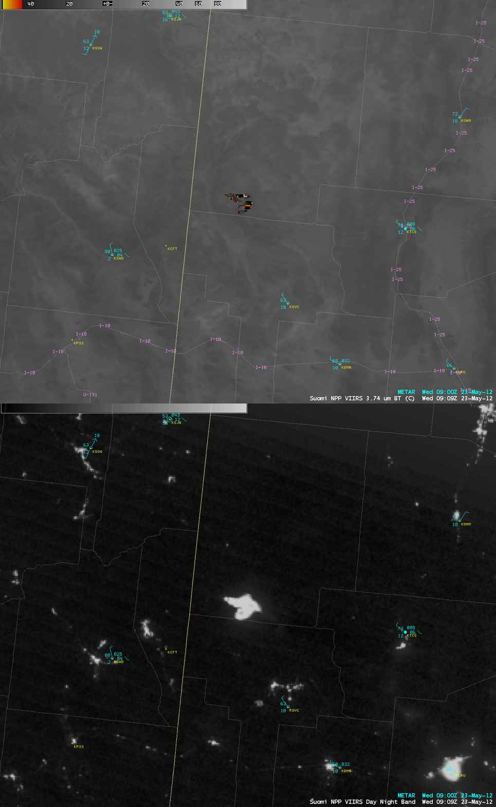
During the previous night-time hours before sunrise (at 09:09 UTC, or 3:09 am local time), an overpass of the Suomi NPP satellite offered a nice comparison between a 1-km resolution VIIRS 3.74 µm shortwave IR image and the corresponding 1-km resolution VIIRS 0.7 µm “Day/Night Band” image of the Baldy Fire in far western New Mexico (above). On the shortwave IR image, a large cluster of hot pixels (red to yellow to black colors) indicated where the most active fires were burning; on the Day/Night Band image, the widespread flames of the fire complex showed up as a large and very bright feature. As an aside, it is interesting to note that the dimly-illuminated path of Interstate 10 (I-10) also shows up on the Day/Night Band image.
Animations of GOES-West visible imagery from May 22nd and from May 23rd illustrate the pulsing nature of the fire. Distinct intensification as measured by the amount of emitted smoke is obvious after 2200 UTC on 22 May, and also after 1800 UTC on 23 May. Late afternoon dewpoint depressions at or above 70 degrees Fahrenheit are testament to the extreme fire danger in western New Mexico.


