Suomi NPP VIIRS images showing Arctic Ocean ice movement
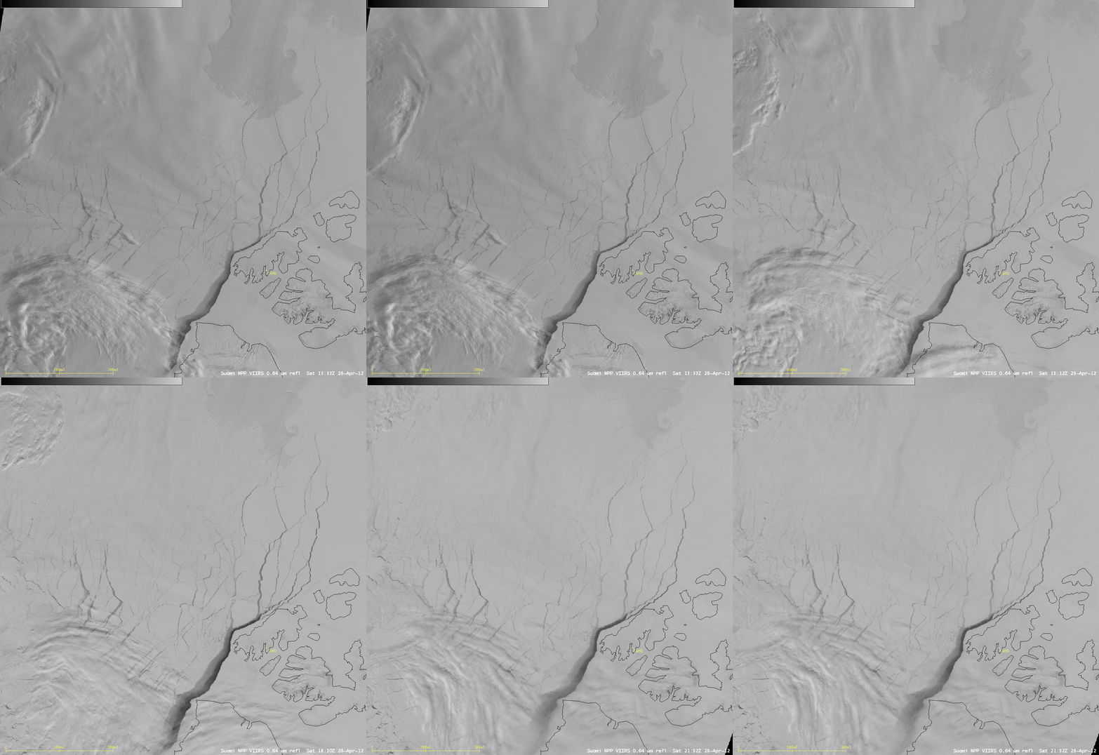
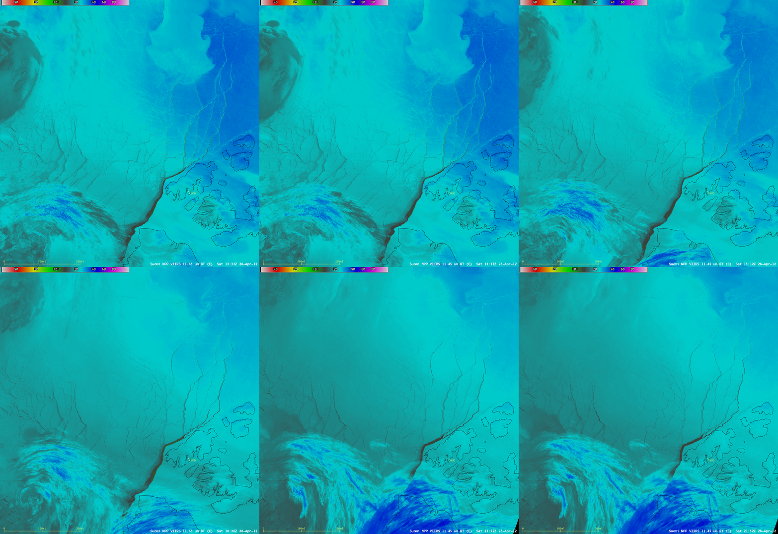
AWIPS images of Suomi NPP VIIRS 0.64 µm visible channel data (above) and 11.45 µm IR channel data (below) showed cloud and ice features over the Arctic Ocean on 28 April 2012. For geographic reference, station identifier CWMD is Mould Bay, located on Prince Patrick Island in the far northwestern portion of the Canadian Arctic Archipelago.
The meteorological cloud features at this time were fairly benign, with some low stratus seen over the northern portion of the satellite scene, and multi-level clouds associated with a cyclone developing to the south. Of particular interest was the amount of sea ice motion during this relatively short 8-hour period — several ice leads opened up and became very prominent features on both the visible and the IR imagery.
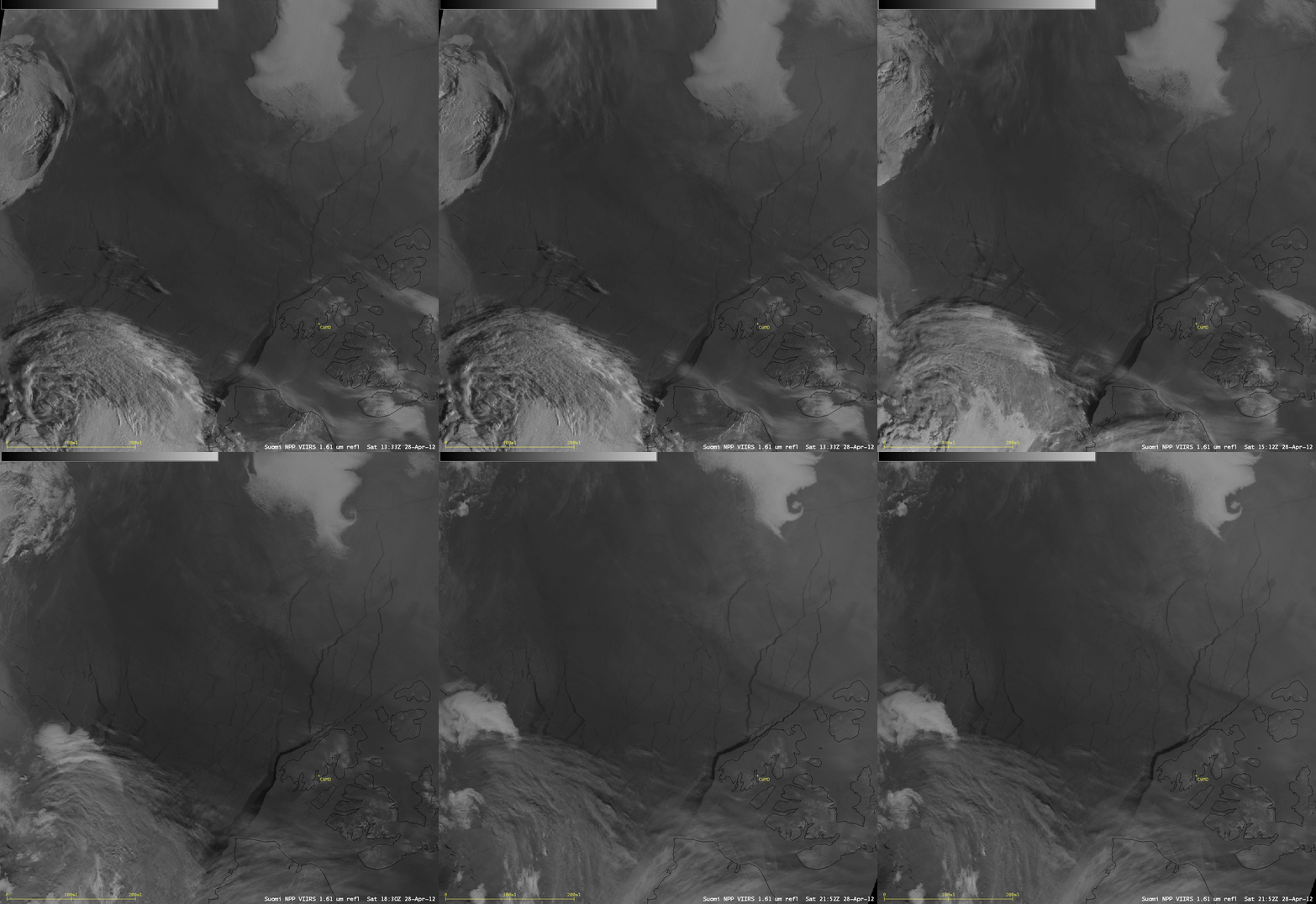
Suomi NPP VIIRS 1.61 µm near-IR images (below) revealed a number of narrow “streaks” of supercooled water droplet clouds (which appear as brighter white features) moving away from the islands, suggesting that there were strong winds across the region helping to move the sea ice. Water (and cloud shadows) appear black on the near-IR images, while ice and snow cover appear as darker shades of gray.
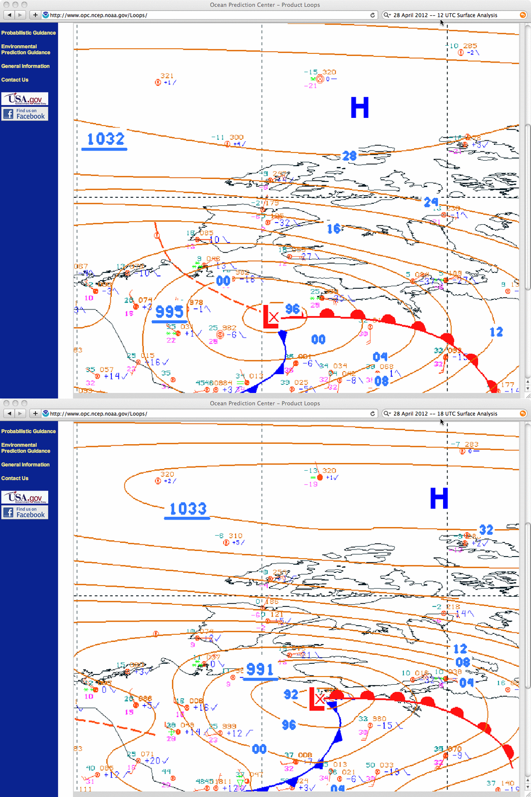
Surface analyses at 12 UTC and 18 UTC (below) indicated that there was a strong pressure gradient over the region, between the High over the Arctic Ocean and a deepening Low over far northern Canada. The effect of this tightening pressure gradient was strong offshore (easterly) winds — the closest available observation site was Sachs Harbour on Banks Island, where they had easterly winds of 25 knots with gusts to 30 knots, and zero visibility with heavy snow and heavy blowing snow at 22 UTC.


