Hurricane Kenneth
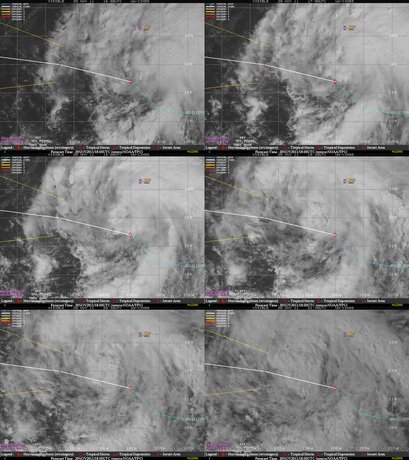
According to the National Hurricane Center, on 20 November 2011 Tropical Storm Kenneth became the latest-forming named tropical storm in the eastern North Pacific basin since Hurricane Winnie formed on 04 December 1983. GOES-11 0.65 µm visible channel images from the CIMSS Tropical Cyclones site (above) showed a well-defined circulation, with a ship report of tropical storm force winds north of the storm center.
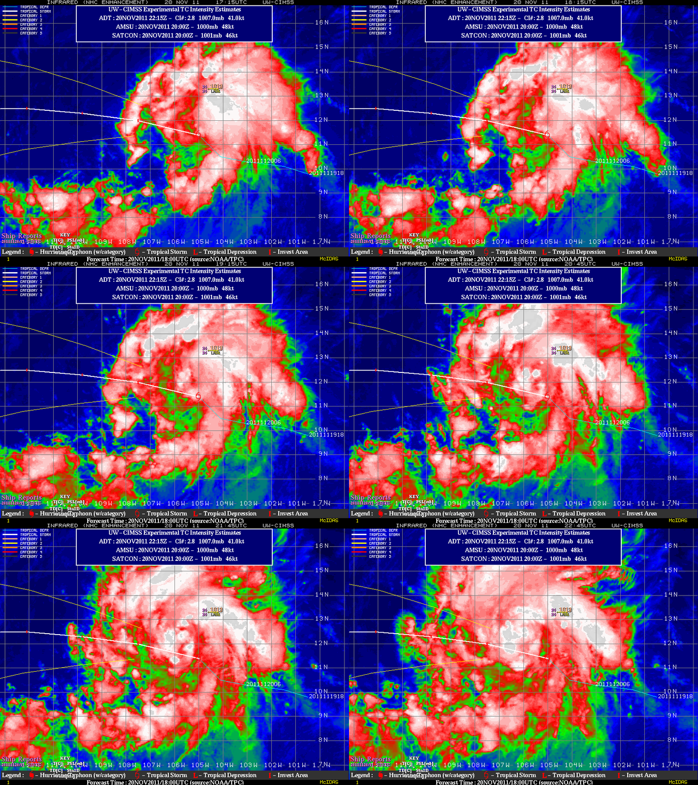
The corresponding GOES-11 10.7 µm IR images (below) showed a trend of increasing convection withing the northern semicircle of the storm.
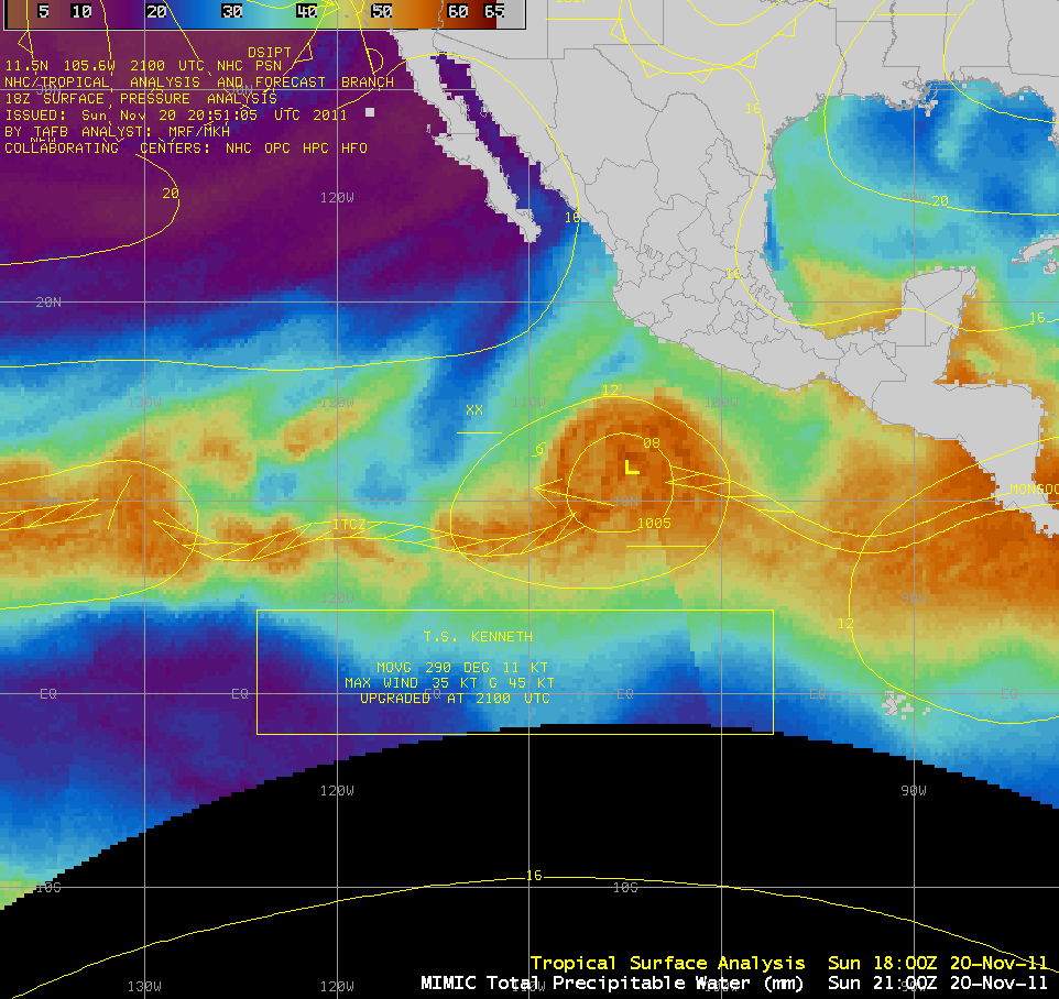
AWIPS images of the MIMIC Total Precipitable Water (TPW) product (below; click image to play animation) indicated that TPW values associated with Tropical Storm Kenneth were in the 50-60 mm range (darker orange colors), as rich moisture was sill in place along the Inter-Tropical Convergence Zone (ITCZ) / Monsoon Trough.
======== 21 November Update ========
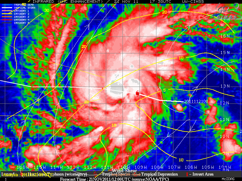
Kenneth was upgraded to a Hurricane on 21 November. GOES-15 0.63 µm visible channel images (above; click image to play animation) showed a ragged eye forming as curved convective bands wrapped around the center of the tropical cyclone. Kenneth was able to intensify in part because it was in an environment that possessed uncharacteristically low values of deep layer wind shear (below).
======== 22 November Update ========
Hurricane Kenneth strengthened to a Category 4 storm on 22 November, becoming the most intense major hurricane to form so late in the season in the satellite era. GOES-15 0.63 µm visible channel images (above; click image to play animation) showed the well-defined eye of Kenneth.


