Tropical Storm Don Forms in the Gulf of Mexico
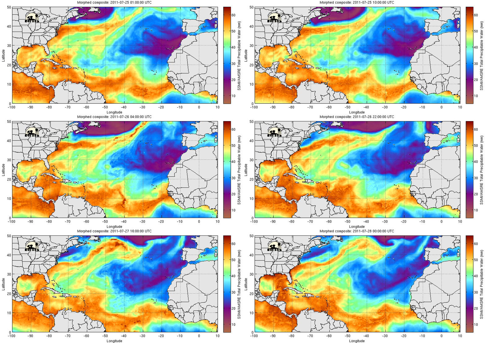
Microwave estimates of total precipitable water (from the CIMSS MIMIC website), above, from 24-27 July 2011, show the progression of a tropical wave through the northwest Caribbean Sea into the southern Gulf of Mexico. Late in the day on 27 July, Air Force Reconaissance found a closed circulation with winds that were strong enough to earn the system a tropical storm designation.
Visible imagery from late in the day (above) on the 27th shows extensive convection, with some overshooting tops over the Yucatan Channel and over the adjacent landmass. Forecasts are for Don to strengthen slowly as it moves towards the west-northwest. Oceanic heat content estimates from RSMAS as displayed at the CIMSS Tropical Weather website show a region of high heat content (associated with the Loop Current in the Gulf of Mexico) north of the projected path of Don. Intensification of Don could be more rapid if the storm moves farther to the north, over the region of higher heat content.
Shear values around Don are low. That and the warm sea surface temperatures over the Gulf argue for slow intensification.
Don’s projected path into south Texas takes it to a region suffering from extreme drought, as shown here.


