Flash Floods in Hawaii
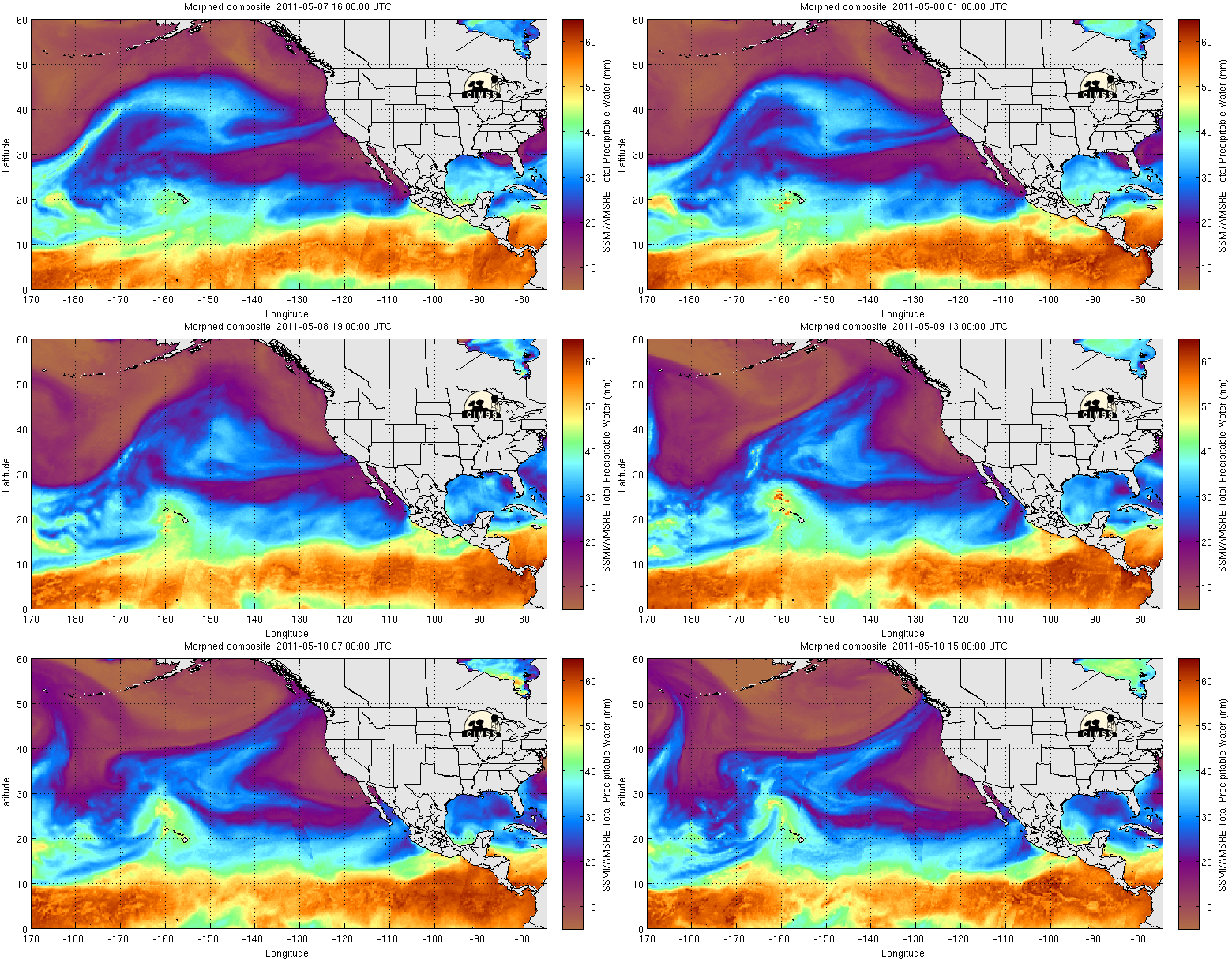
Images of MIMIC Total Precipitable Water, above, show moist air emerging from the Intertropical Convergence Zone and streaming north over the western islands of Hawaii.
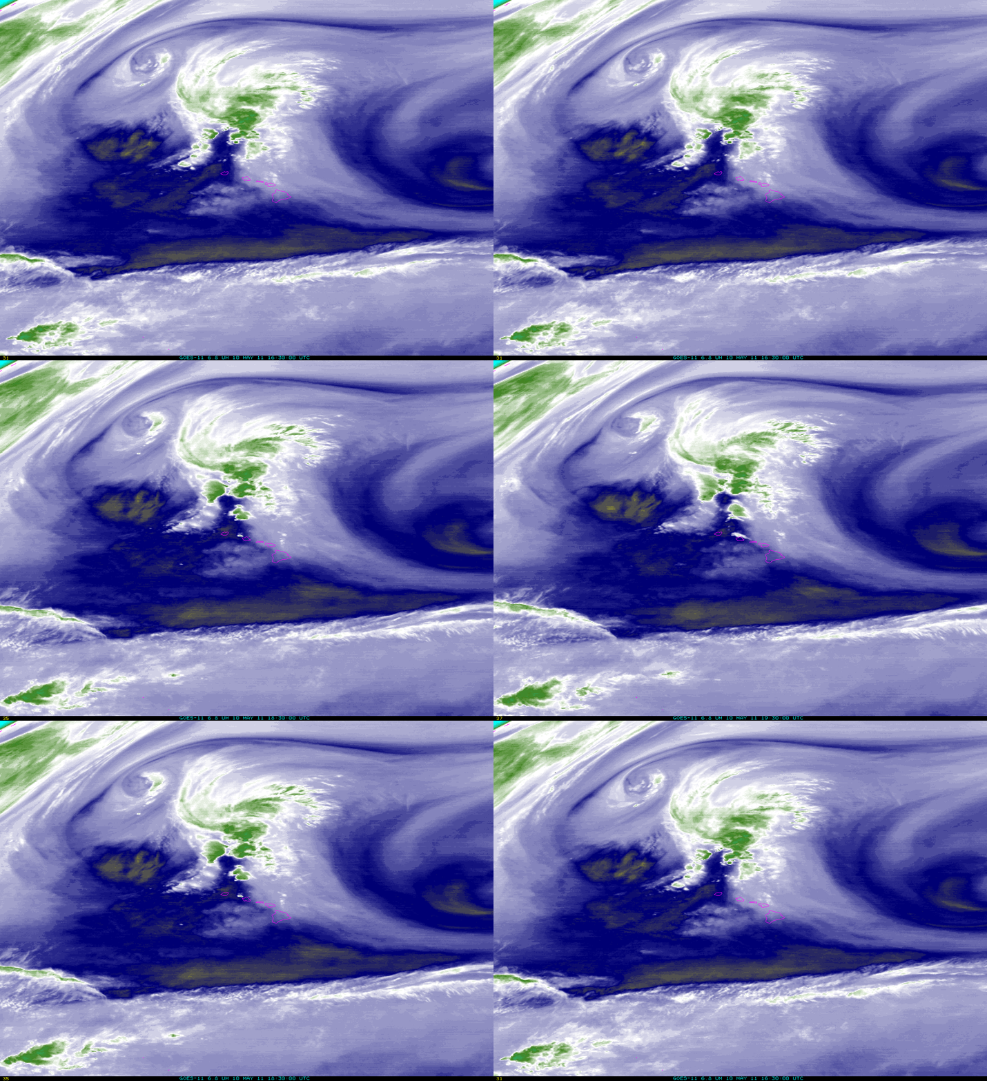
GOES-West water vapor imagery (the rocking animation, above) shows the circulation north of the Hawaiian islands that is drawing moisture northward. Because the water vapor channel on the Imager is most accurate at sensing the temperature at the top of the moist layer, however, water vapor imagery can significantly underestimate the amount of water vapor that is in the atmospheric column. The warm temperatures evident over the western Hawaiian Islands (the blue and yellow enhancements) suggest that the water vapor that is emitting radiation sensed by the satellite is warm and confined to lower levels in the atmosphere. Images of Total Precipitable Water give a better indication of how much water vapor is available for precipitation.
Flash flood watches continue through late Tuesday, 10 May, for the western Islands of Hawaii (Oahu, Kauai and Niihau) as the moisture plume continues to drift westward.
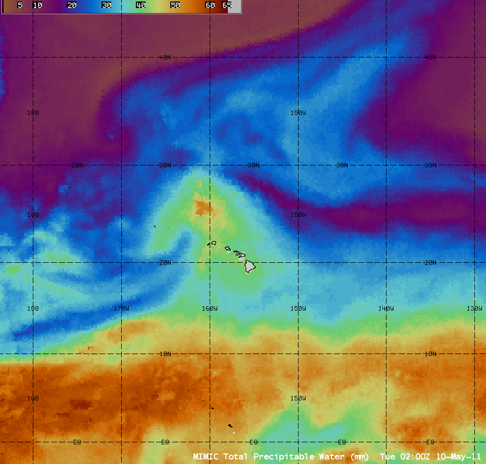
The CIMSS MIMIC Total Precipitable Water product is also available for NWS forecast offices to add to their local AWIPS workstations (via Unidata LDM subscription) — a sample animation is shown below. To learn more about the MIMIC TPW product and its applications, a VISIT lesson is also available.


