Tule fog in the Central Valley of California
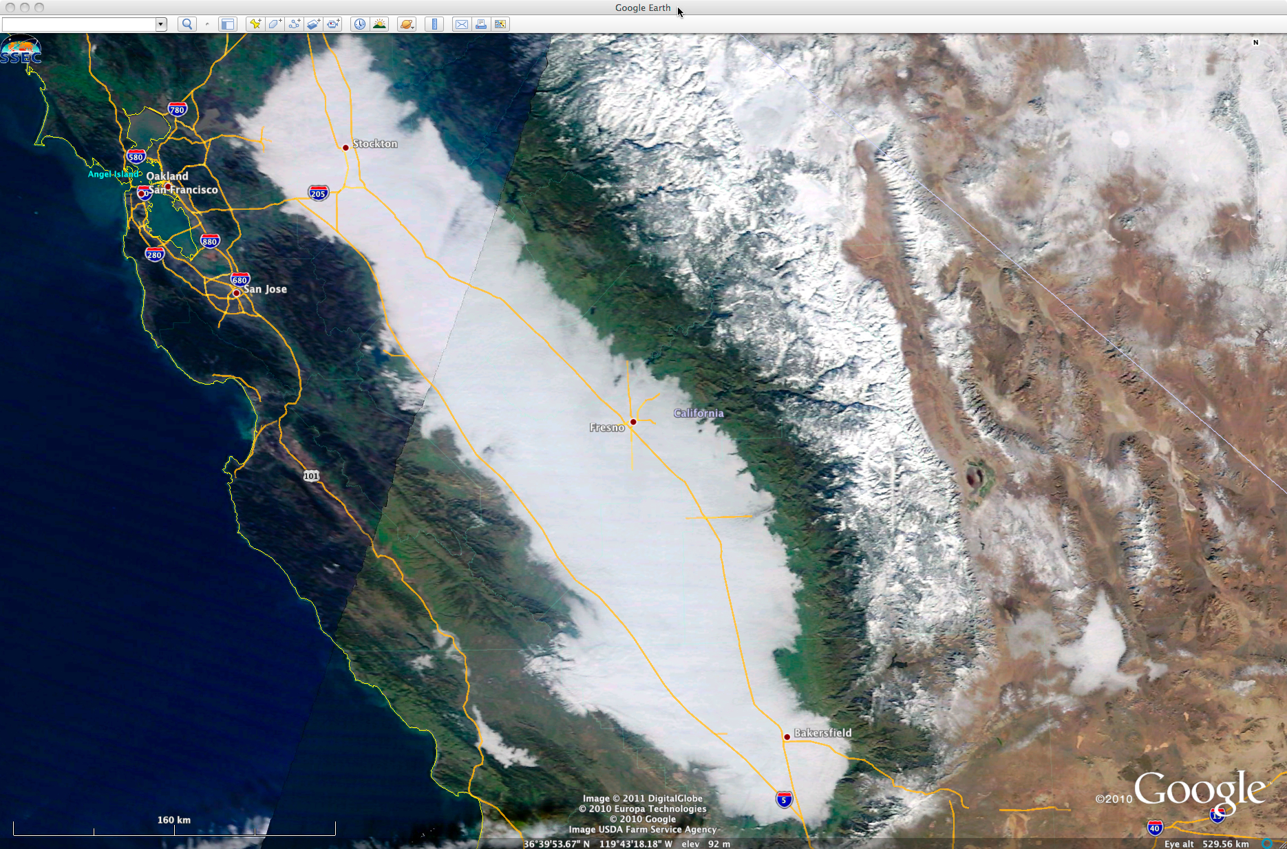
McIDAS images of GOES-11 0.65 µm visible channel data (above) showed a persistent Tule fog event across much of the Central Valley of California on 05 January 2011. The northern portion of the fog eventually began to erode into the afternoon hours, but the remainder of the fog feature showed little change. A 1-km resolution MODIS Red/Green/Blue (RGB) true color image from the SSEC MODIS Today site (below) offered another view of the fog. The snow-covered Sierra Nevada Range can be seen to the east of the Central Valley.
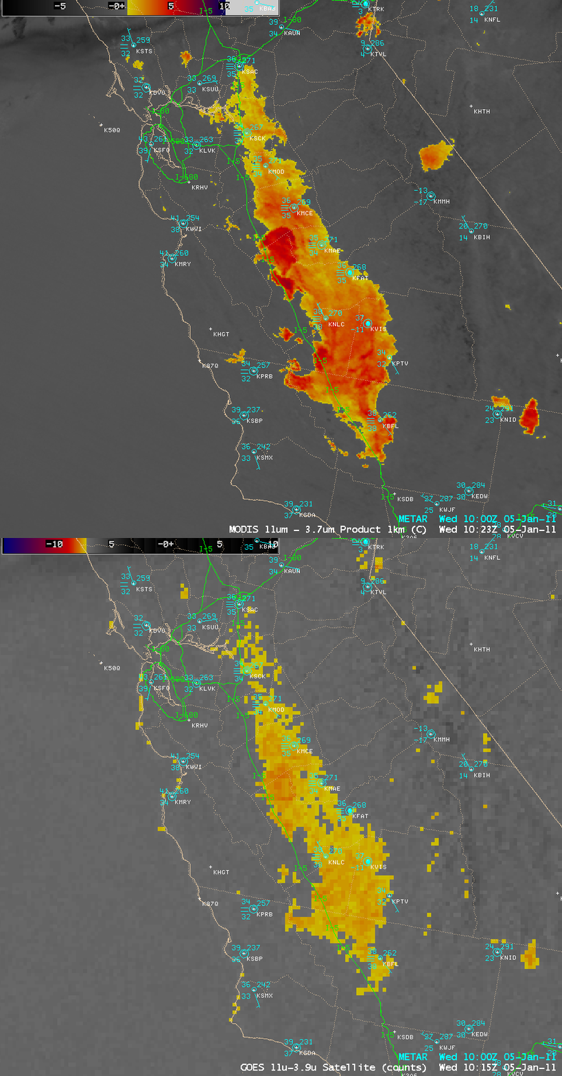
Before the areal extent of the fog could be monitored using daytime visible images, a comparison of AWIPS images of the 1-km resolution MODIS fog/stratus product and the corresponding 4-km resolution GOES-11 fog/stratus product (below) demonstrated the clear advantage of improved spatial resolution for detecting the location of the fog edges. In addition, the portions of the fog that were deeper in vertical extent were highlighted with an orange to red color enhancement.
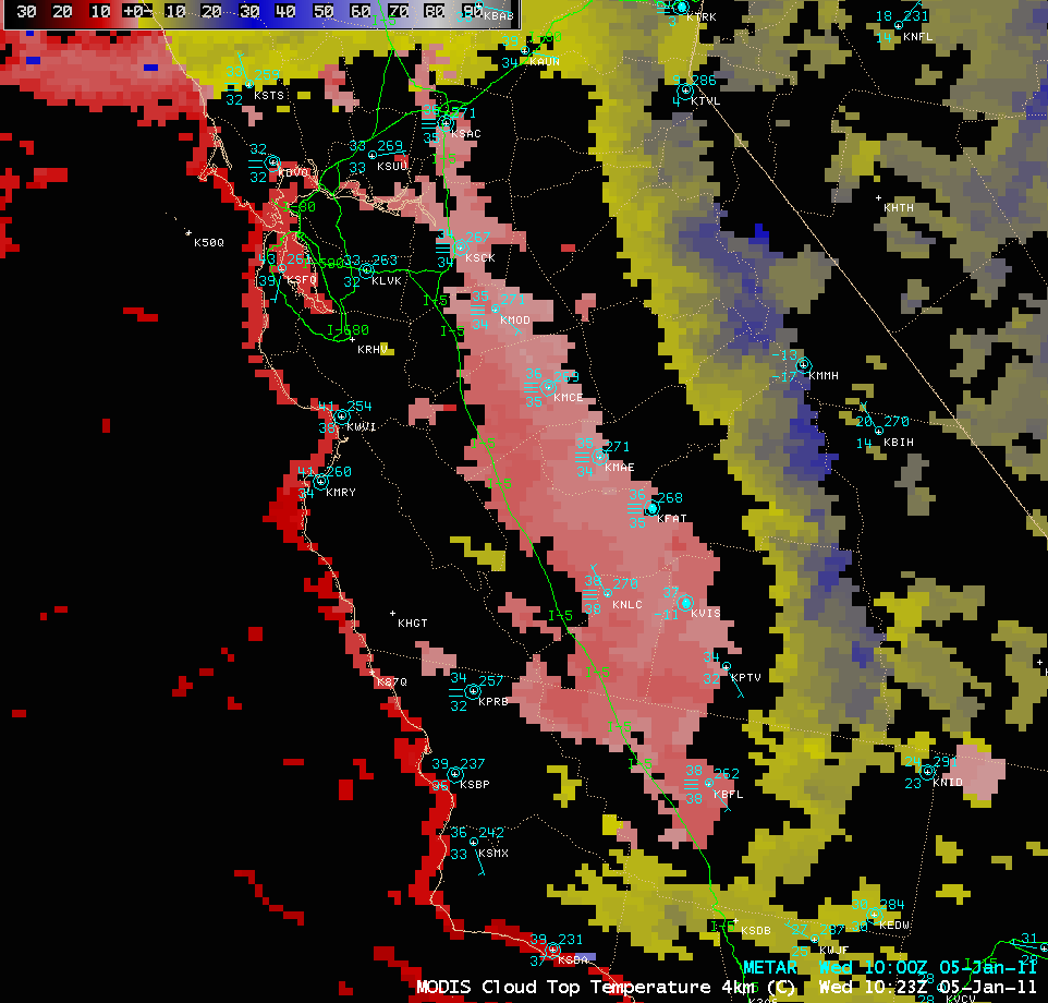
The MODIS Cloud Top Temperature (CTT) product (below) depicted CTT values of +1 to +4º C (lighter red color enhancement) across the fog feature. Note that the CTT product incorrectly identified the cold, snow-covered Sierra Nevada mountains as cloud, with CTT values between 0 and -25º C (yellow to blue color enhancement).


