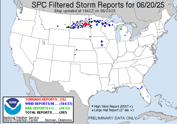
Severe weather over the northern Plains (including an EF-5 tornado near Enderlin, North Dakota)

A fast-moving thunderstorm complex raced across North Dakota and Minnesota in the late afternoon/evening/overnight on 20-21 June 2025, as shown above. GOES-19 band 13 (10.3 µm) imagery and derived stability (Lifted Index) show the development of notable instability with an alignment over North Dakota along the direction of convective movement. One very noteworthy aspect of the cold cloud-tops in GOES-19 is their very rapid movement across central North Dakota from about 0100-0500 UTC on 21 June. Mesoscale discussions from SPC on this complex are here, here, here, here, here, here, here, here, here and here (!! — there were a lot of them!). SPC Watch numbers 447, 448 and 449 covered this system.
This system caused numerous tornadoes and severe wind reports as shown below.
________________
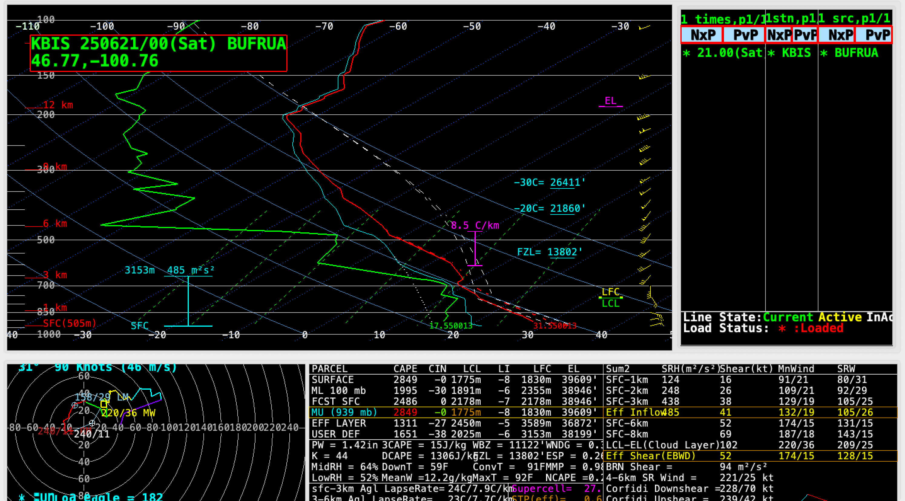
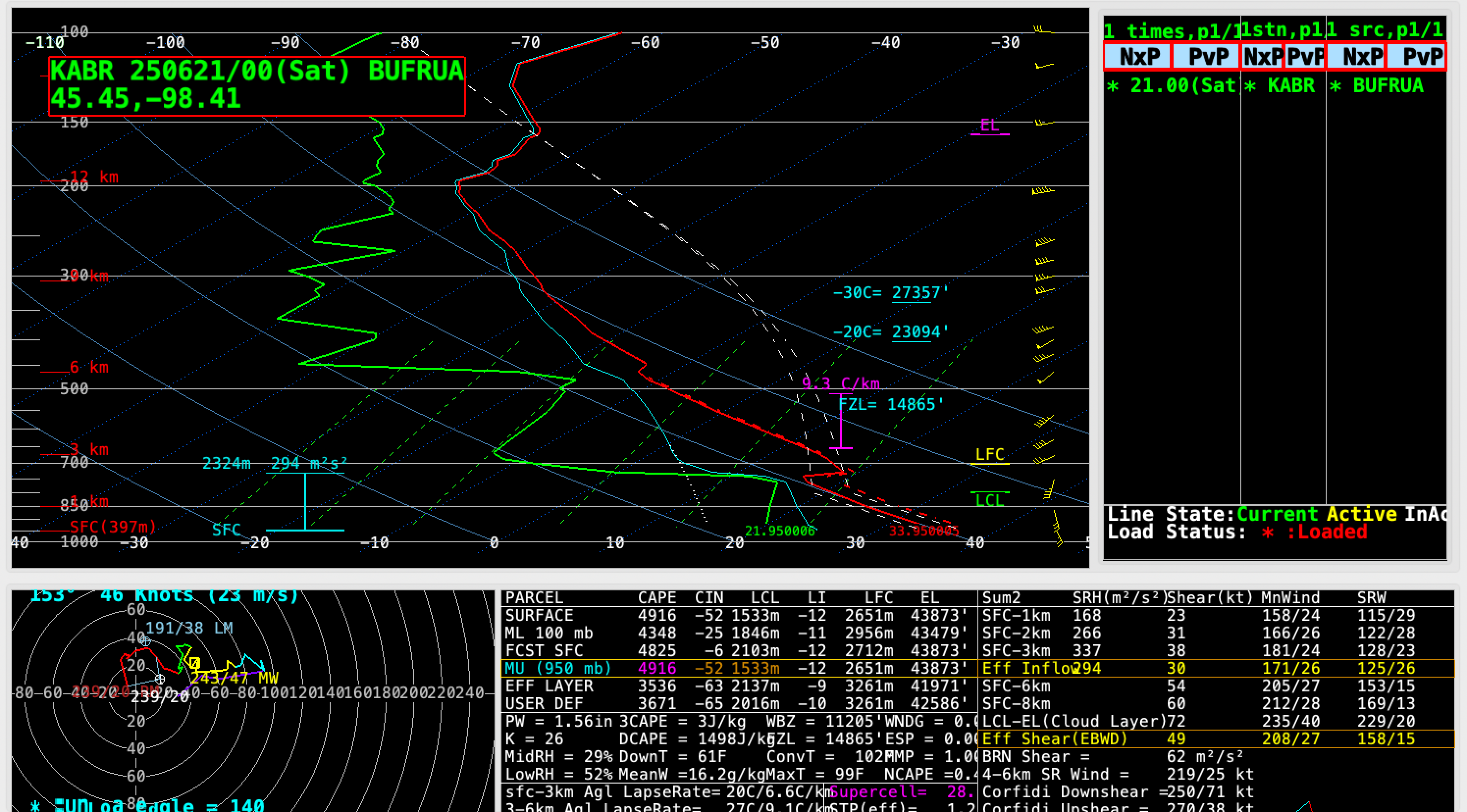
Overlapping 1-minute Mesoscale Domain Sectors provided GOES-19 (GOES-East) imagery at 30-second intervals over much of the area affected by this severe convection; shown below is Infrared imagery of a large mesoscale convective system over western/central North Dakota and a pair of supercell thunderstorms in eastern North Dakota as they eventually merged and began to move eastward across northwestern Minnesota. Pulsing overshooting tops exhibited infrared brightness temperatures in the -75 to -79ºC range (brighter white pixels embedded within dark black areas) — which represented a significant overshoot of the Most Unstable (MU) air parcel’s Equilibrium Level (EL), according to rawinsonde data at Bismarck ND and Aberdeen SD.
The supercell thunderstorms that developed over eastern North Dakota produced several tornadoes, including an EF3-rated tornado near Enderlin shortly after 0400 UTC that was responsible for 3 fatalities (NWS Grand Forks damage survey) **NOTE: after further investigation, Enderlin tornado #1 was upgraded from an EF-3 to an EF-5; specific details are available here. This was the first EF5-rated tornado in the US since 20 May 2013 in Moore OK**. Hail as large as 3.00″ in diameter also was reported with these supercell thunderstorms. The highest wind gusts associated with this derecho event included 111 mph in eastern North Dakota and 106 mph in northwestern Minnesota.

30-second GOES-19 Clean Infrared Window (10.3 µm) images with time-matched (+/- 3 minutes) SPC Storm Reports plotted in white, from 0040-0715 UTC on 21 June (courtesy Scott Bachmeier, CIMSS) [click to play animated GIF | MP4]