Strong thunderstorms in the Fairbanks, Alaska area
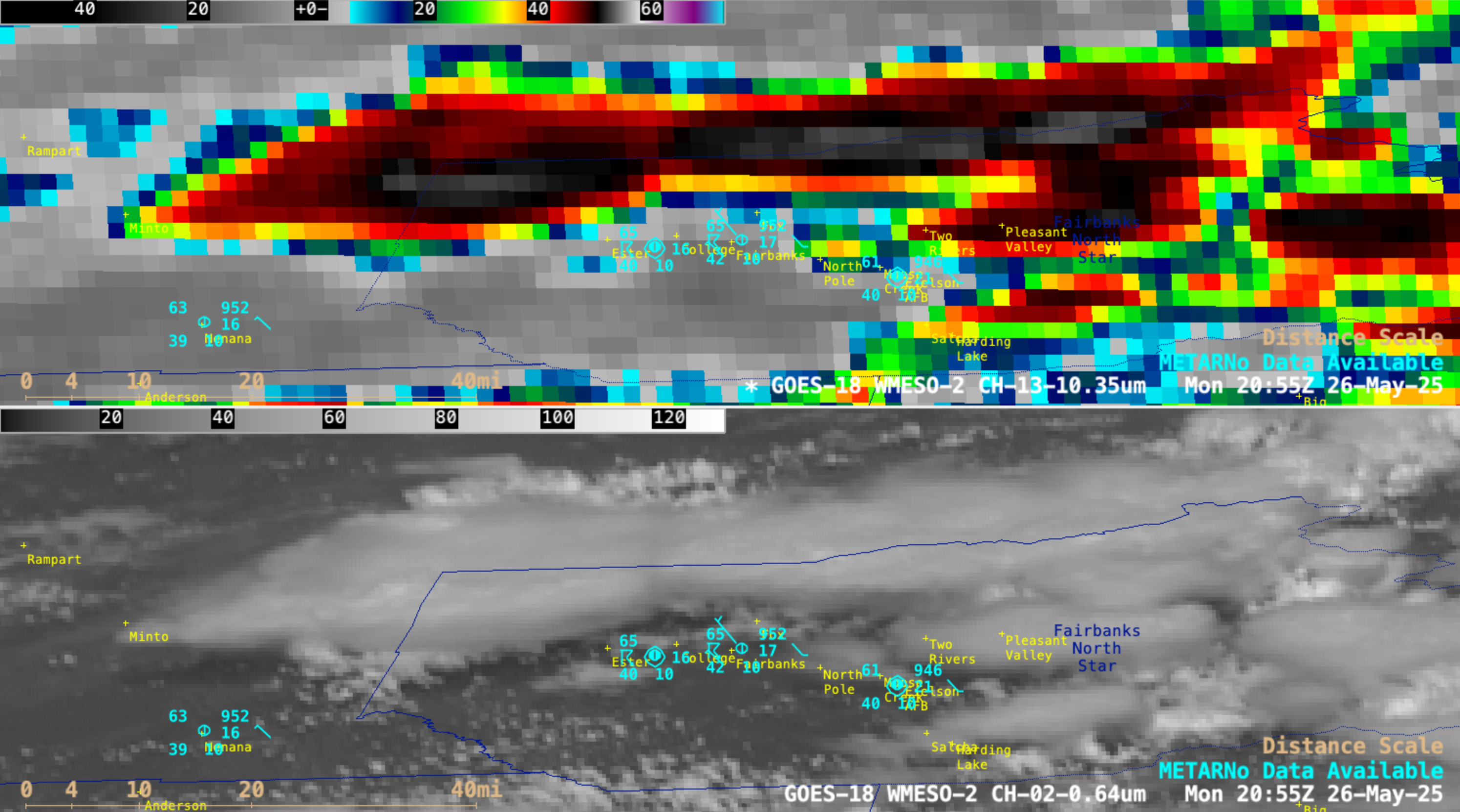
1-minute GOES-18 Clean Infrared Window (10.3 µm, top) and Red Visible (0.64 µm, bottom) images, from 1910-2300 UTC on 26 May [click to play MP4 animation]
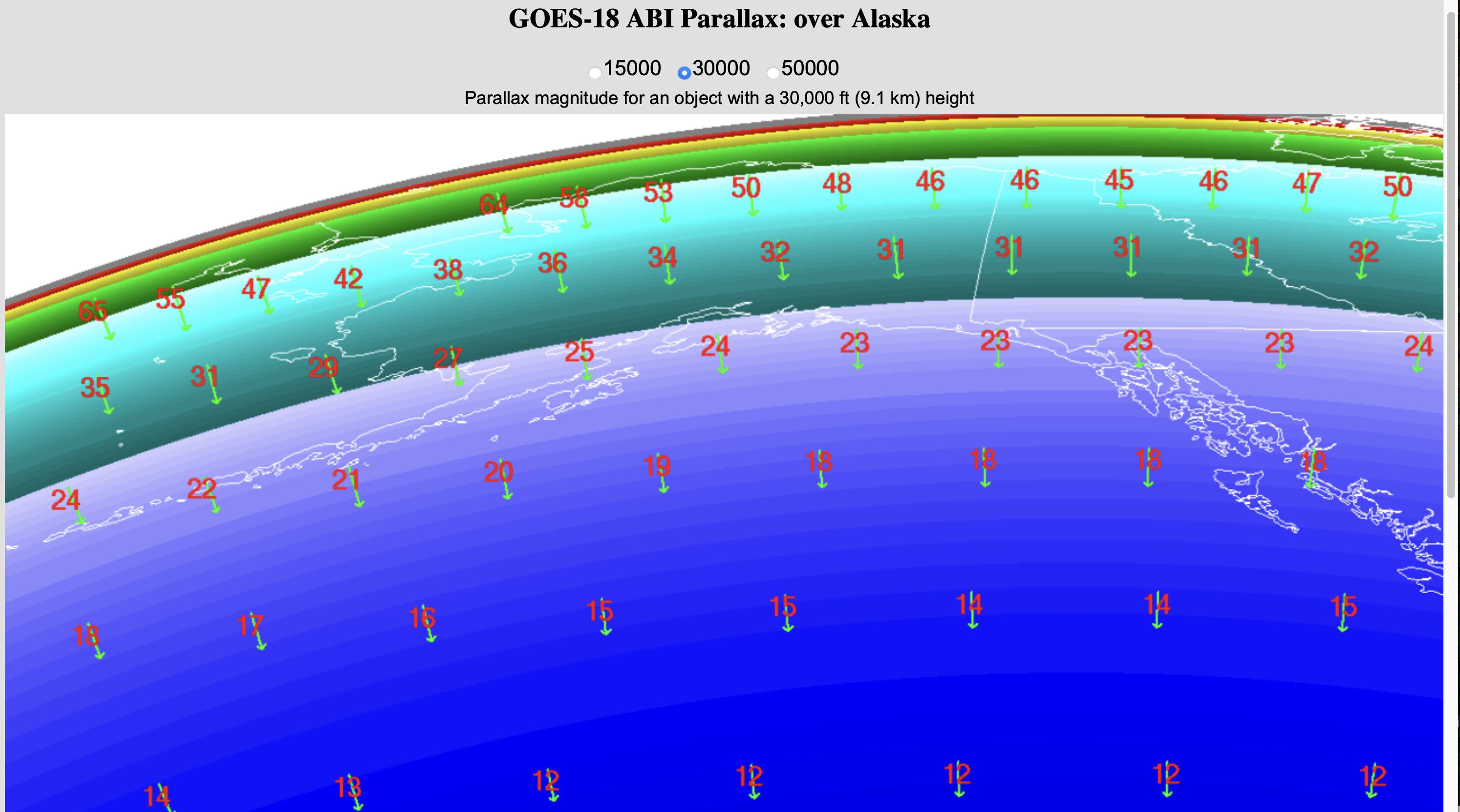
A sequence of Suomi-NPP VIIRS Infrared Window and Visible images (below) displayed 3 views of these thunderstorms — and without the parallax (from this site) that is inherent with GOES-18 imagery at the high latitudes of Alaska, the storms were situated more directly over the locations that reported hail (Fox, Fairbanks, North Pole and Moose Lake). The coldest cloud-top infrared brightness temperatures sensed with VIIRS instrument were around -60ºC.
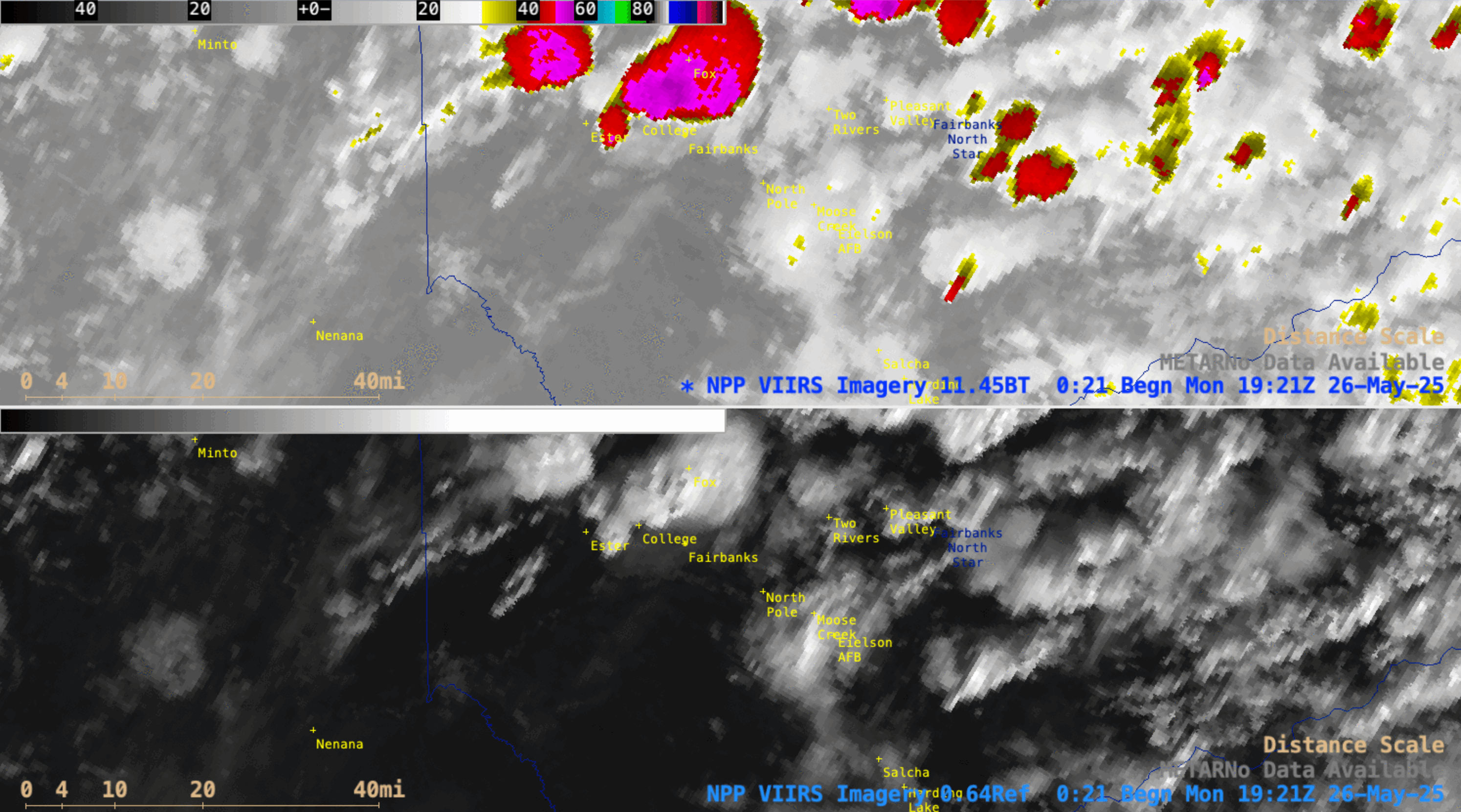
Sequence of Suomi-NPP VIIRS Infrared Window (11.45 µm, top) and Visible (0.64 µm, bottom) images that were valid at 1927, 2108 and 2248 UTC on 26 May [click to enlarge]
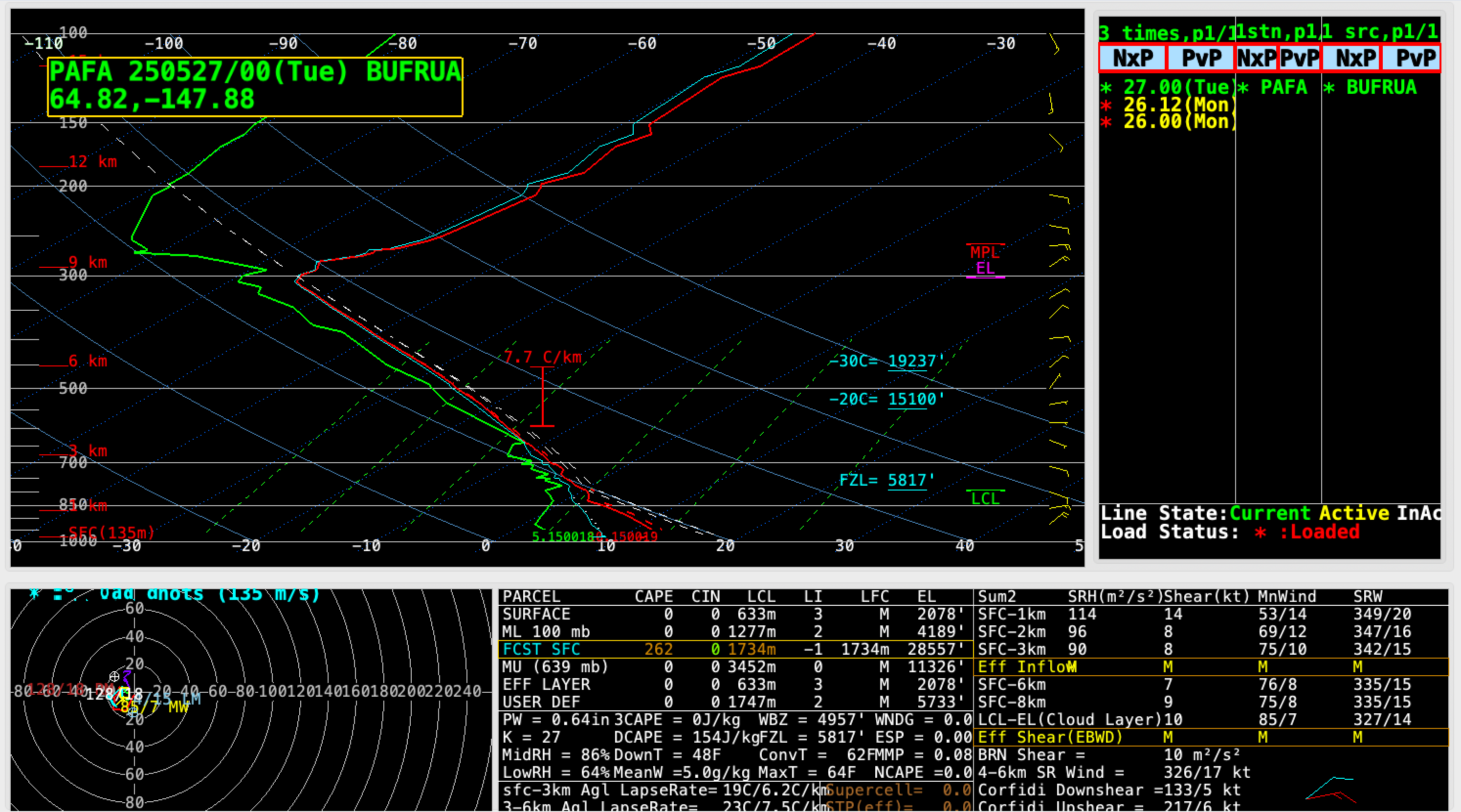
Plot of rawinsonde data from Fairbanks, Alaska at 0000 UTC on 27 May [click to enlarge]
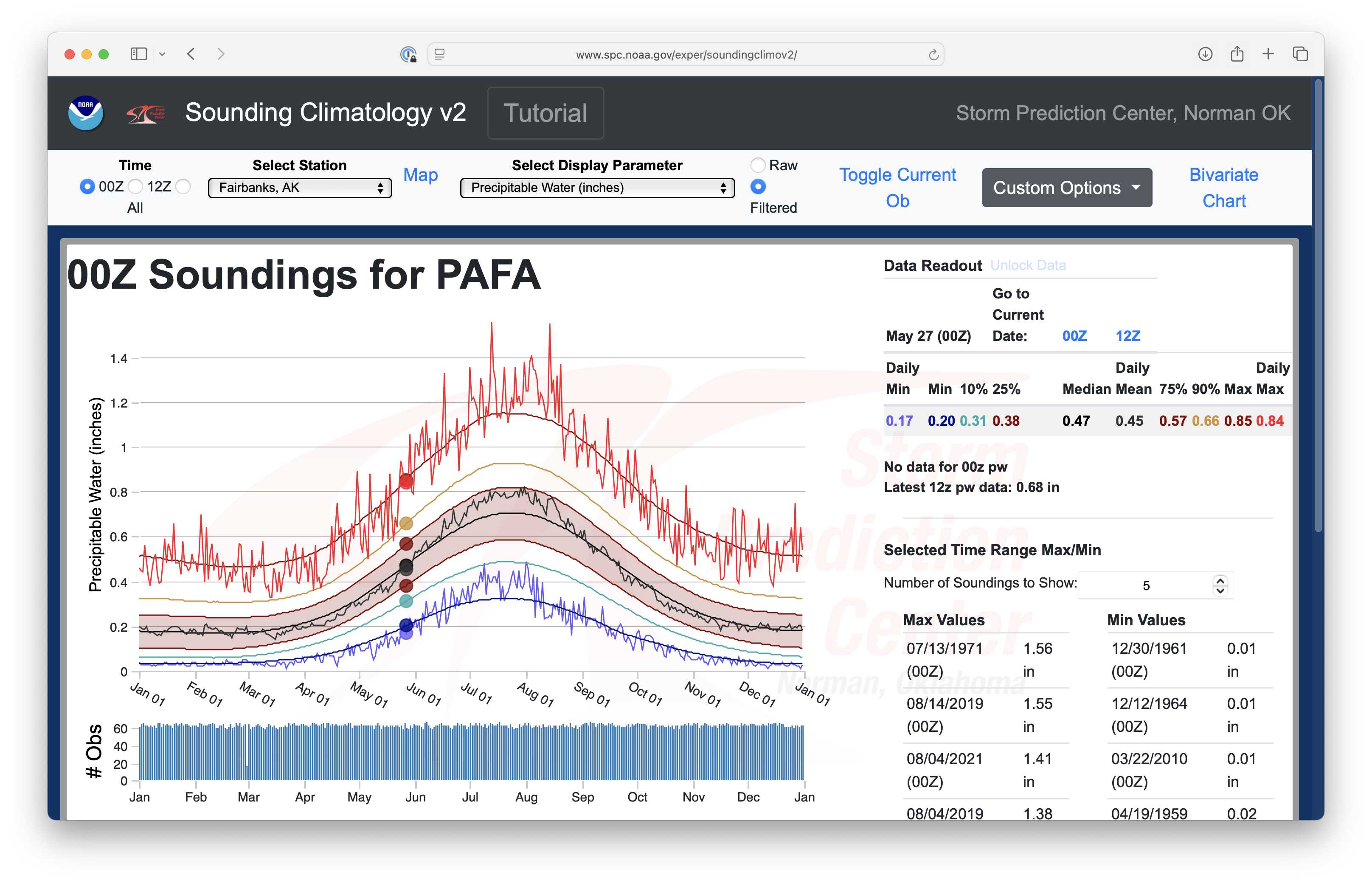
Climatology of Total Precipitable Water (PW) for Soundings at Fairbanks (PAFA), with the values for all soundings at 0000 UTC on 27 May highlighted [click to enlarge]