Severe thunderstorms in Nebraska and Iowa

1-minute GOES-19 “Red” Visible (0.64 µm) images with time-matched (+/- 3 minutes) SPC Storm Reports plotted in red, from 2200 UTC on 17 April to 0056 UTC on 18 April [click to play animated GIF | MP4]
In the corresponding 1-minute GOES-19 “Clean” Infrared Window (10.3 µm) images (below), the coldest cloud-top infrared brightness temperatures associated with some of the pulsing overshooting tops were in the -75 to -78ºC range.

1-minute GOES-19 “Clean” Infrared Window (10.3 µm) images with time-matched (+/- 3 minutes) SPC Storm Reports plotted in white, from 2200 UTC on 17 April to 0211 UTC on 18 April [click to play animated GIF | MP4]
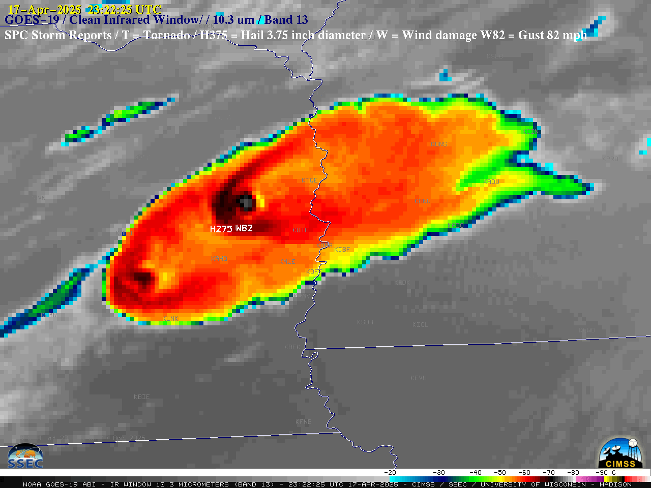
GOES-19 Visible and Infrared images at 2322 UTC on 17 April [click to enlarge]
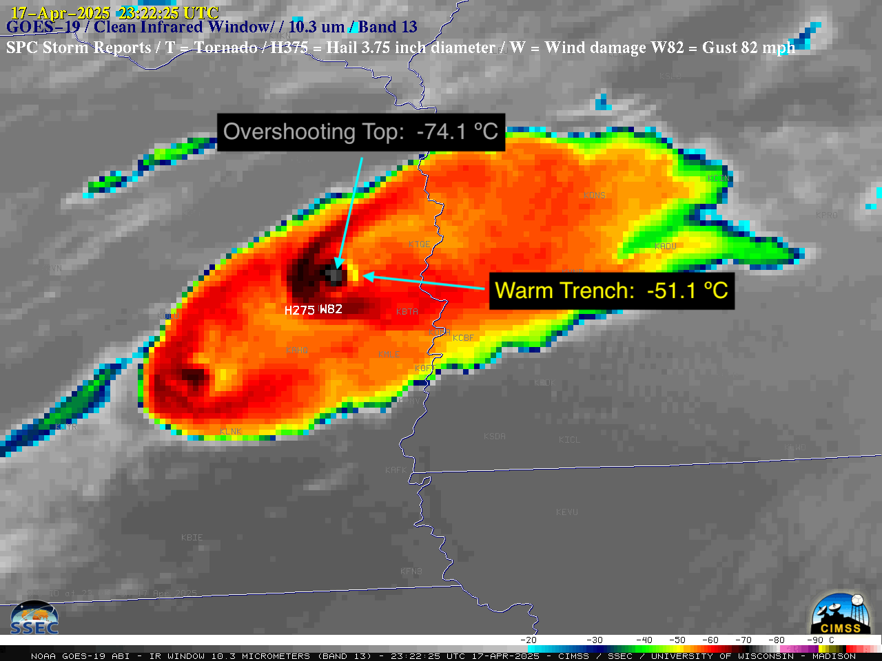
GOES-19 Infrared image at 2322 UTC on 17 April, with labels of cloud-top infrared brightness temperatures of the overshooting top and adjacent downwind warm trench [click to enlarge]
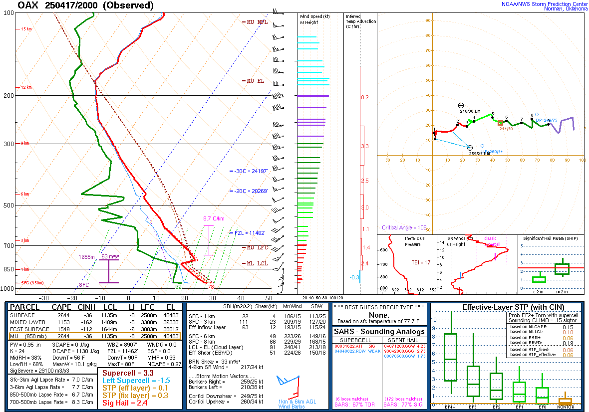
Plot of Omaha, Nebraska rawinsonde data at 2000 UTC on 17 April [click to enlarge]