LightningCast probabilities over southern Wisconsin

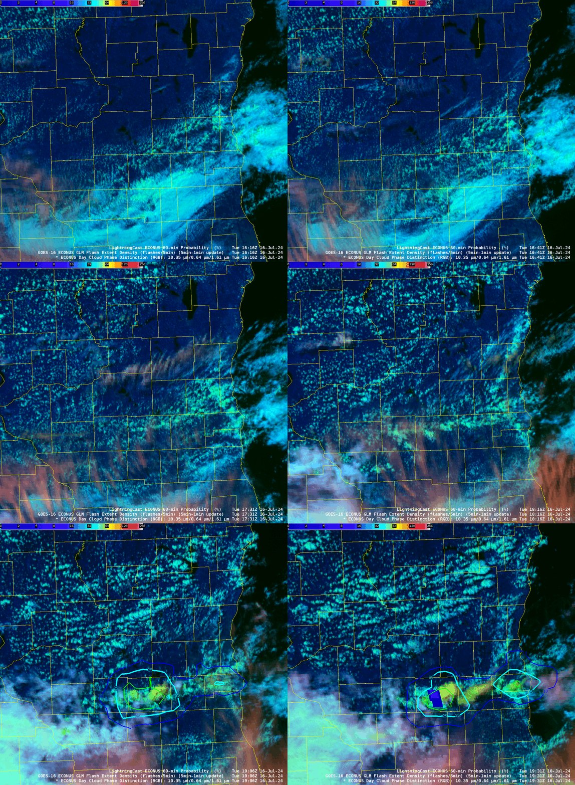
Day Cloud Phase Distinction imagery, above, from the GOES-16 CONUS Sector, shows the development of convection along the southern tier of counties in Wisconsin. LightningCast probabilities (the probability that a GLM observation will occur within the next 60 minutes) start to ramp up shortly after 1800 UTC, a 10% contour appears at 1826 UTC (in Rock County over southern Wisconsin), a 50% contour at 1851 UTC. The first GLM observation occurred between 1906 and 1911 UTC, meaning a lead time of more than 20 minutes from the appearance of the 50% contour.
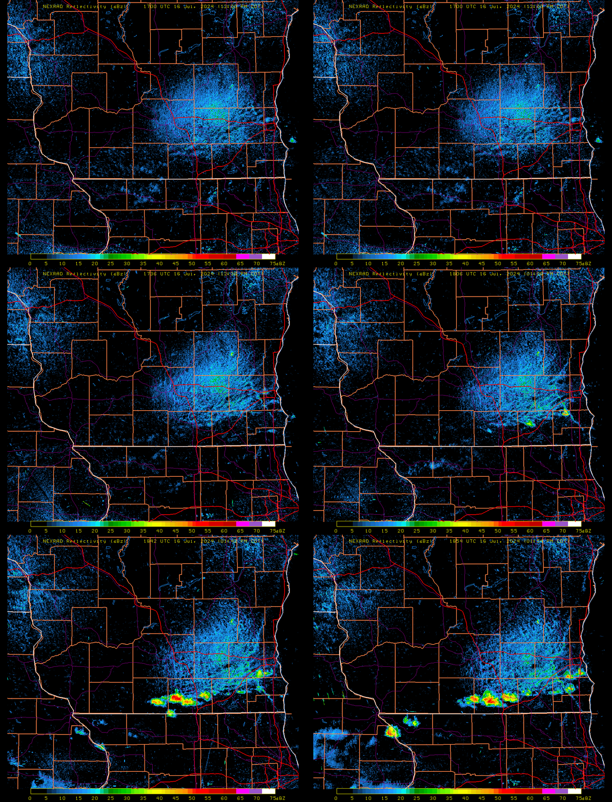
Nexrad reflectivity for this time (downloaded from this site) is shown below. Note in particular that radar echoes did not occur until around 1806 UTC (here’s a toggle showing the radar at 1801 and 1806) — but LightningCast values started to increase around 1751 UTC. LightningCast is suggesting something might happen before a signal appears on radar. The interaction between the east-west line of convection over southern Wisconsins and the lake breeze front propagating inland also deserves mention!

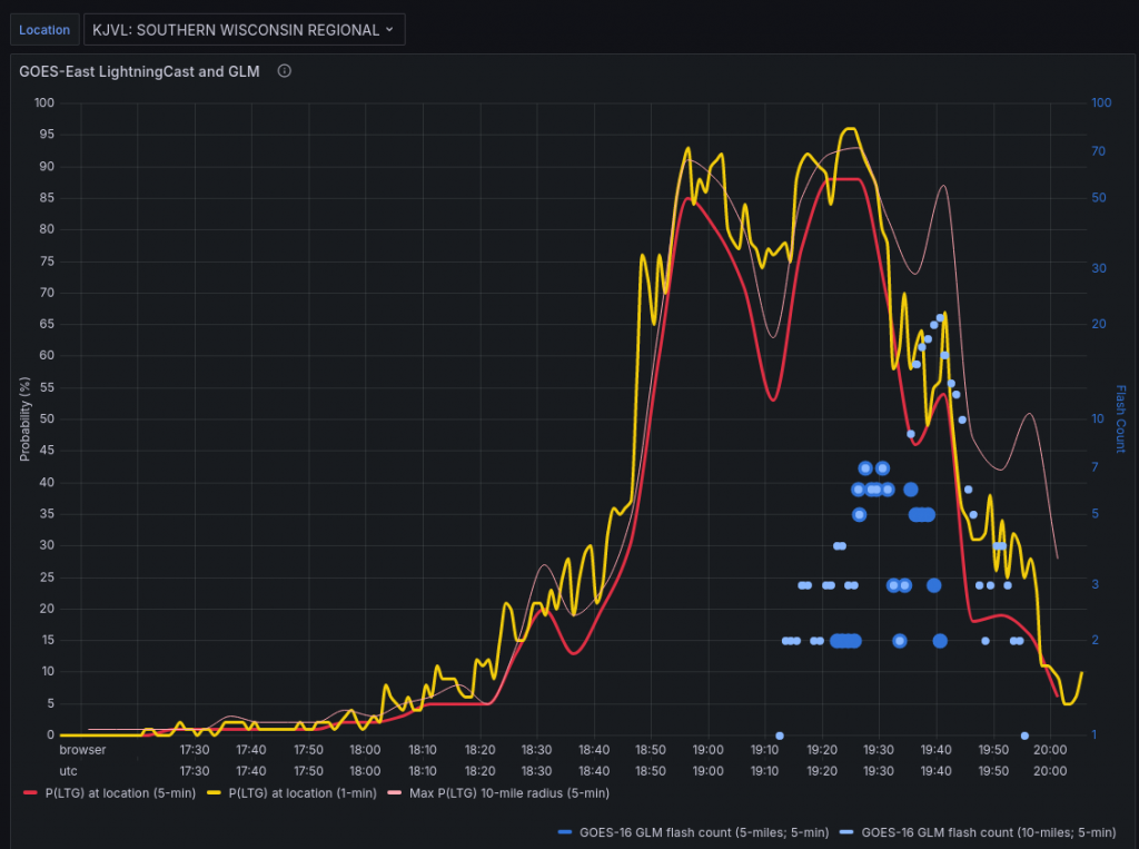
LightningCast Probabilities are available at this RealEarth instance. One of the features at that site is the Aviation Lightning Dashboard, available at all airports within the USA (and some outside of the USA). The readout for the Rock County airport (KJVL) is shown below.


