By Scott Bachmeier •
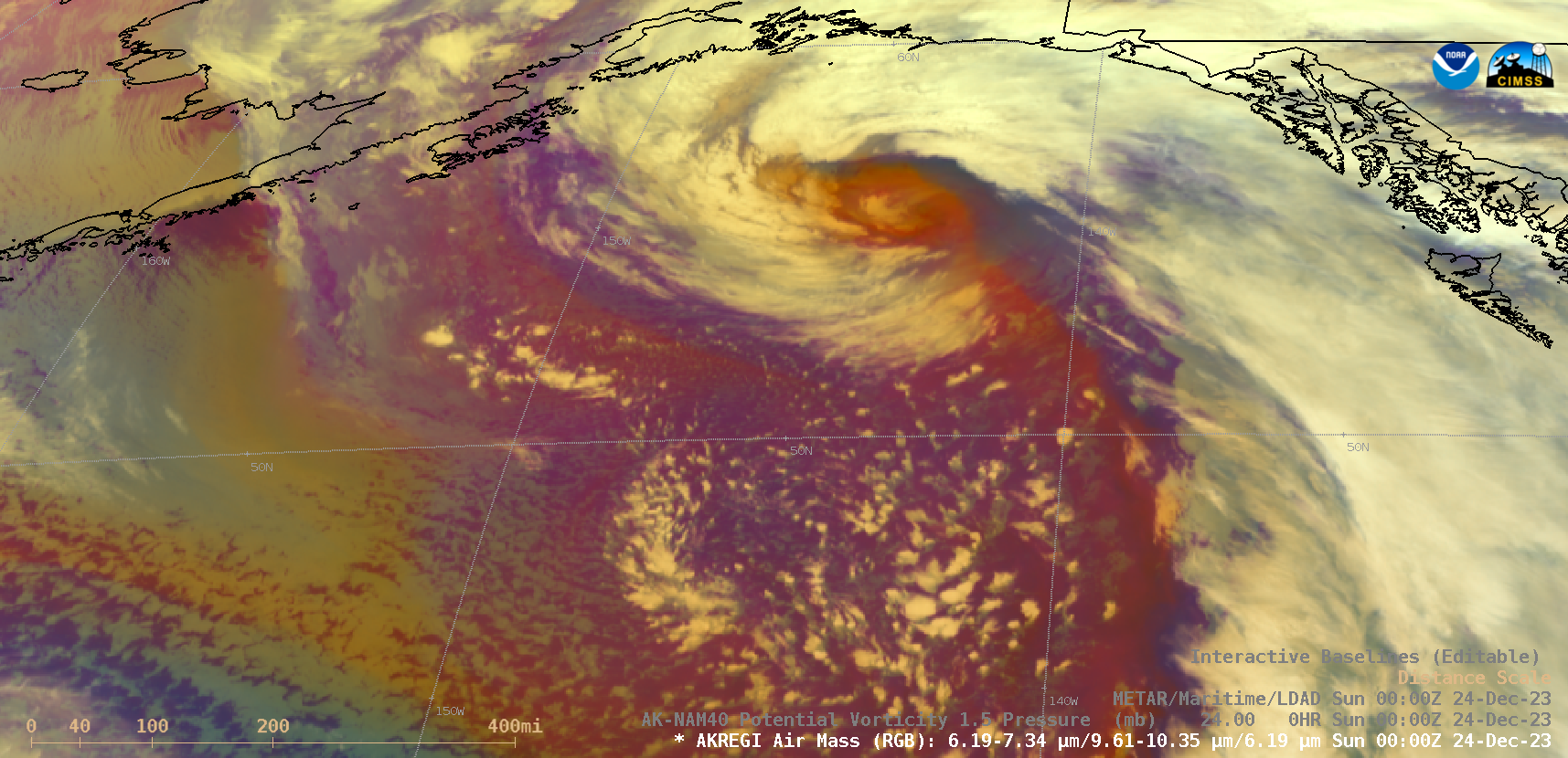
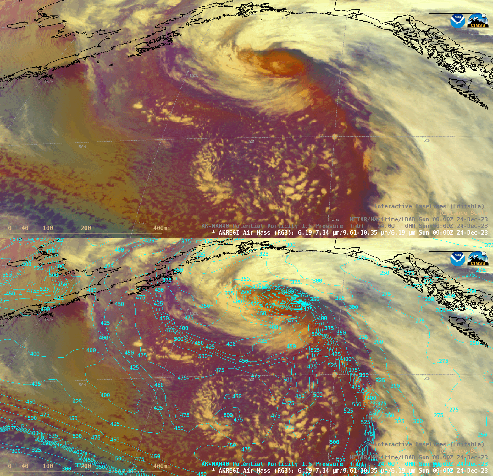
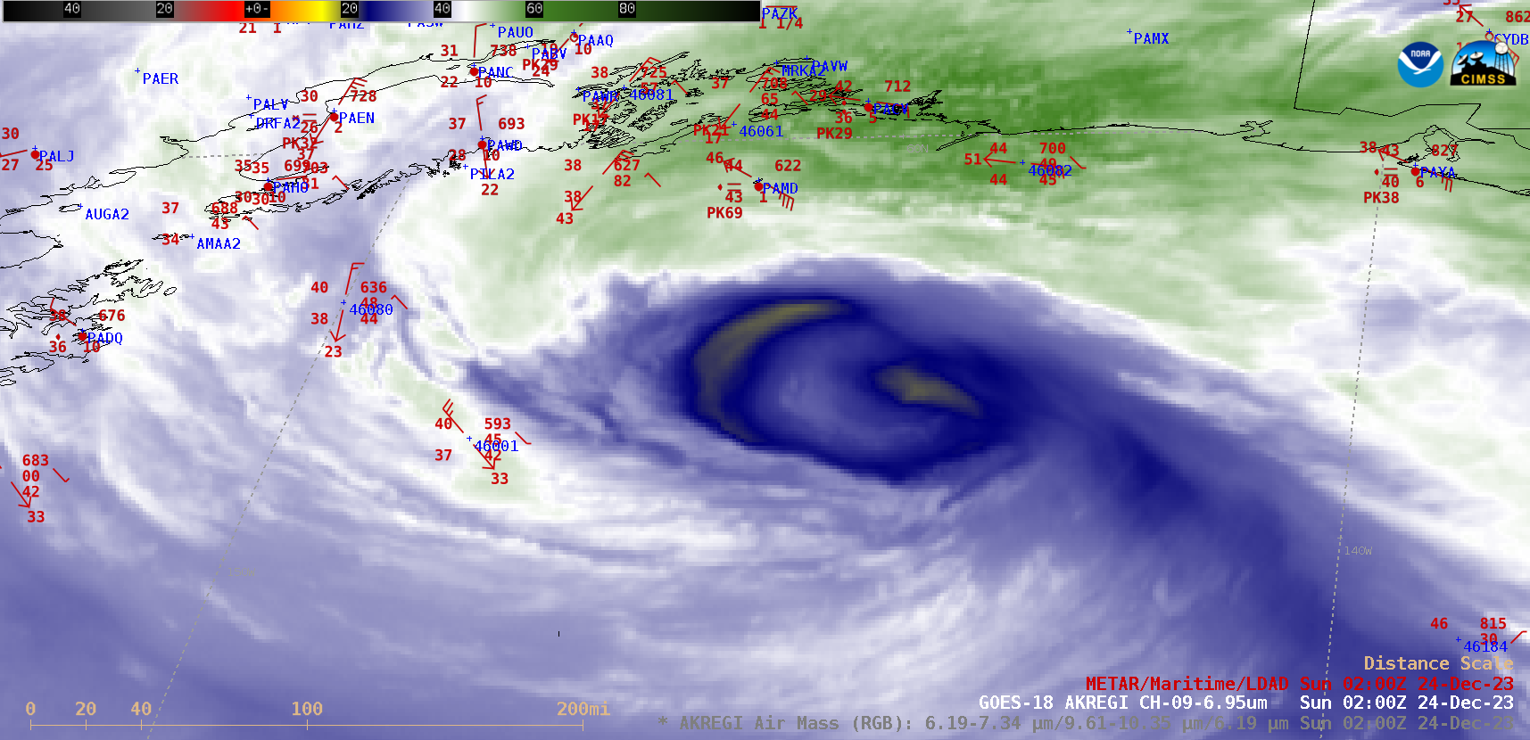
10-minute Full Disk scan GOES-18 Air Mass RGB images (above) showed a cyclone as it intensified to a Hurricane Force Low by 0000 UTC on 24 December 2023 as it moved north across the Gulf of Alaska (suface analyses). Brighter orange-red hues in the RGB images highlighted a Potential Vortcity (PV) Anomaly within the core of the low pressure system — AK-NAM40 model fields indicated that the “dynamic tropopause” (taken to be the pressure of the PV 1.5 surface) had descended to near the 800 hPa pressure level at 0000 UTC on 24 December (below). A closer view of GOES-18 Air Mass RGB and Mid-level Water Vapor (6.9 µm) images (below) displayed the low as it eventually moved inland across Southcentral Alaska by 1200 UTC on 24 December. Notable peak wind gusts included 70 knots at Buoy 46082 at 0710 UTC, 69 knots at Middleton Island (PAMD) around 0200 UTC and 60 knots at Codova (PACV) around 1100 UTC. This Hurricane Force Low was rather anomalous in terms of its low Mean Sea Level Pressure (MSLP) and strong 925 hPa wind speeds (source), as shown below.Categories: GOES-18, Red-Green-Blue (RGB) images