Wet weather in the Pacific Northwest
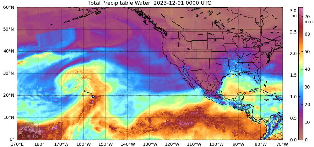
Hourly GOES-18 Hemispheric views, above, from 2140 UTC on 1 December to 2040 UTC on 4 December, (from the CSPP Geosphere site) show the development of a strong system in the Gulf of Alaska. This system is tapping into an airstream rich in moisture that augurs for a wet period along the Pacific Northwest coast. Flood watches and have been issued from western Washington and Oregon. MIMIC Total Precipitable Water fields in December ending at 1500 UTC on 4 December, below, show that some of the moisture in the North Pacific may have been part of the Kona Low that drenched Hawai’i last week.
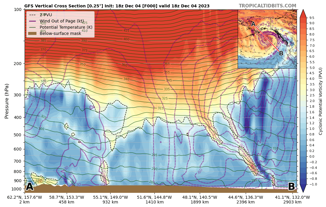
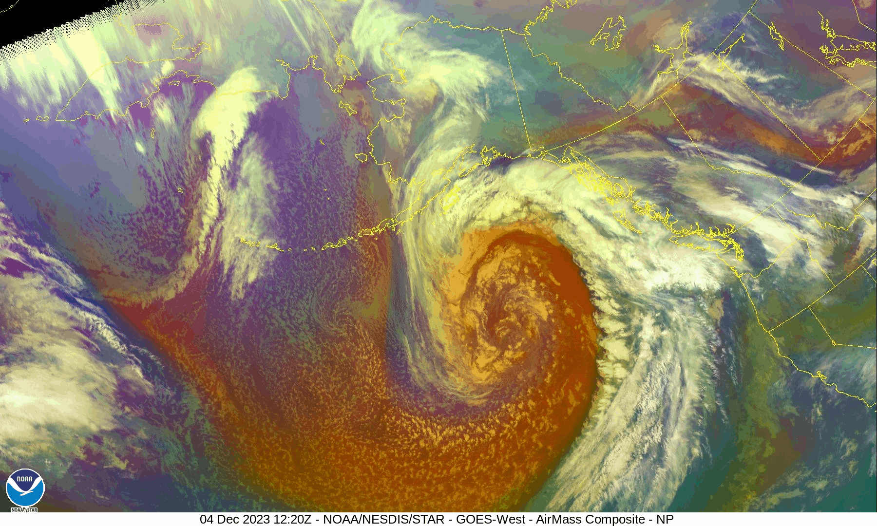
Airmass RGB imagery from GOES-18, below (from this OSPO site), shows the well-developed cyclone with the characteristic orange signal in the airmass RGB denoting air with a large Potential Vorticity signal (as confirmed in this cross-section from1800 UTC on 4 December, take from this site).
For more information on this event, refer to the websites of the National Weather Service Offices in Seattle, Portand and Medford.