Add Level 2 Products to satellite imagery to understand the atmosphere
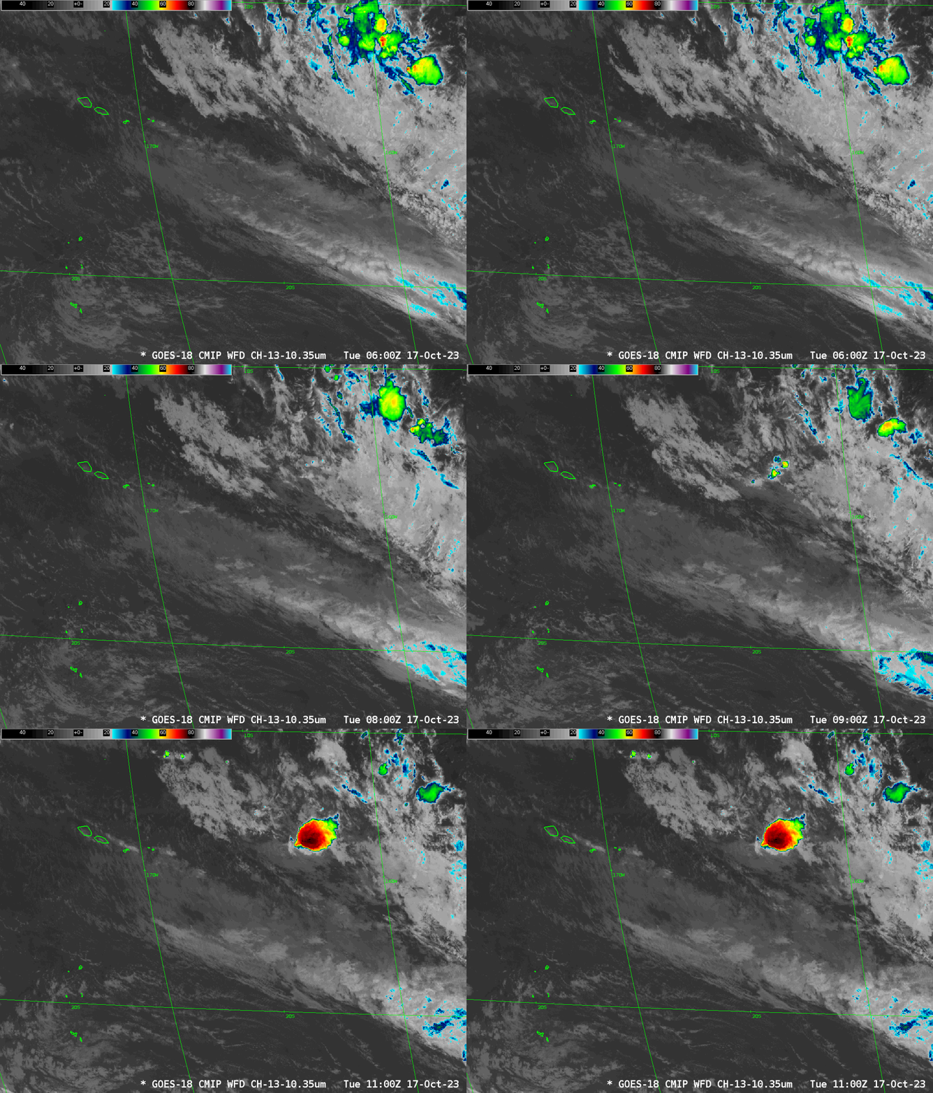
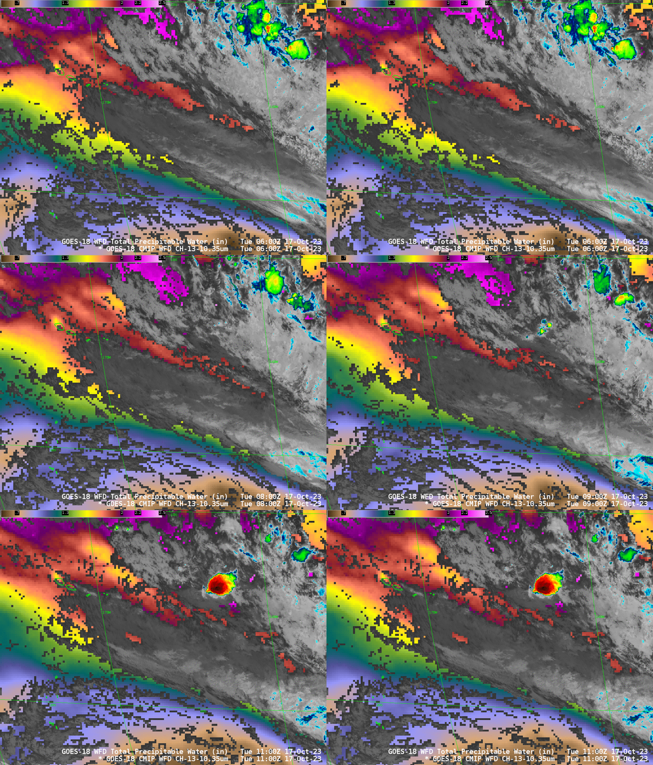
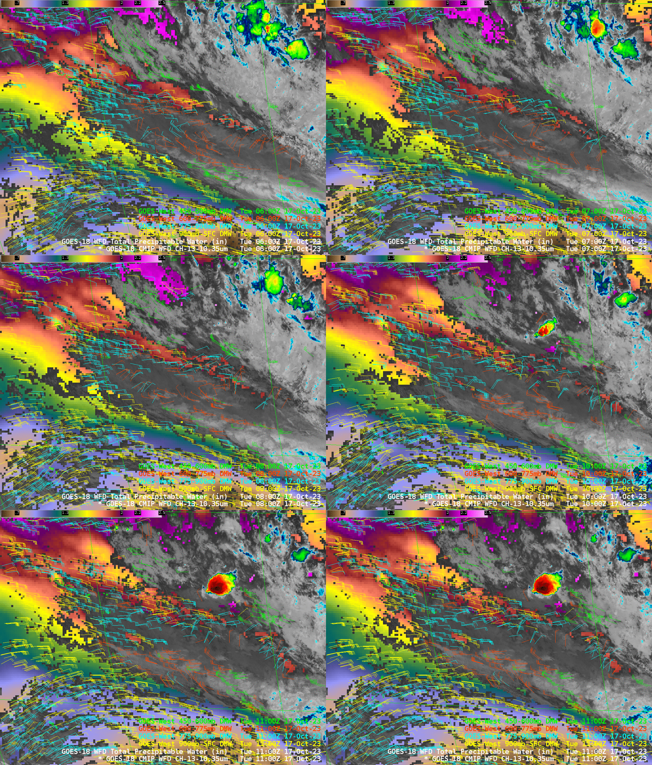
GOES-R Satellites (GOES-16 as GOES-East and GOES-18 as GOES-West) provide single-channel observations, such as the clean window infrared image above that can be used to identify features. In the example above, a mid-level cloud deck stretches southeastward from the Samoan islands that surround 170oW Longitude. Higher clouds with with embedded convection are apparent in the northeastern quadrant of the animation, with a noticeable convective feature forming from 1000 to 1100 UTC. A useful Level 2 product to include in a Clean Window infrared image is the Total Precipitable Water: this is a clear-sky only product and thus gives information where the Band 13 image is returning surface information. The animation below has TPW underlain under the Band 13 image and the default AWIPS enhancement for TPW has been altered: the driest value is 0.5 (inches) rather than 0.0. The TPW distribution allows a viewer to note that the cloud band to the southeast of the Samoan Islands is aligned with a moisture gradient. That deep convective complex is developing near the southern gradient of that deepest moisture. The driest atmosphere is south of 20oS in the image below.
Derived Motion Wind vectors are another Level 2 product, and they can be plotted as a function of pressure, as shown below. This added information provides useful context to the infrared imagery. At lower levels (surface-900 mb), cloud motion is brisk and from the east and southeast at 20-25 knots. From 775-900 mb, motion is more easterly; derived vectors have appeared on top of the cloud band that stretches southeastward from the Samoan islands. The convection that develops between 1000 and 1100 UTC is within a region of cyclonic winds. Between 600-775 mb, winds are more westerly, and the convection that is developing between 1000 and 1100 UTC is within a region of diffluence associated with anticyclonic motion. Winds from 450-600 mb also show diffluence in the region where convection developed.
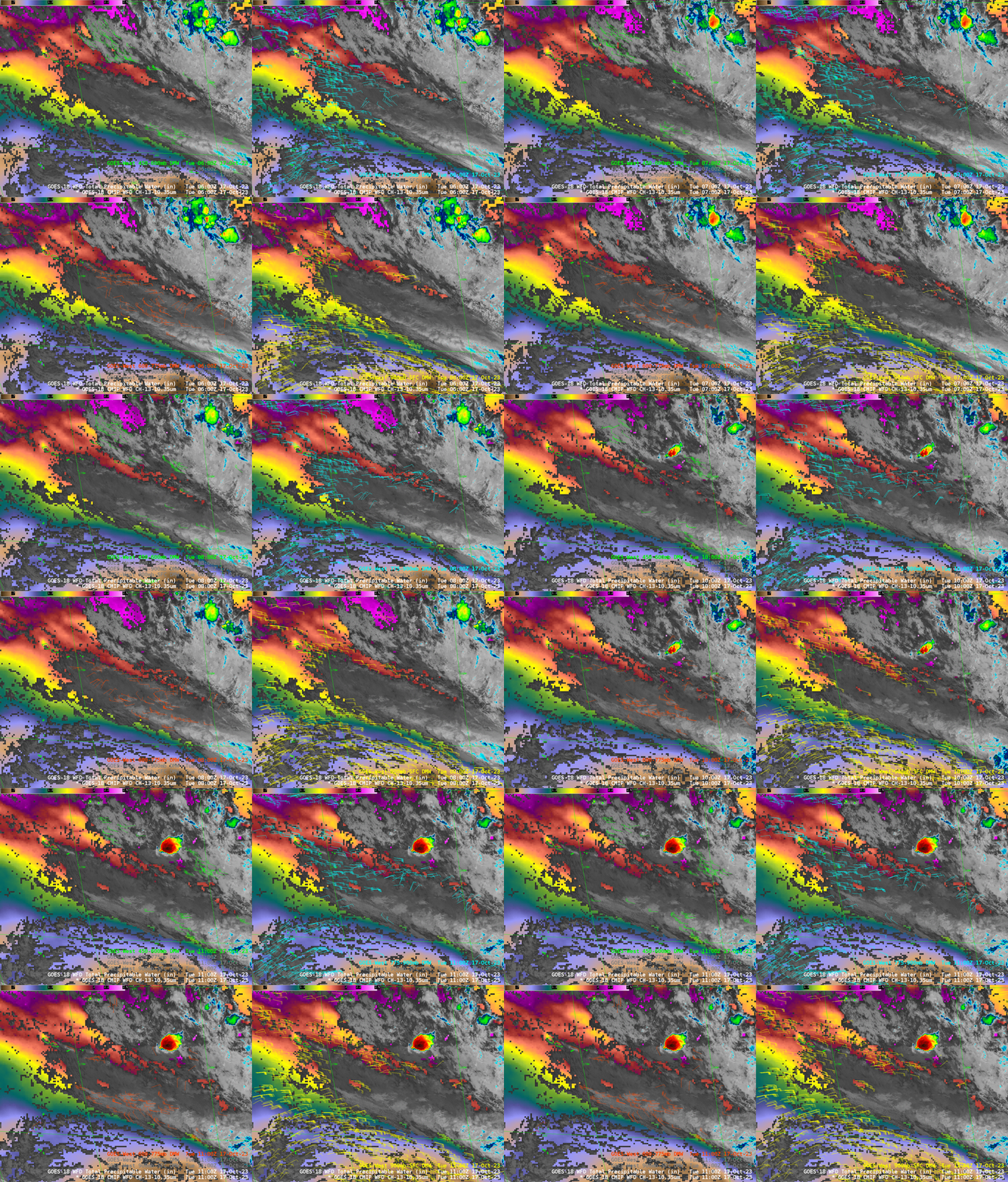
The animation below shows the derived winds all plotted on top of each other. AWIPS will also plot vectors such that the wind barb color is a function of wind speed. Low-level winds at this time are mostly derived from the 3.9 µm imagery. High-level winds are derived from Water Vapor channels and from 11.2 µm imagery.
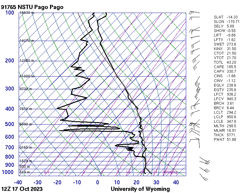
The pronounced shift in wind direction with height is also apparent from the 1200 UTC 17 October 2023 Rawinsonde from Pago Pago, below (from this link).
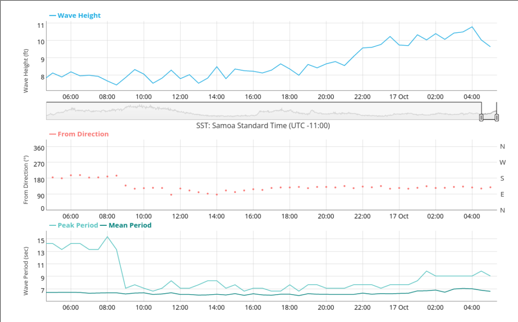
The persistent winds have raised seas around American Samoa. The buoy at Aunu’u below shows seas climbing to above 10 feet before sunrise American Samoa Time on the 17th. One other recent change that has happened is the cessation of the very long-period southerly swell that had persisted for several days through yesterday.
In this environment with persistent winds, Tutuila experienced rain activity that was unforecast by numerical models. Night Microphysics RGB imagery, below, from the CSPP Geosphere site, show the evolution of cloud lines from light violet to violet with a reddish tint as clouds grow in height and start to precipitate.
_______________
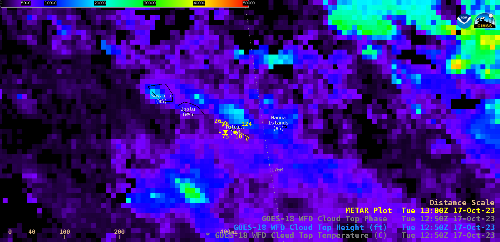
GOES-18 Cloud Top Height derived product, from 0500 UTC to 1520 UTC on 17 October (courtesy Scott Bachmeier, CIMSS) [click to play animated GIF | MP4]
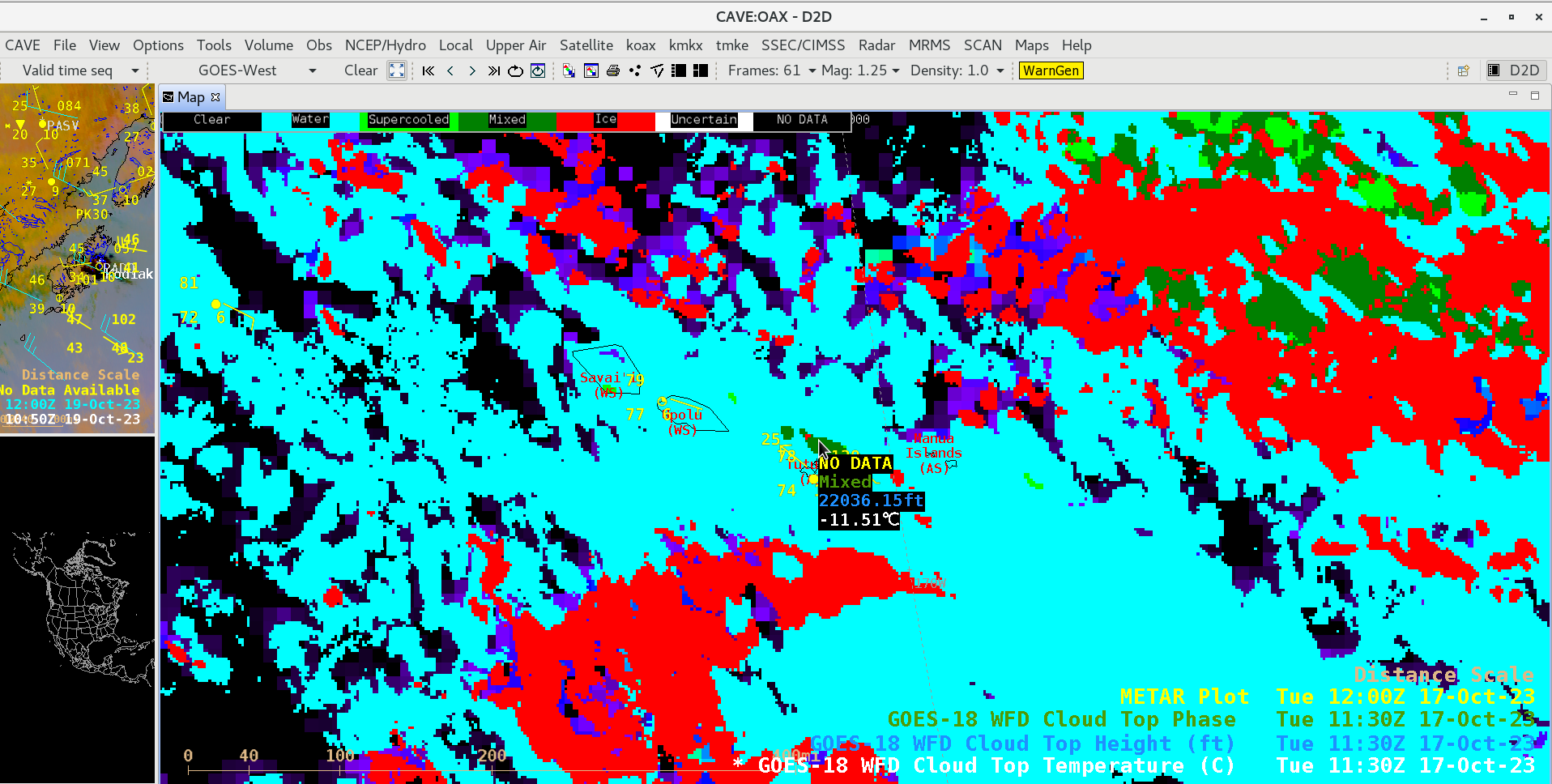
Two other GOES-18 Level 2 derived products that helped to further characterize the rain-producing cloud lines were Cloud Top Height (above) and Cloud Top Phase (below). As cloud-top heights increased and reached colder temperatures, their cloud-top phase changed from water (cyan) to supercooled (light green) then to mixed supercooled/ice (darker green). Note that not all of the hourly METAR surface reports were plotted by AWIPS: at 0820 UTC and 0850 UTC, heavy rain reduced the surface visibility to 1.0 and 0.5 mile, respectively, at Pago Pago International Airport on Tutuila Island, American Samoa (plot | text).
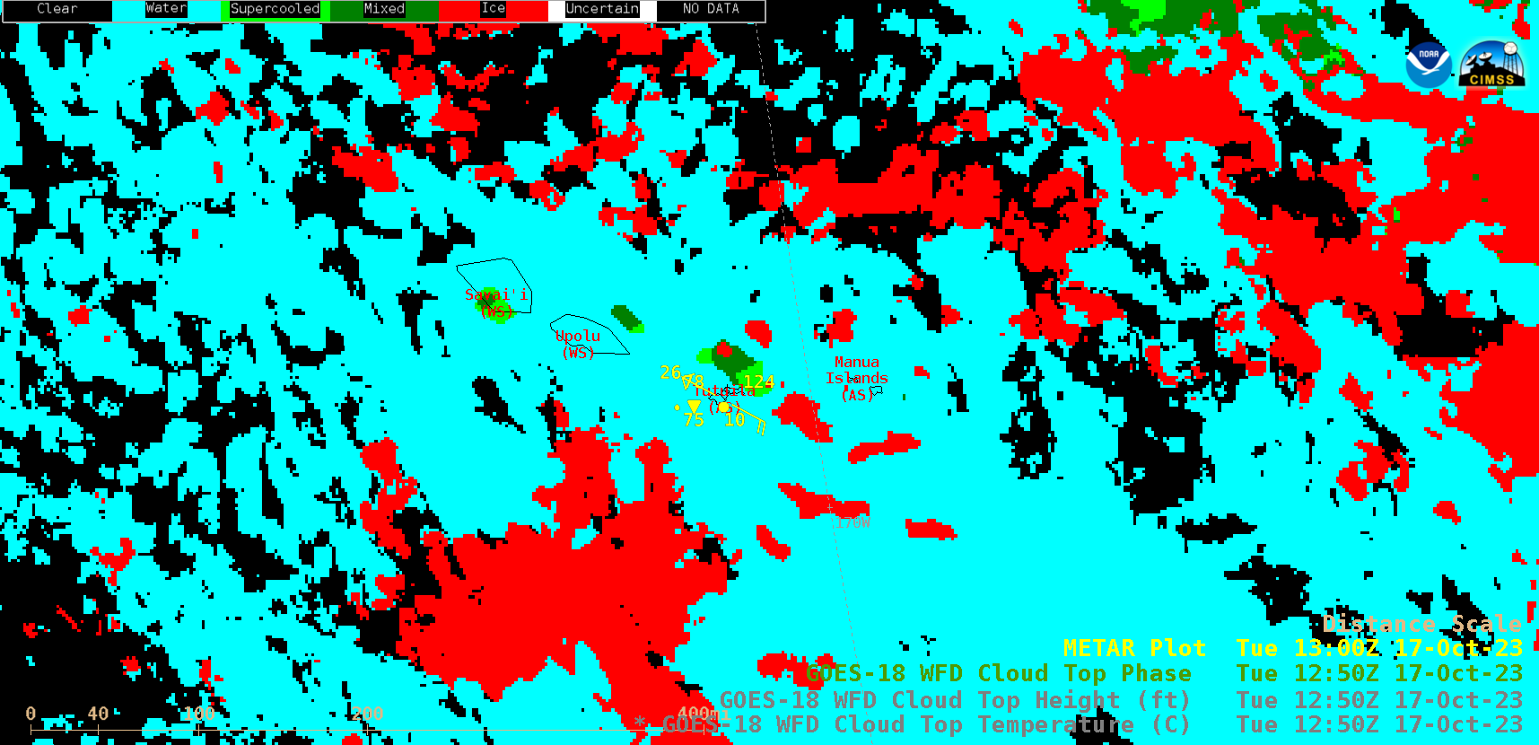
GOES-18 Cloud Top Phase derived product, from 0500 UTC to 1520 UTC on 17 October (courtesy Scott Bachmeier, CIMSS) [click to play animated GIF | MP4]
Cursor sampling of GOES-18 Cloud Top Phase, Cloud Top Height and Cloud Top Temperature at 1130 UTC — when the maximum height of the cloud line in the vicinity of Tutuila was 22036 ft — is shown below.


