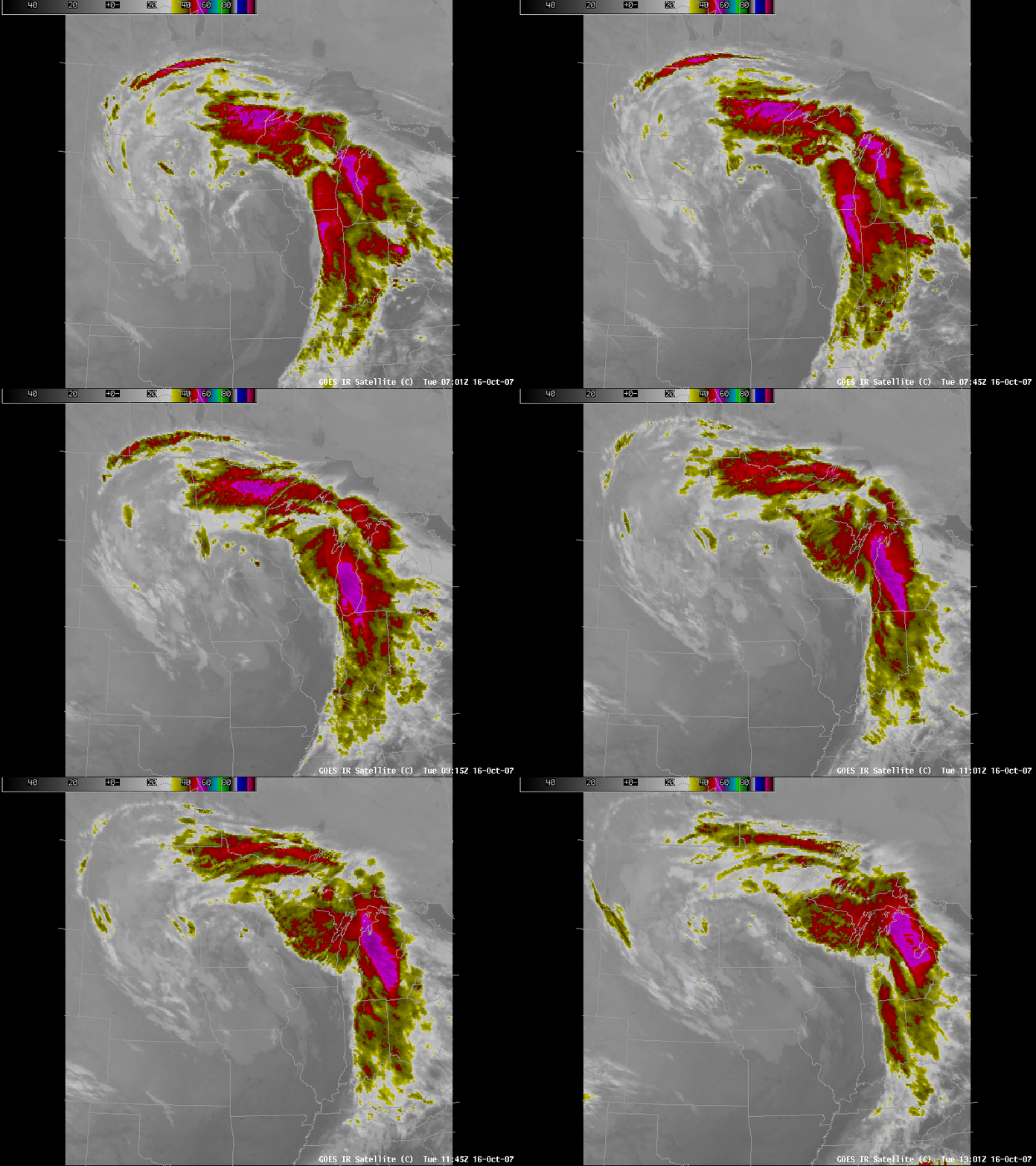
TROWAL in the upper Midwest, October 2007
An occluded storm that affected the upper midwest early in the morning of 16 October displayed cloud characteristics that can be interpreted as the development of a TROWAL (A TROugh of Warm air ALoft). The highest, coldest clouds tops that at the start of the loop are in north-central Illinois can be interpreted as the edge of the warm conveyor belt in this occluded system. As that edge translates northeastward across Lake Michigan and into lower Michigan, cold cloud tops blossom over southeast and east-central Wisconsin and then move westward or northwestward. These cold clouds can be interpreted as the development of precipitation in the TROWAL airstream, which originates in the warm sector and then turns cyclonically into the cold air on the cyclonic shear side of the warm conveyor belt.
TROWALs are characterized by warm air aloft, and RUC model output for this day shows warmth aloft in a region that overlays a region of precipitation. Here is the temperature on the 320 K theta-e surface at 0900 UTC — the midpoint of the IR loop above. A tongue of warm air — which would be a depression on this isentropic surface — extends west-northwestward from eastern Wisconsin towards northwest Wisconsin. Note how well the canyon correlates spatially with radar echoes shown here. Note also that the warm tongue at 850 mb, shown here, does not overlay as well with the radar echoes. (A loop of the three images is here). TROWALs move through isobaric surfaces and lie along isentropic surfaces. Care must therefore be taken when interpreting thermodynamic parameters associated with a TROWAL.


