Heavy rainfall and flooding causes a ground stop at Detroit Metropolitan Wayne County Airport
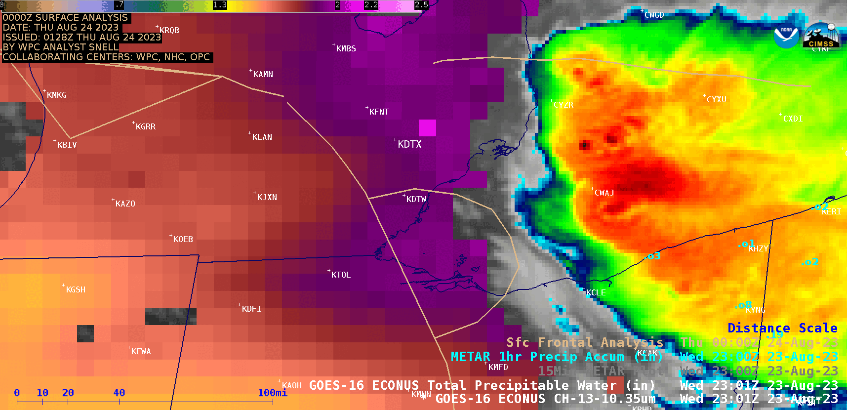
GOES-16 “Clean” Infrared Window (10.3 µm) images, with an overlay of the Total Precipitable Water derived product [click to play animated GIF | MP4]
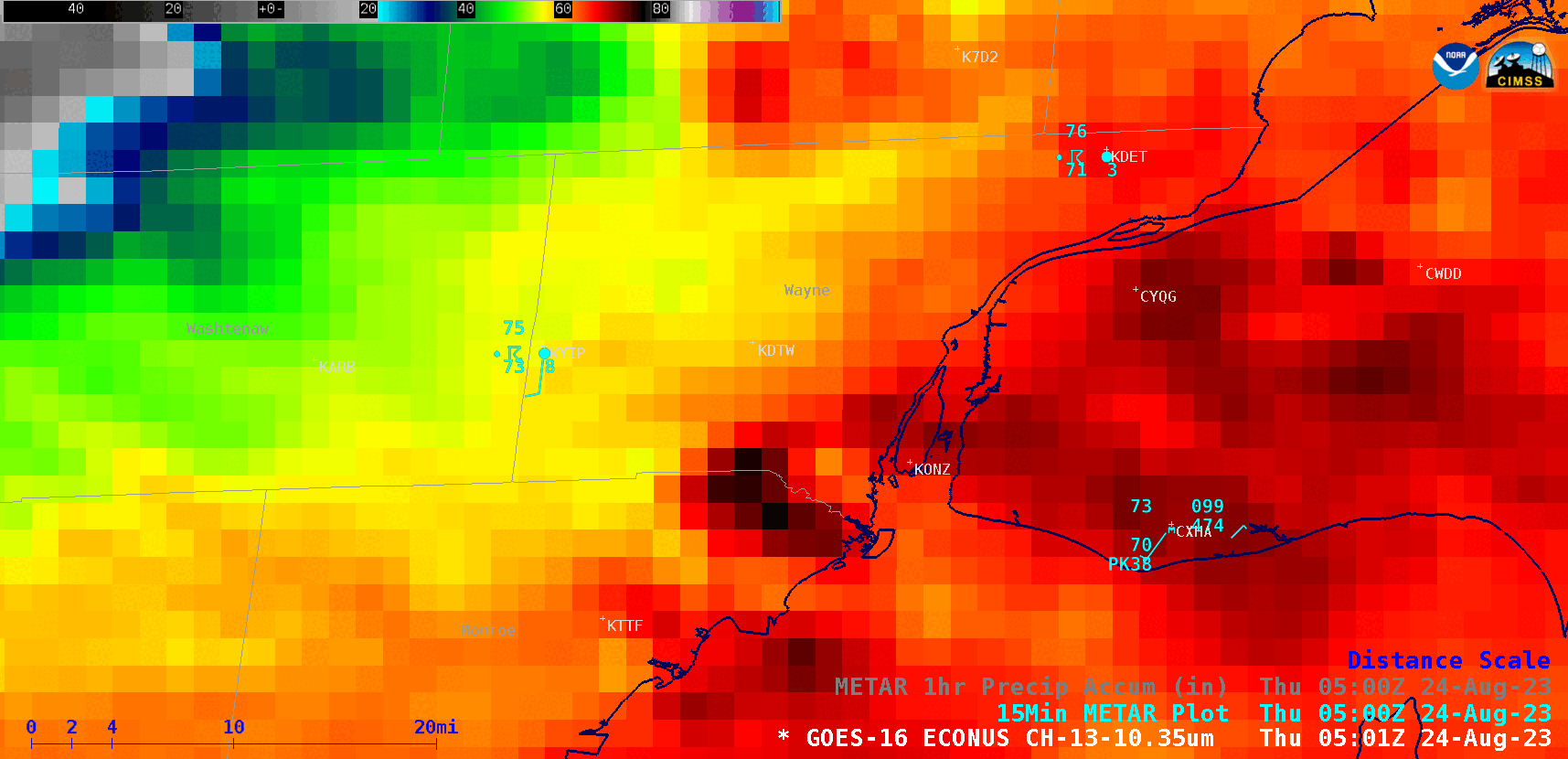
GOES-16 “Clean” Infrared Window (10.3 µm) images, with 15-minute METAR surface reports plotted in cyan [click to play animated GIF | MP4]
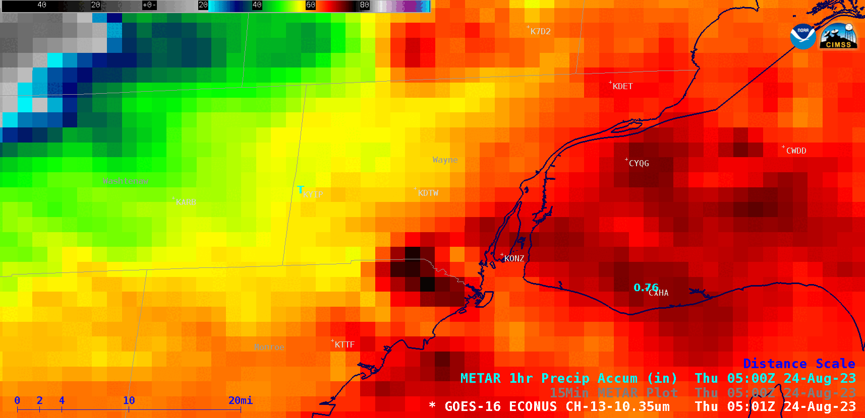
GOES-16 “Clean” Infrared Window (10.3 µm) images, with 1-hour Precipitation Accumulation plotted in cyan [click to play animated GIF | MP4]
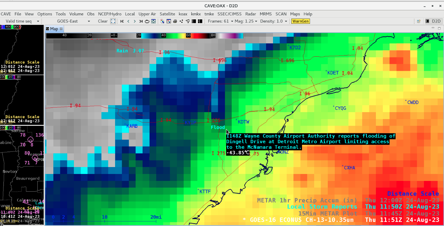
GOES-16 “Clean” Infrared Window (10.3 µm) image at 1151 UTC, with Local Storm Reports plotted in cyan [click to enlarge]