NUCAPS Profiles near Typhoon Mawar (added: And Day Night Band imagery with Mesospheric Gravity Waves)

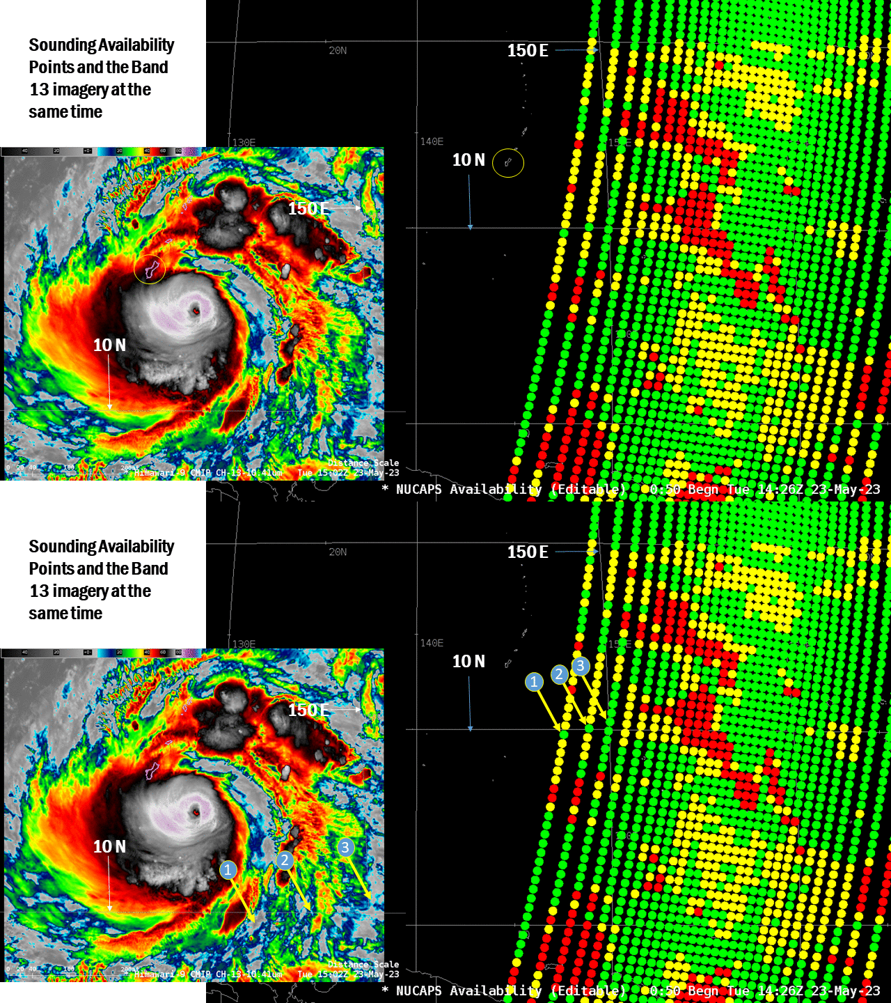
When NOAA-20 flew over the eastern half of Typhoon Mawar at 1500 UTC on 23 May 2023, broken cloudiness to the south and east of the storm allowed for successful infrared retrievals. What did those three retrievals indicated in the toggle above show?
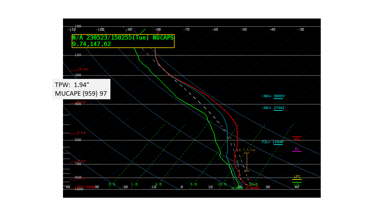
Retrieval 1, below, showed a very warm upper-tropospheric atmosphere; -30oC temperatures nearly at 31000 feet! The very warm upper troposphere calls to mind the warmth with Typhoon Soulik in 2018; Soulik’s eye was so large that a successful retrieval occurred within the eye (link) and -30oC was at 34000 feet!

Soundings at Points 2 and 3 are not quite so warm; -30oC is “just” at 30000 feet.

Even if NOAA-20 overflies a strong tropical cyclone with abundant clouds, it’s possible that partial clearing on the periphery of the storm can help diagnose atmospheric thermodynamics there.
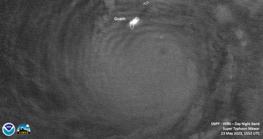
Suomi NPP overflew Mawar at 1552 UTC on 23 May, and mesospheric gravity waves are evident in this Day Night Band imagery, below, radiating out from the storm center.


