Heavy rain over Kona, Hawai’i
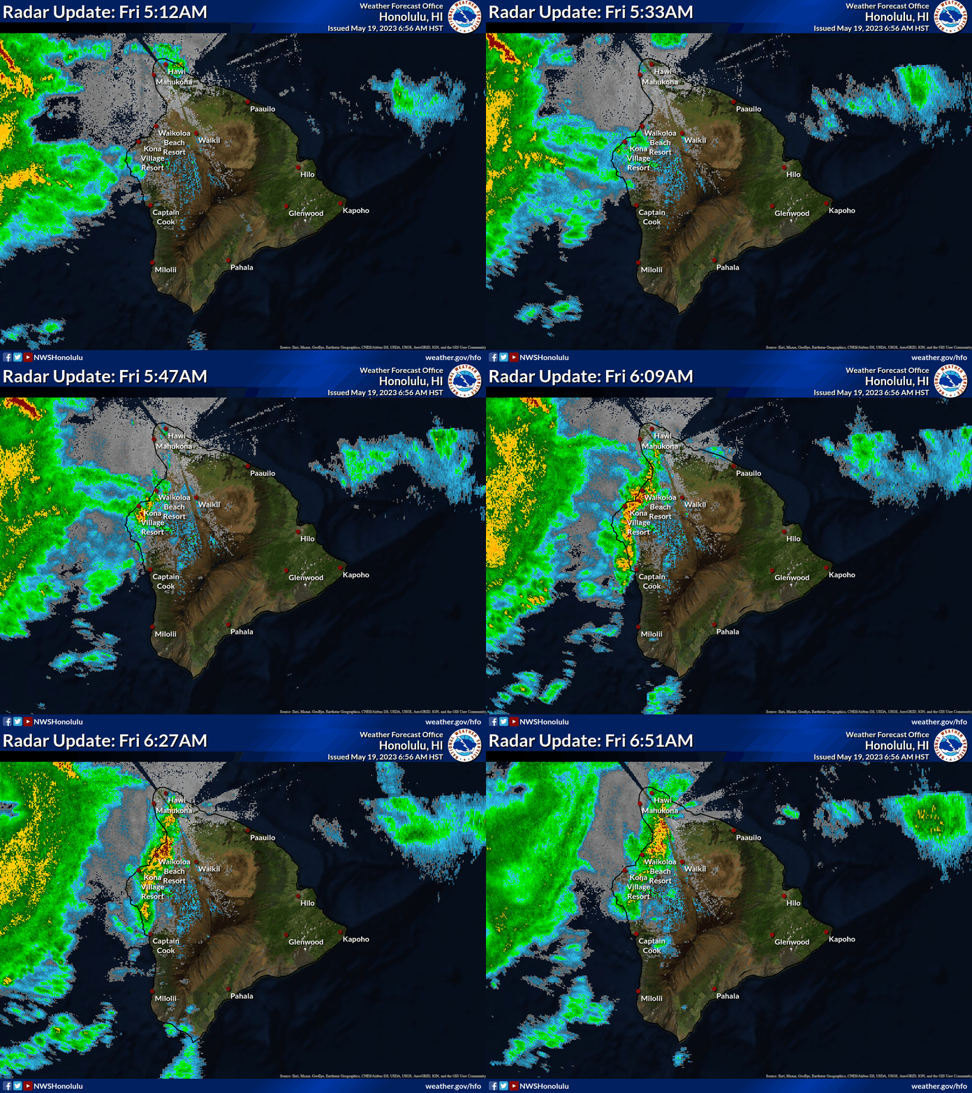
Radar imagery over the island of Hawai’i, below, from 512 – 639 AM HST shows the development of strong thunderstorms over/near Kona. Note that 512 AM HST is 1512 UTC; 639 AM HST is 1639 UTC. The heavy rains led to the issuance of a Flash Flood Warning (link). What satellite products might have helped with situational awareness in this event?
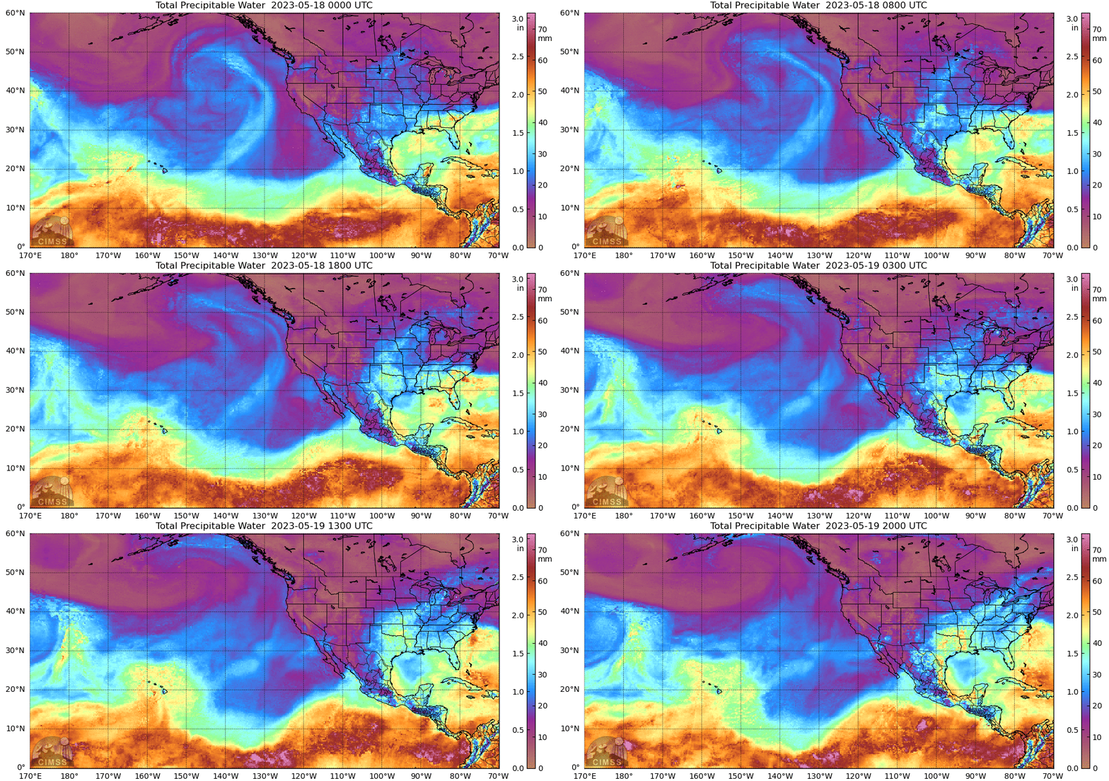
MIMIC Total Precipitable Water fields, below, from 0000 UTC on 18 May through 2000 UTC on 19 May, show moisture throughout the Hawai’ian island chain. The total precipitable water at Hilo increased from 40.2 mm to 44.2 mm from 1200 UTC 18 May to 1200 UTC 19 May (link). Sometimes NUCAPS fields from NOAA-20 can give information about the environment in which convection might develop. On 19 May, however, the islands of Maui and Hawai’i sat in between NOAA-20 overpasses, as shown below, using data from this website (Suomi NPP and NOAA-21 sampled the region, but NUCAPS products are not yet operational from NOAA-21, and an anomaly exists in the CrIS instrument on Suomi NPP). This case demonstrates why two JPSS soundings providing operational data are useful. NUCAPS on this day does give an overview of the large-scale thermodynamics: Cold temperatures at 500 mb and (relatively) warm temperatures at 850 mb highlight reduced stability over the Hawai’ian Island chain.
GOES-18 Derived Stability indices — such as Lifted Index, shown below with the default AWIPS enhancement altered so that the range is -5 to 10 — are clear-sky only products. By using animations, however, a user can discern regions where instabilities exist when occasional cloud breaks occur, as shown below. Modest instability (albeit individual pixels!) is diagnosed over the western part of the island of Hawai’i at various times before the outbreak of convection between 1500 and 1600 UTC.
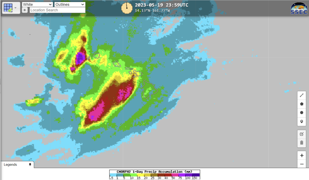
Different websites show quantitative estimates of precipitation. How did they do for this admittedly small-scale event? CMORPH2 precipitation estimates are available at RealEarth (enter ‘CMORPH’ in the Search box at that website) as shown below, and suggest only 5-10 mm on that day with an apparent minimum over Kona.
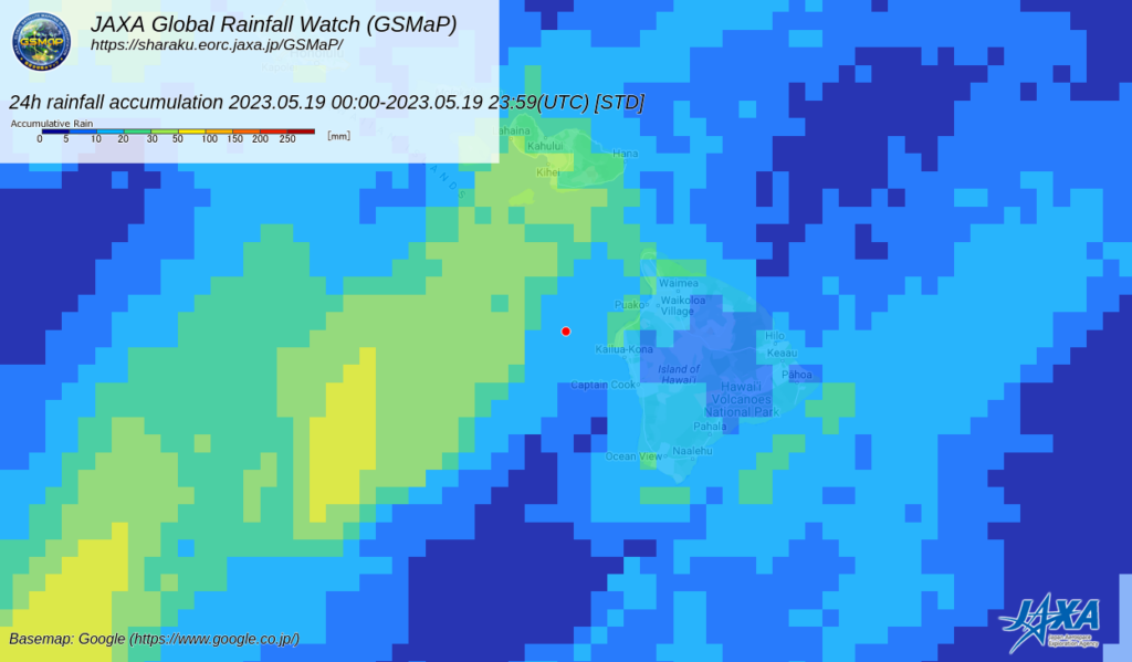
GsMap (from JAXA), shown below, does a bit better with the placement of a maximum over Kona. The values — from 20-30 mm — are too light.
