Severe thunderstorms across Oklahoma and Texas

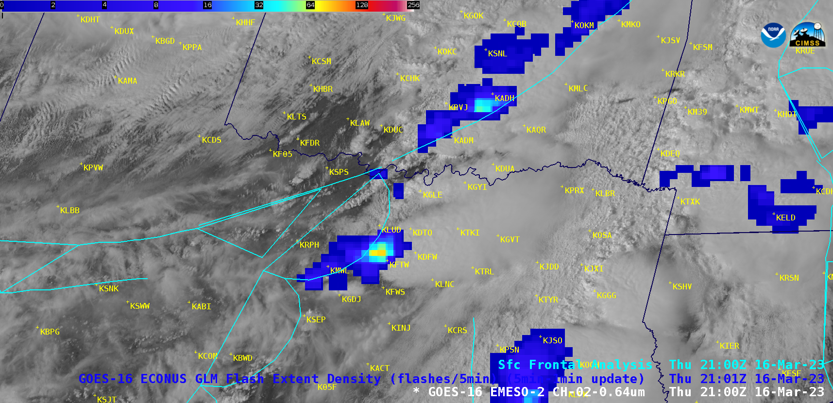
GOES-16 “Red” Visible (0.64 µm) images, with an overlay of GLM Flash Extent Density and surface fronts [click to play animated GIF | MP4]

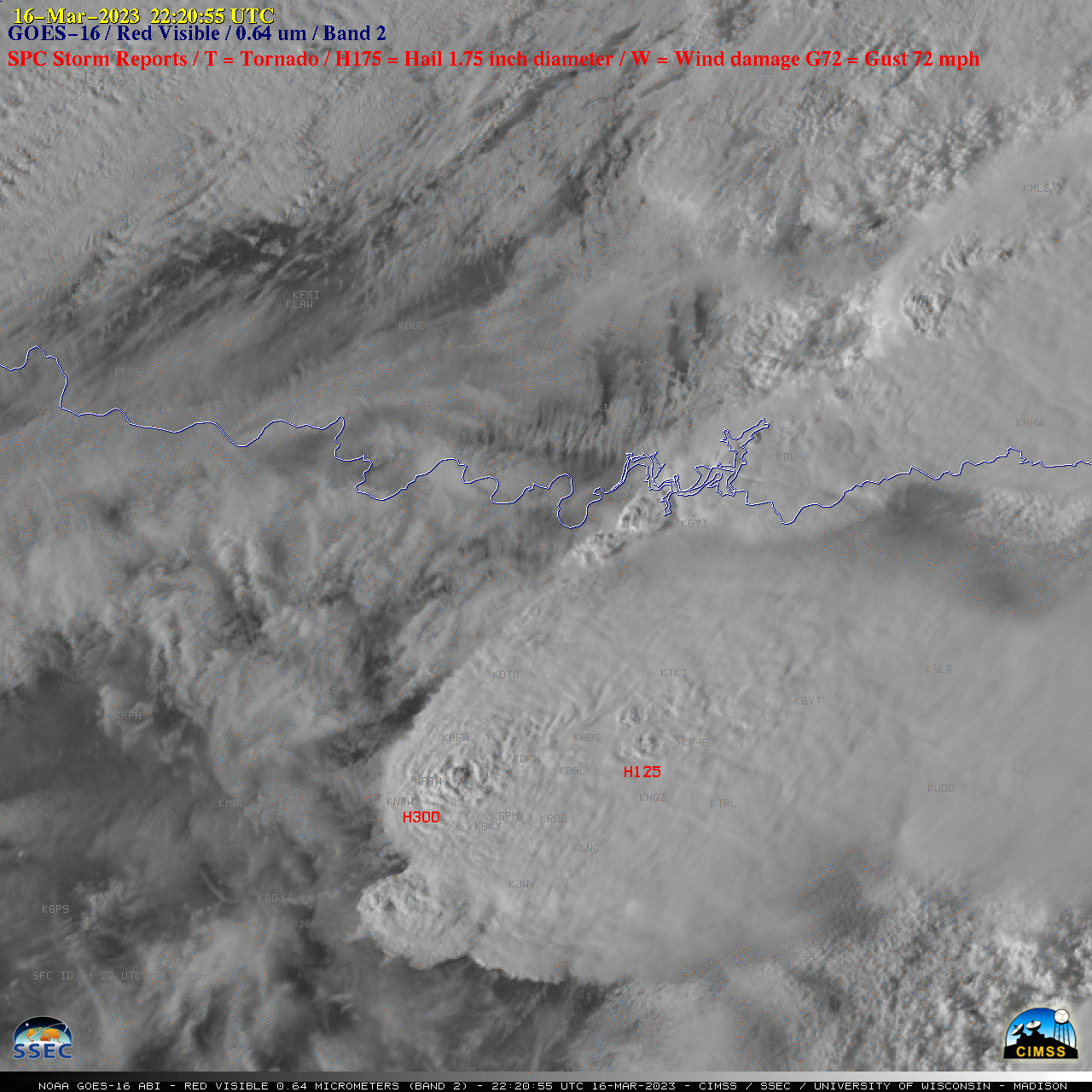
GOES-16 “Red” Visible (0.64 µm) images, with time-matched SPC Storm Reports plotted in red [click to play animated GIF | MP4]
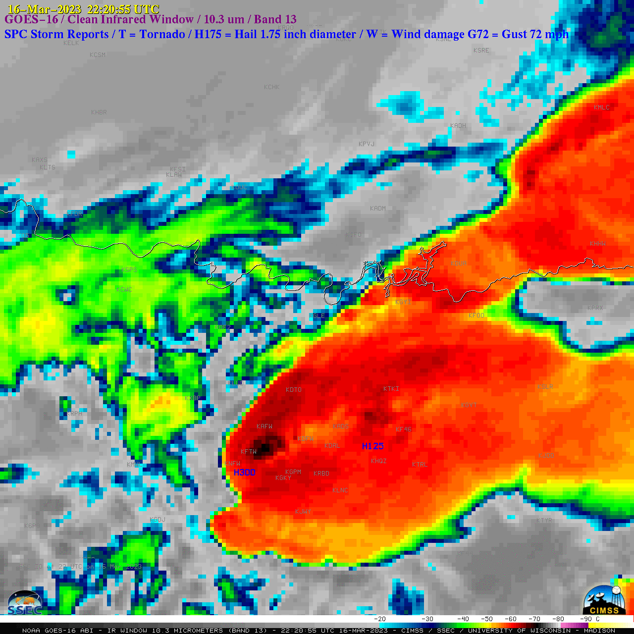
The corresponding 1-minute GOES-16 “Clean” Infrared Window (10.3 µm) images with plots of time-matched SPC Storm Reports (below) indicated that some of the thunderstorm overshooting tops exhibited infrared brightness temperatures in the -70 to -73ºC range (lighter gray pixels embedded within darker black regions).

GOES-16 “Clean” Infrared Window (10.3 µm) images, with time-matched SPC Storm Reports plotted in blue [click to play animated GIF | MP4]

