Blowing dust across parts of Colorado, Nebraska and Kansas
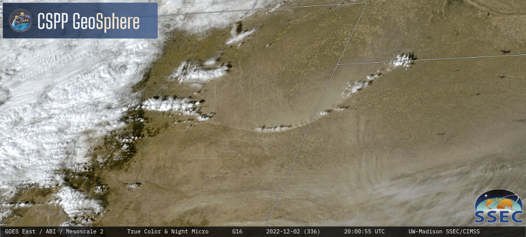
GOES-16 True Color RGB images [click to play MP4 animation]
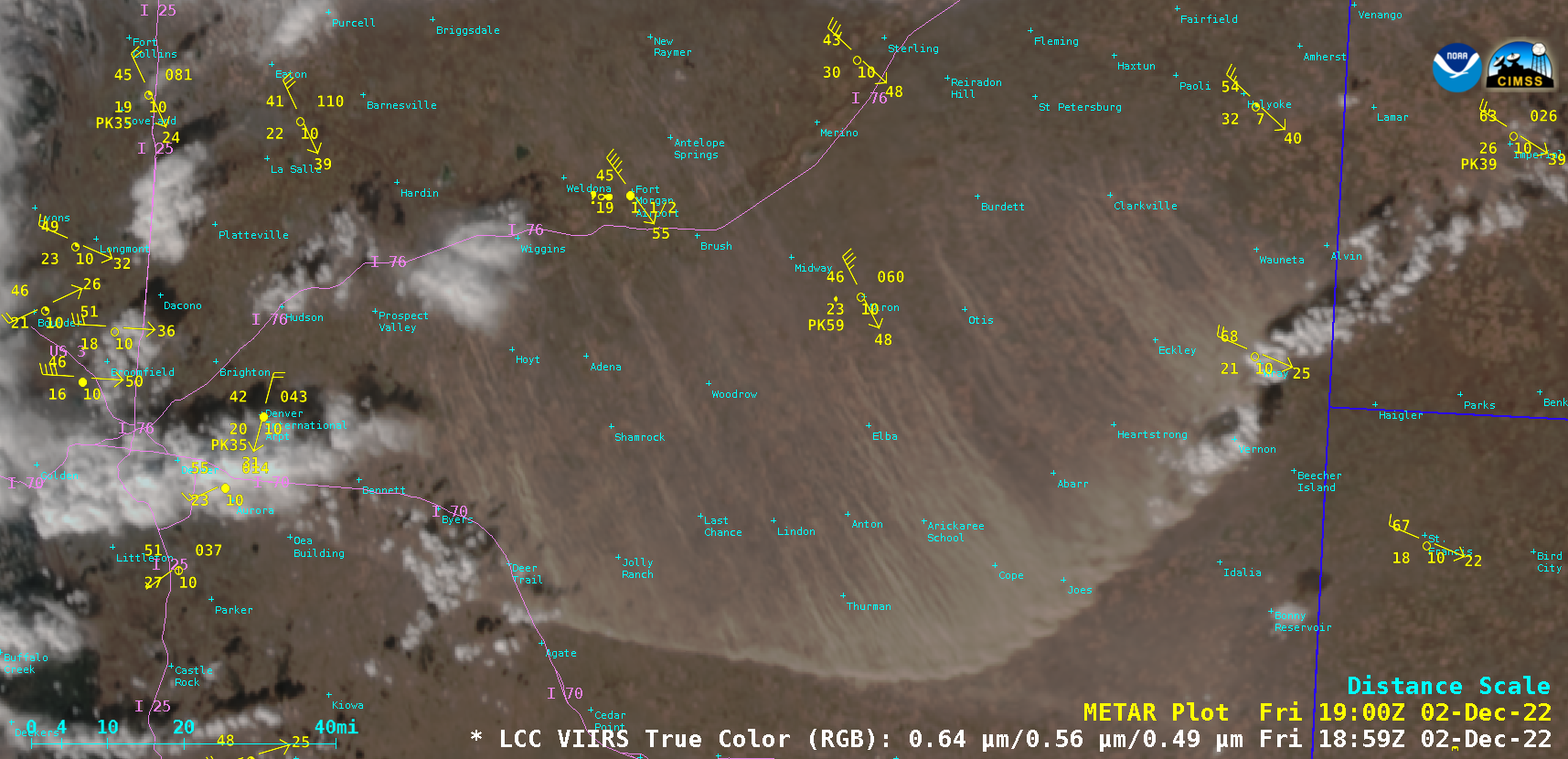
Suomi-NPP VIIRS True Color RGB image, valid at 1905 UTC [click to enlarge]
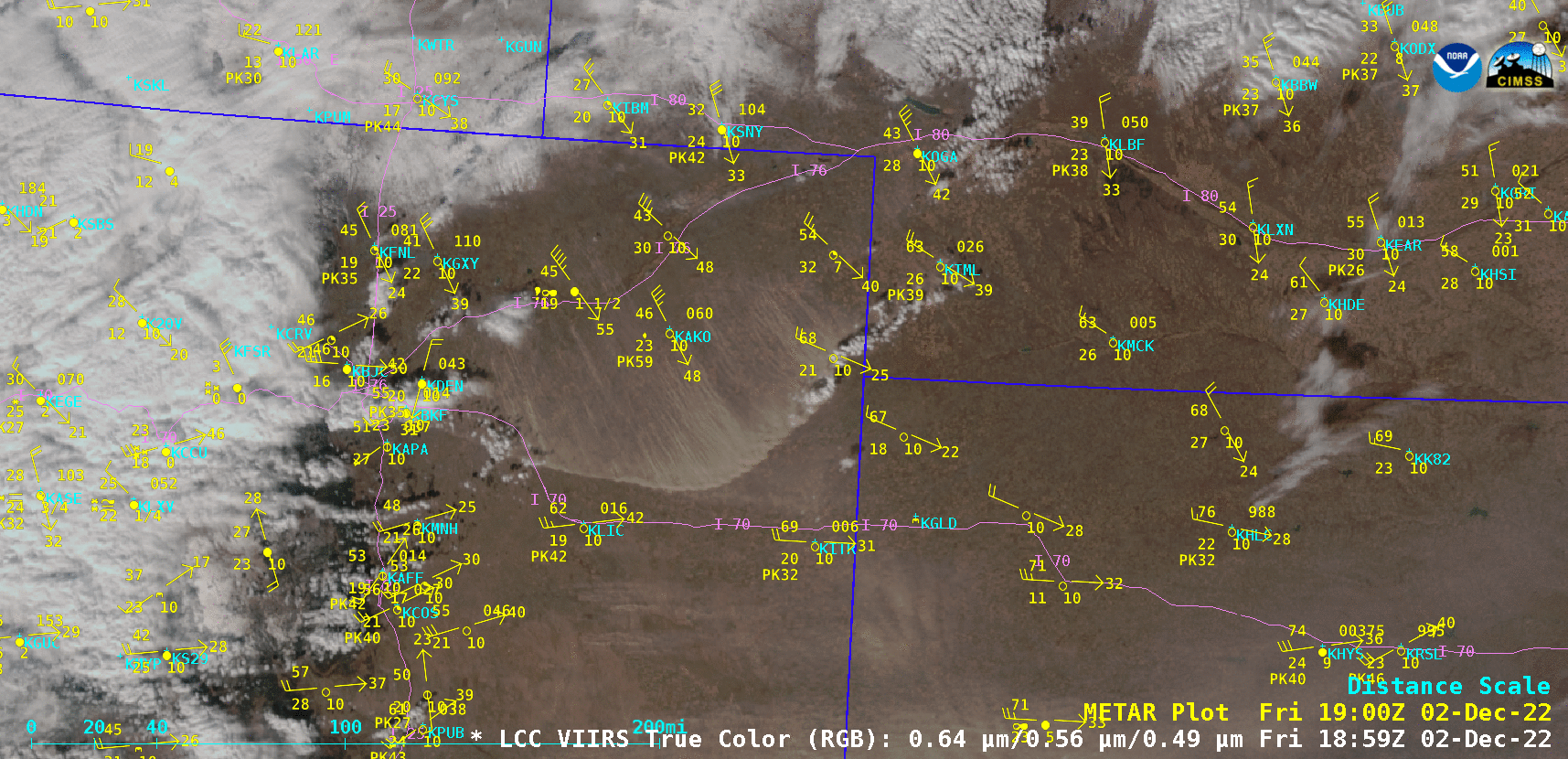
Sequence of VIIRS True Color RGB images from Suomi-NPP and NOAA-20 [click to enlarge]

GOES-16 Dust RGB images, with GOES-16 Derived Motion Winds plotted in green and hourly surface reports plotted in yellow [click to play animated GIF | MP4]
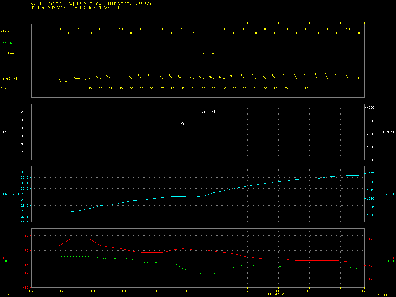
Plot of surface report data at Sterling, Colorado [click to enlarge]
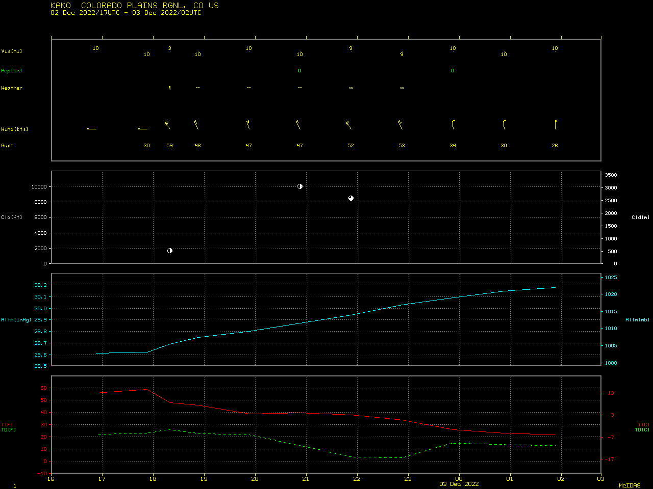
Plot of surface report data at Akron, Colorado [click to enlarge]
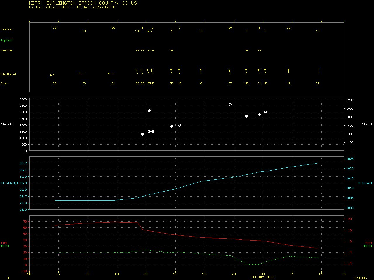
Plot of surface report data at Burlington, Colorado [click to enlarge]