Eruption of Mauna Loa on Hawai’i
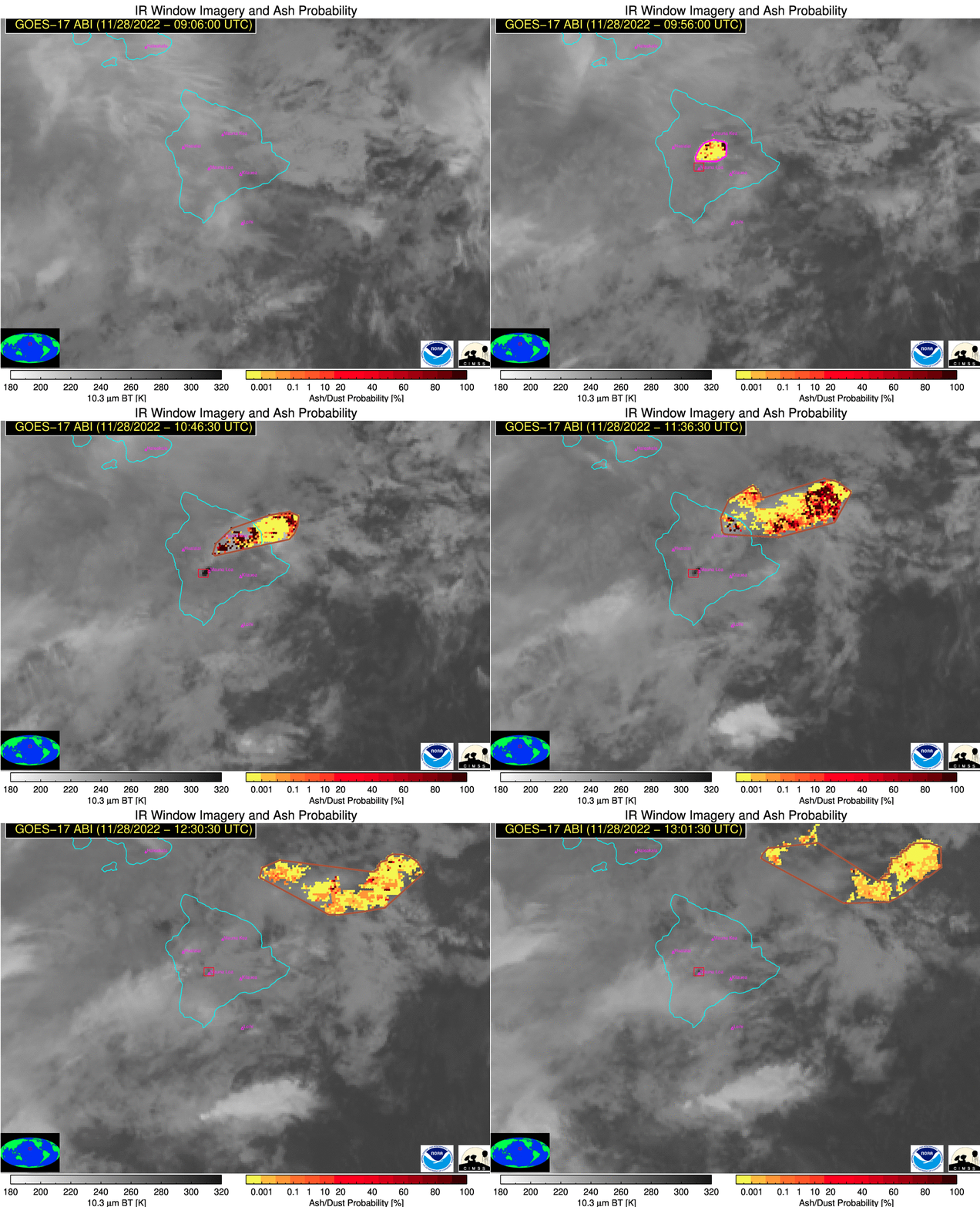
Mauna Loa on the Big Island of Hawai’i became active overnight, ending a quiescent phase that started back in 1984 — the longest period of dormancy for this Volcano since the 1800s. The Ash Probability animation above, combining both GOES-17 PACUS and GOES-17 Full Disk imagery (using imagery from this site) shows the Ash Cloud from this eruption moving northeastward from Hawai’i into the Pacific Ocean. The hot spot of the caldera is also apparent in the imagery.
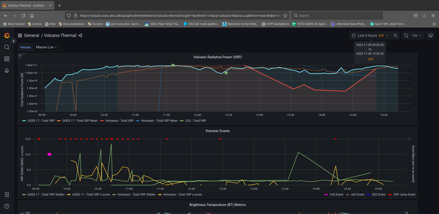
The SSEC/CIMSS Volcano Monitoring website also includes a Thermal Monitoring tab, and the information for Mauna Loa (link) from 0926 to 1526 UTC on 28 November is shown below.
Tim Schmit (NOAA STAR/ASPB) created the 16-panel animations below, one showing all GOES-17 channels and one showing all GOES-18 channels. The heat signature is very apparent at 3.9 µm — but there is also a significant contributions at 1.6 µm and 2.2 µm! The window channels (Bands 11, 13, 14 and 15 at 8.4 µm, 10.3 µm, 11.2 µm and 12.3 µm) also show the heat signature. The effects of the Loop Heat Pipe malfunction on GOES-17 are also apparent in the Band 12 and Band 16 imagery (9.6 µm and 13.3 µm) by the end of the animation; GOES-18 has a more pristine look. Post-launch check-outs for GOES-18 continue, and it is scheduled to become operational as GOES-West in January of 2023. (GOES-18 data in the animation are preliminary and non-operational).
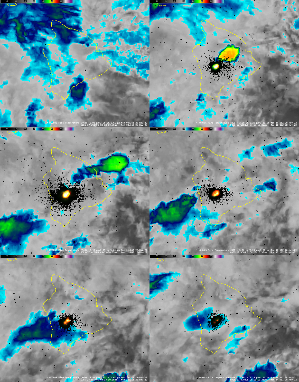
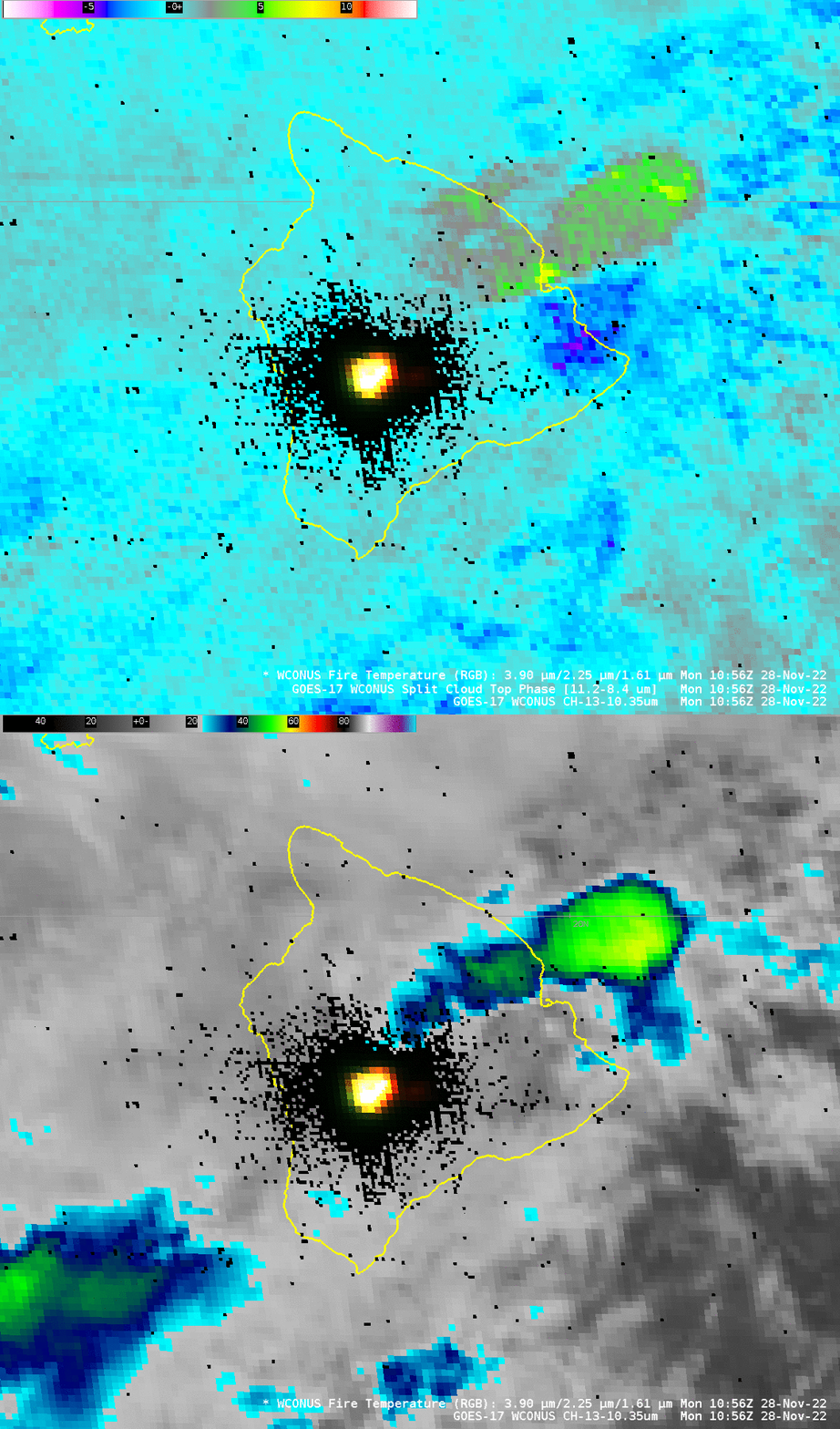
The animation below shows the Clean Window Infrared (10.3 µm) and the Fire Temperature RGB. Note the ash cloud in the 10.3 µm imagery is difficult to distinguish from other clouds, except by inferring a connection to the sudden hot spot in the Fire Temperature RGB. Channel difference products, however, such as the Split Cloud Top Phase (11.2 µm – 8.4 µm), shown underneath the animation below, do highlight the ash cloud (compare the signals in the Ash Cloud stretching east-northeast of Hawai’i with the cloud approaching Hawai’i from the southwest), as would RGBs that incorporate that difference field (that is, the Ash RGB, a variation of which is available at the SSEC/CIMSS volcano website, from both ABI and VIIRS data).
Larger-scale animations of GOES-17 Ash RGB and SO2 RGB images (below) exhibited a strong signature of SO2 within the volcanic cloud — particularly the segment that drifted east-northeastward away from the Big Island of Hawai`i during the 0931-2101 UTC period.
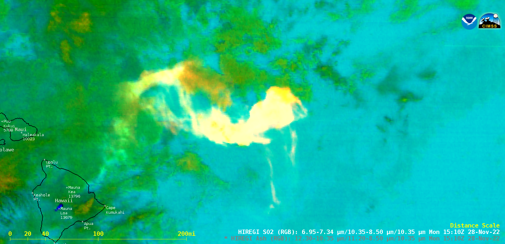
GOES-17 Ash RGB and SO2 RGB images (credit: Scott Bachmeier, CIMSS) [click to play animated GIF | MP4]
NOAA-20 overflew Hawai’i shortly after 1130 UTC, and the higher-resolution (compared to ABI) VIIRS instrument gave a good view of the eruption. The I04 (3.74 µm) channel showed such warm temperatures that wrap-around effect occurred in the imagery (the white region that is within the orange/red center of the signal), and the visible signal was so bright that a hysteresis effect is apparent downscan of the volcano in the Day Night band imagery. Note in the Day Night Band image that a very small signal is apparent over Kilauea to the southeast of Mauna Loa.
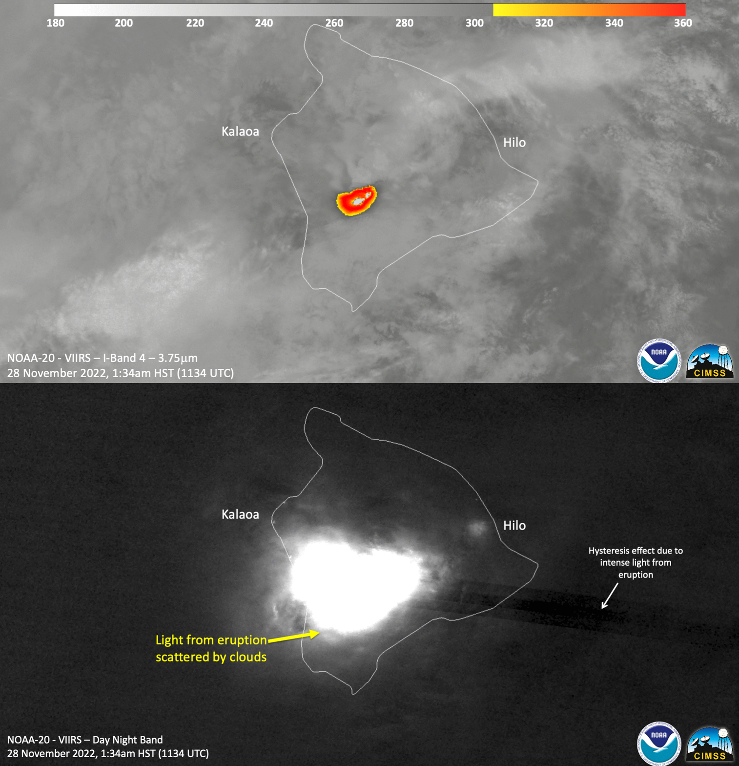
For more information on this evolving event, refer to this USGS website, or this one. The CIMSS Volcanic Monitoring website includes satellite imagery and interpretation of this event. Also, as of 1900 UTC on 28 November 2022, GOES-17 Mesosector 1 is positioned over Hawai’i to give 1-minute imagery over the volcano. (SSEC Geo Browser link ; CIRA Slider ; NOAA Star Website ; Wisconsin AOS site ; College of Dupage)

