Polar Hyperspectral modeling during severe weather: Iowa on 12 April 2022
Previous posts on the CIMSS Blog (here, here, here) have detailed a modeling system that incorporates thermodynamic information from hyperspectral soundings (CrIS on Suomi/NPP and NOAA-20; IASI on Metop-B/Metop-C) into a version of the Rapid Refresh model. The improved definition of thermodynamic distributions by the hyperspectral data (that is: better spectral resolution) is combined with the better spatial and temporal resolution of the Advanced Baseline Imager (ABI) on GOES-16 to produce 18-h forecasts every hour (model output is available here; a Journal Article describing this data fusion is here). This product is to be demonstrated at the Hazardous Weather Testbed, starting in May of 2022.
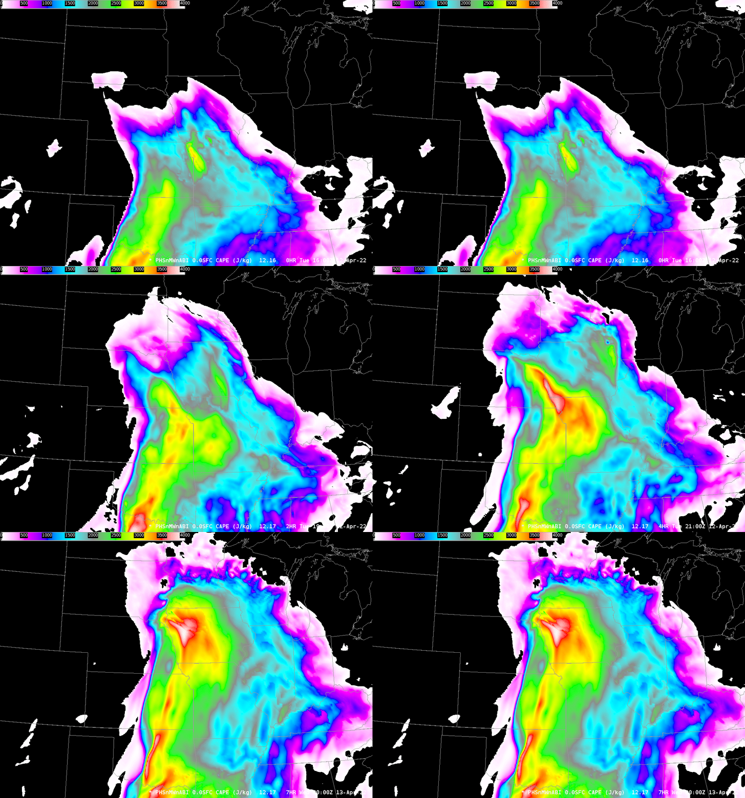
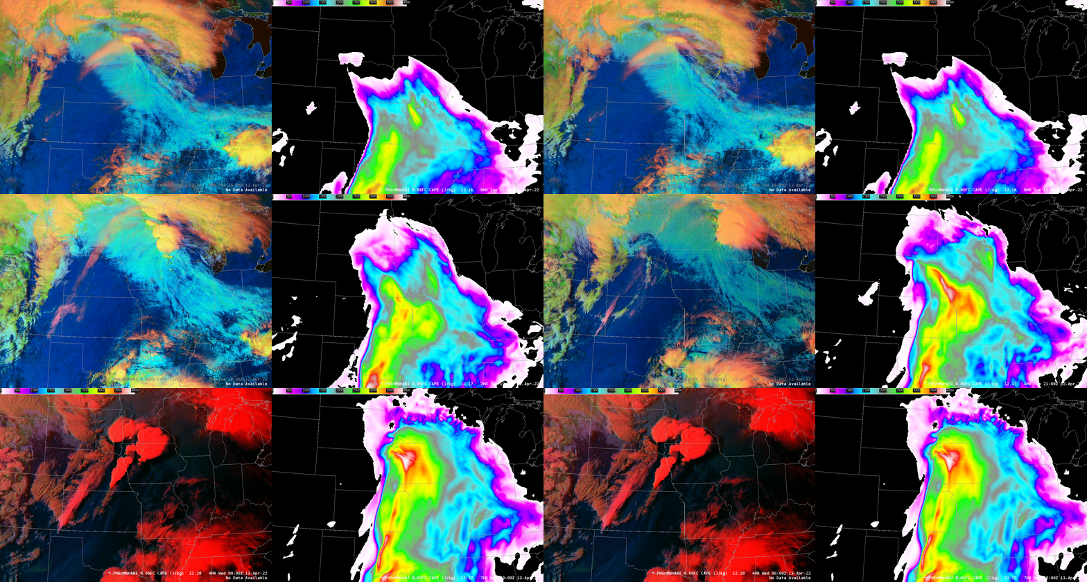
Severe weather occurred in the Plains on 12 April (SPC Storm Reports). What did this modeling system show? The animation above shows Convective Available Potential Energy, hourly from 1600 – 0000 UTC on the 12th. The first two frames are analyses, the final frames are part of the 1700 UTC forecast, which should include some IASI input from the morning Metop overpasses (MetopB orbits on 12 April; MetopC orbits on 12 April). Two areas of enhanced CAPE are present: one starts near Kansas City and lifts northeastward into southeastern Minnesota and western Wisconsin before eroding; a second, larger region of stronger CAPE moves from Oklahoma/Kansas into western Iowa by 0000 UTC. Was convection associated with this instability? That is shown below: side-by-side animations of GOES-16 Day Cloud Phase Distinction and PHSnABI CAPE values.
Strong convection develops initially over northeast Iowa/southern Minnesota just north of the eastern diagnosed CAPE maximum. A second round of convection develops over western Iowa in association with the diagnosed CAPE maximum there.
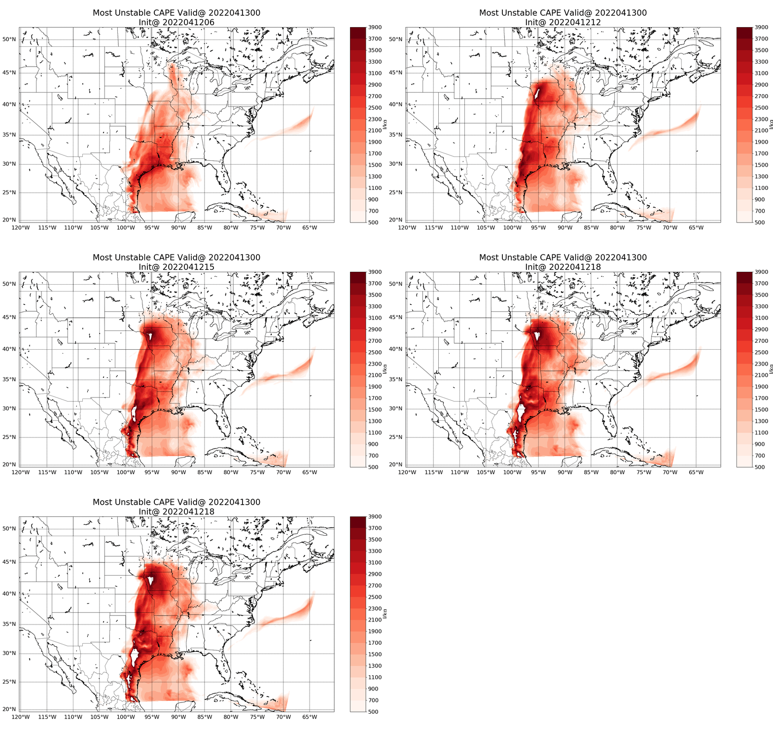
The model data output are archived at this link. It’s pretty easy to view how forecasts are changing with time as an event approached. For example, the animation below compares forecast CAPE values for 0000 UTC on 13 April — 18-h, 12-h, 9-h and 6-h forecasts from 06, 12, 15, and 18 UTC on 12 April 2022. Note the big change between the forecast initialized at 0600 UTC and the one initialized at 1200 UTC. Between those two times, Suomi-NPP and NOAA-20 will have overflown the central United States and helped the initial fields in the model to represent more accurately the thermodynamics. Forecasts after that concentrate CAPE values over western Iowa.
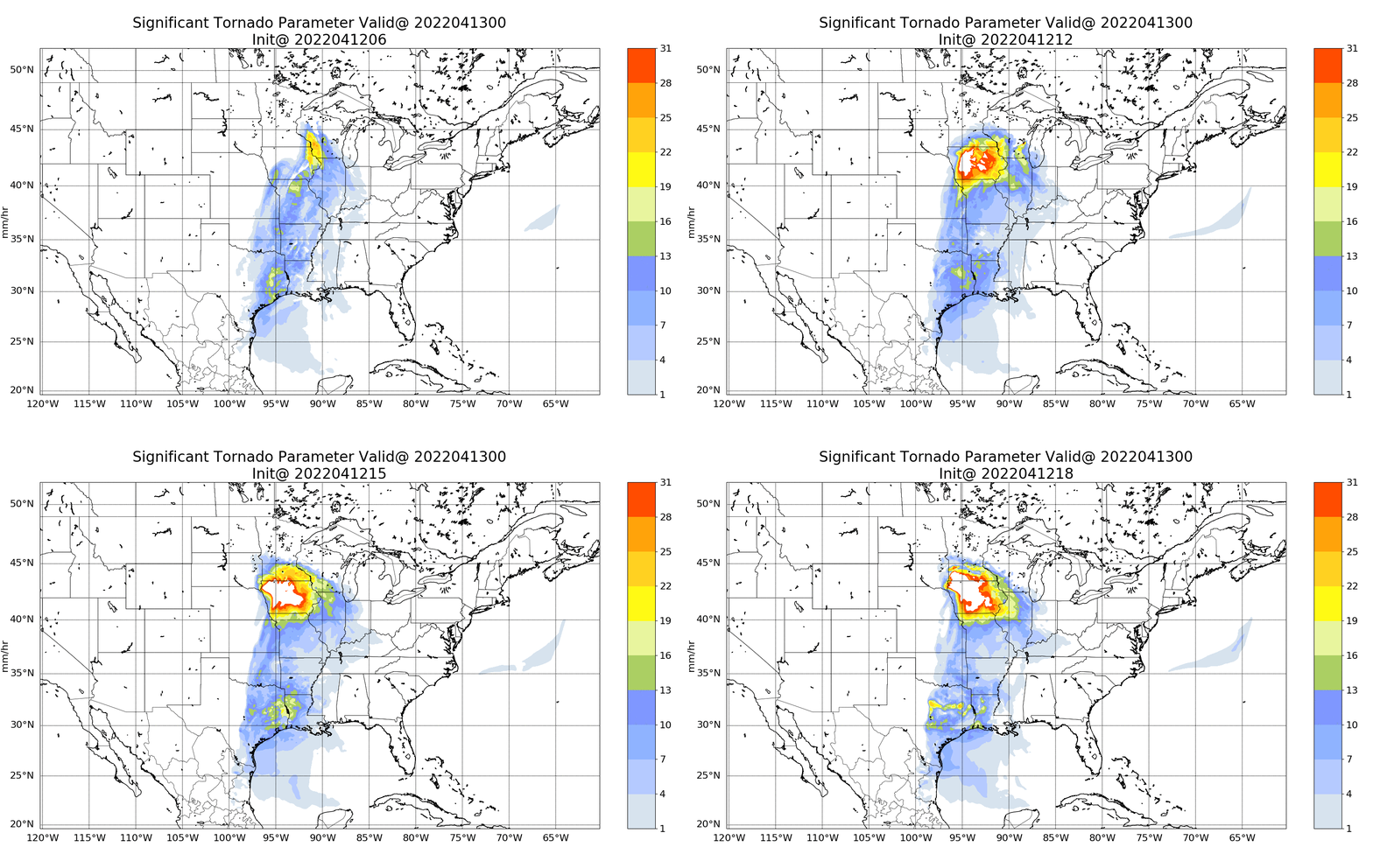
Changes in the Significant Tornado Parameter (STP) for the same time, from the same model runs, are shown below, and tell the same story. Thermodynamics and wind profiles in the model are most strongly favorable for tornadogenesis over western Iowa.
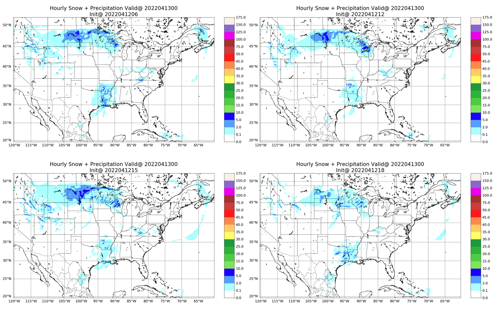
What did the model precipitation look like? CAPE and STP show a potential. But the convection has to develop and be influenced by the CAPE and STP. Model precipitation is shown below. Only the 1800 UTC model run shows the strong convection that developed over western Iowa by 2200 UTC — and that precipitation is a bit too far west.
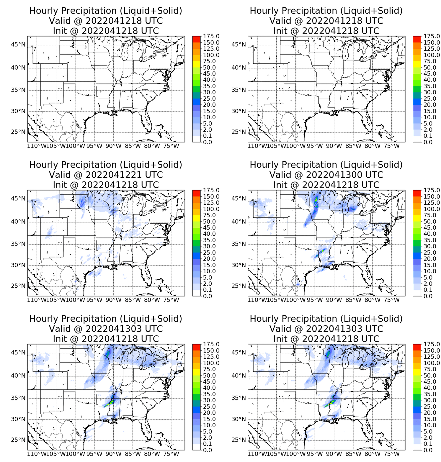
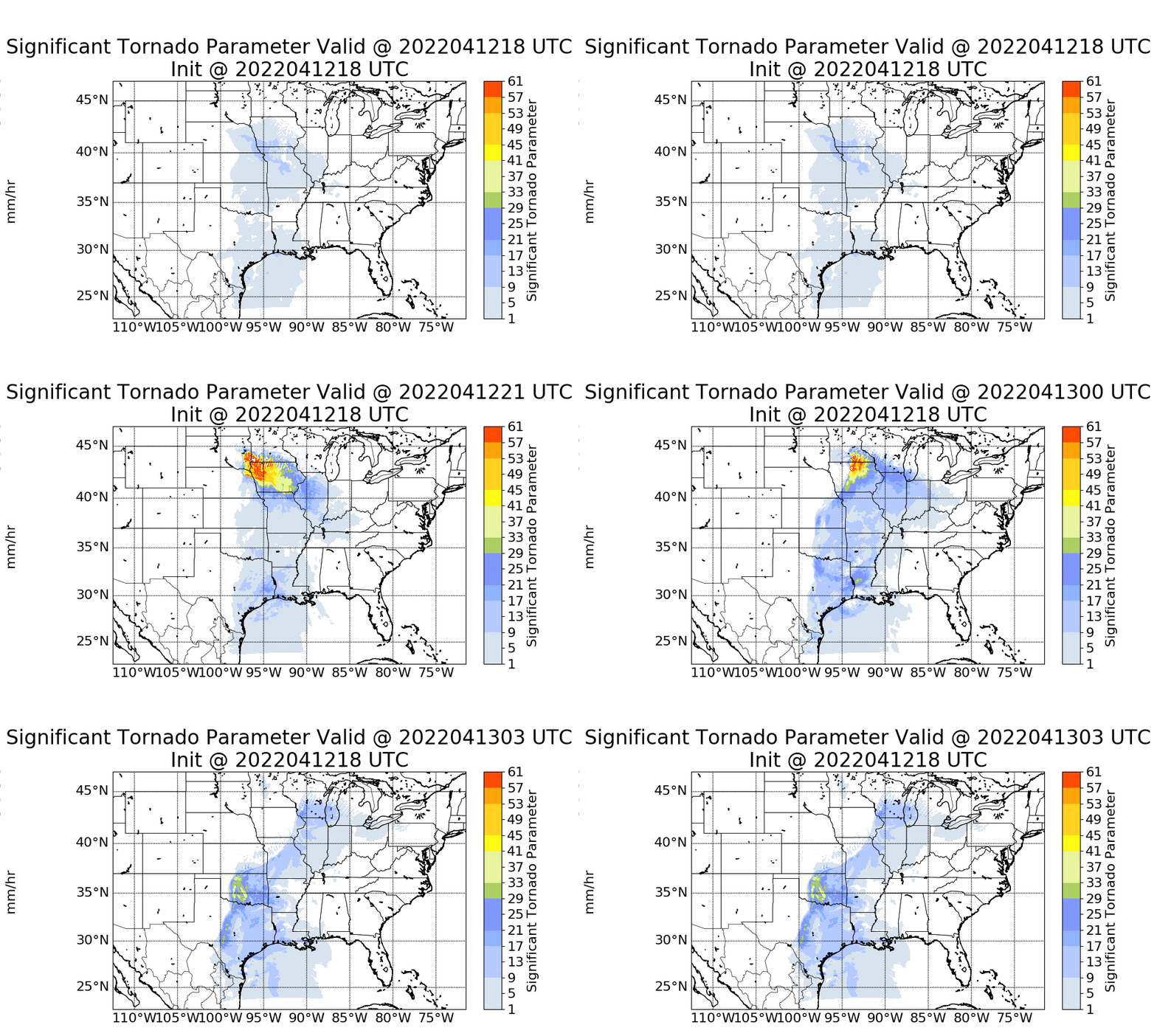
There is also a 3-km version of this model available at the model output link. (This one) The higher-resoluation model run (as might be expected) does a far better job in predicting the onset of convection. Output from the 1800 UTC model run is shown below. Initiation and behavior is very well-matched with observations. The Significant Tornado Parameter from this run (bottom) shows that parameter maximizing over northwest/northcentral Iowa between 2100 UTC on the 12th and 0100 UTC on the 13th. The first tornado per SPC Storm reports occurred shortly after 2300 UTC on the 12th.
This case demonstrates the power of adding Polar Hyperspectral Sounding information into a model run: An accurate forecast of likely tornadic development resulted. The next generation of Geostationary Satellites (GeoXO) are slated to carry a GXS — a Hyperspectral Sounding in geostationary orbit — that could also supply accurate thermodynamic information to numerical models to enhance forecasts. For more on GeoXO, click here.

