Polar Hyperspectral modeling of Severe Weather

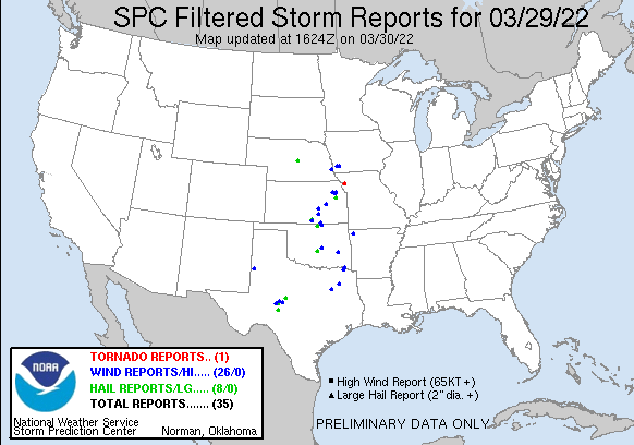
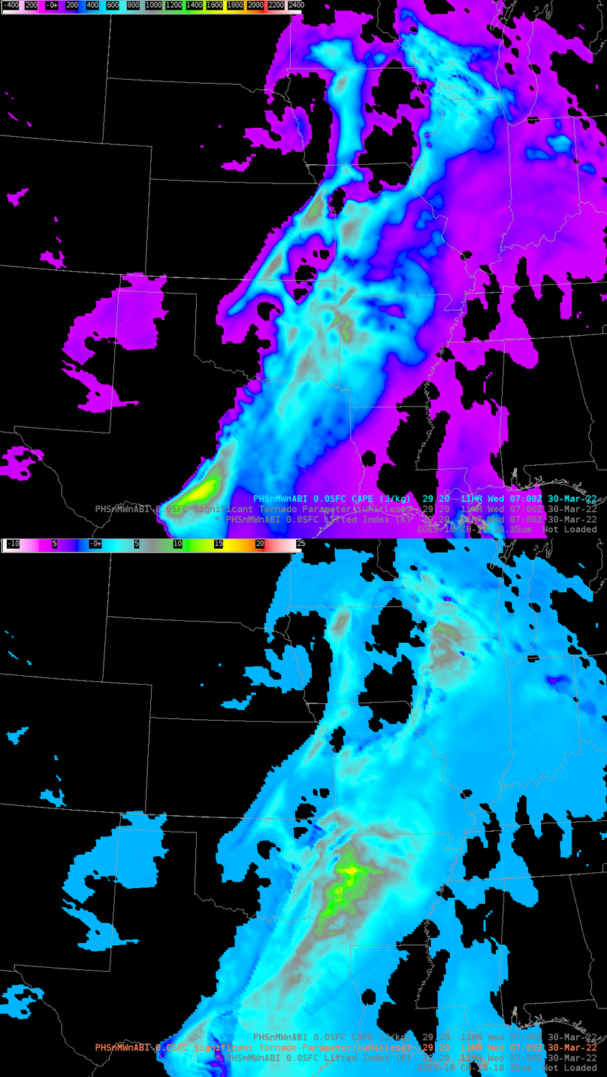
As part of the Hazardous Weather Testbed this year at the Storm Prediction Center, CIMSS will be demonstrating forecast model output initialized with hyperspectral data from Polar Orbiters that is fused with ABI data; this methodology takes advantage of (for example) the high spectral resolution of CrIS on NOAA-20 and the high spatial and temporal resolution of the ABI on GOES-16. (See this blog post). Preliminary storm reports for 29-30 March 2022 are shown above, scattered severe weather occurred over the southern Plains. What did the PHSnMWnABI data look like for this event, specifically for the severe weather in northwestern Arkansas reported around 0909 UTC?

The toggle above compares two estimates of instability, one using just thermodynamics (Convective Available Potential Energy — CAPE), one incorporating model wind fields as well (STP). This 11-hour forecast was a bit fast, bringing the largest tornado threat into northwestern Arkansas by 0700 UTC (in reality, per the SPC, severe weather occurred shortly after 0900 UTC). The toggle below compares 11-h forecast of CAPE to the initial field (i.e., 00-h) of CAPE at 0700 UTC and the GOES-16 Band 13 infrared (10.3 µm) satellite imagery at 0700 UTC. The initial field certainly shows enhanced instability lagging behind the coldest cloud tops!

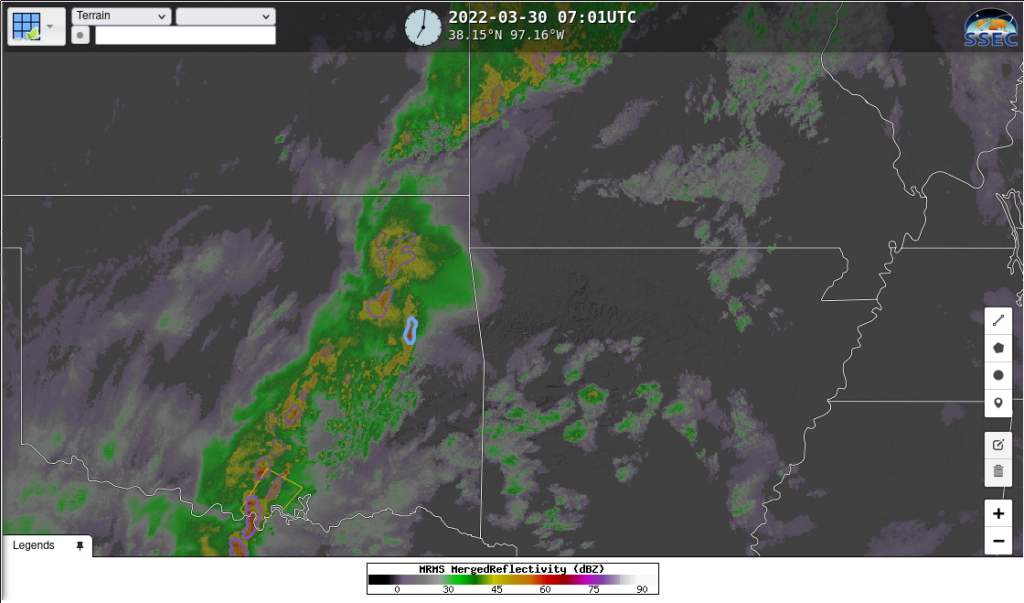
ProbSevere (version 3), as shown at this website, will also be demonstrated at HWT this year. The readout below, from 0701 UTC, shows the strongest convection lagging the predicted region of strongest instability.

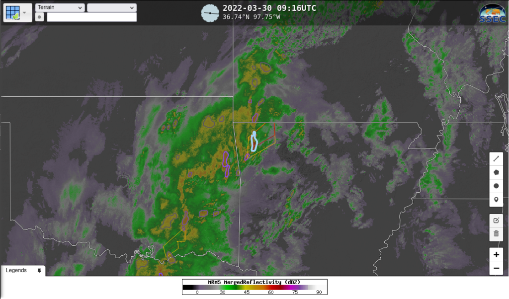
ProbSevere version 3 at 0916 UTC shows a maximum over the severe storm near Springdale, AR. The ProbSevere readout (from this website) for that radar object, shows a maximum value at 0910 UTC.

Use the model forecast fields to better identify the regions of risk in the 3-12 hour timeframe, and then use observation-based products to hone in on exactly where the biggest threat exists.

