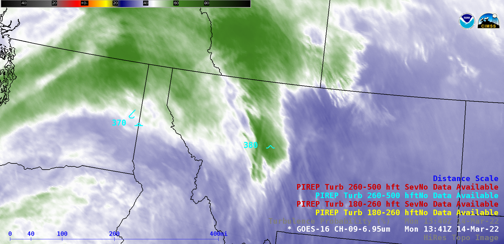
Turbulence associated with an orographic banner cloud over Montana

GOES-16 Mid-level Water Vapor (6.9 µm) images + plots of pilot-reported turbulence, with and without an overlay of Turbulence Probability [click to play animated GIF | MP4]
A GOES-16 Cloud Top Height derived product (below) indicated that the banner cloud tops were in the 37,000-40,000 feet range (darker blue enhancement) — the altitude of many pilot reports of turbulence that day.
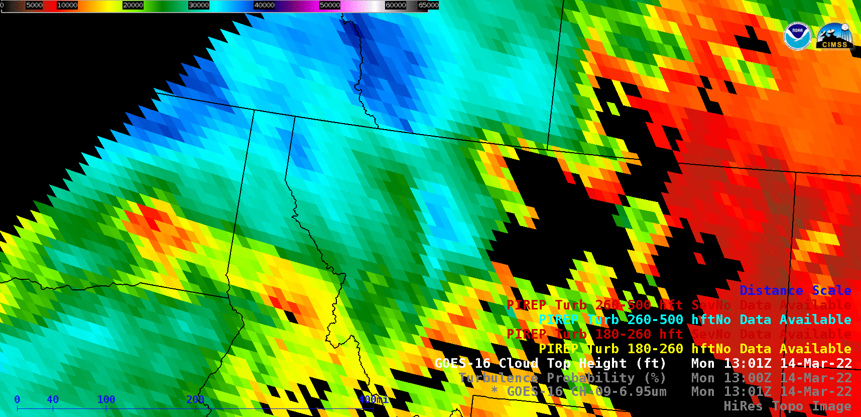
GOES-16 Cloud Top Height derived product, with plots of pilot-reported turbulence [click to play animated GIF | MP4]