Sheared Tropical Storm Peter
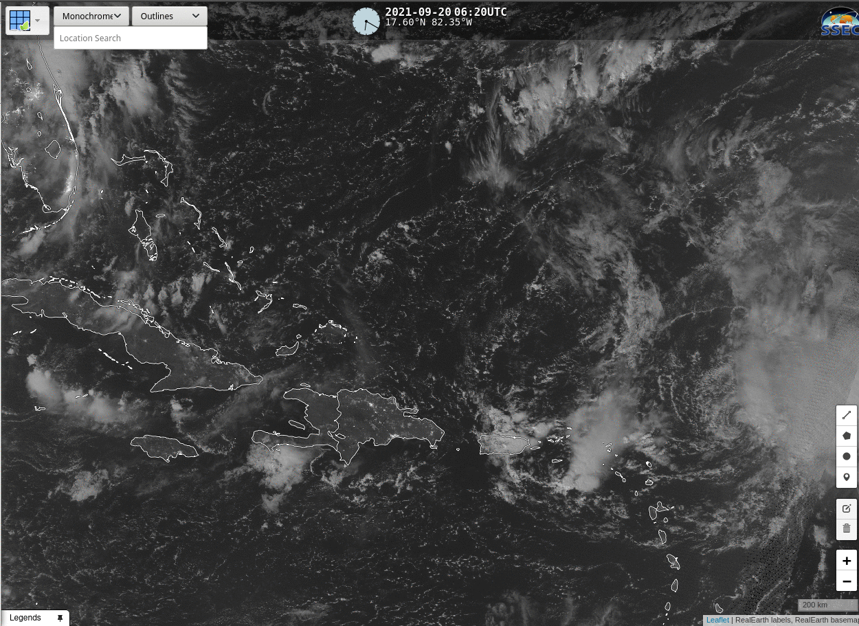
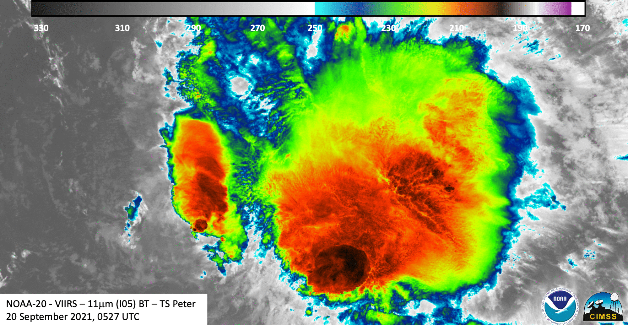
Suomi NPP Day Night imagery, in a toggle above with infrared imagery from GOES-16, (both displayed in RealEarth) depicts a classic sheared Tropical Cyclone structure to the east-northeast of the Caribbean Sea. The low-level circulation (very apparent in the nighttime visible imagery under the illumination of a near-full moon) is displaced to the west of the deep convection near the edge of this Suomi NPP scan. Indeed, the low-level circulation is difficult to discern in the single enhanced infrared image (animation better reveals its structure however). An earlier (0527 UTC) overpass from NOAA-20, below (VIIRS imagery courtesy William Straka, CIMSS), also shows the circulation to the west of the main convection. It would be a challenge to locate correctly the storm center based solely on the VIIRS infrared imagery!
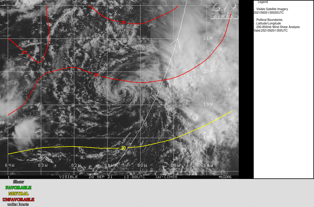
The shear that is disrupting TS Peter’s structure is shown below (imagery from the SSEC Tropical website), overlain on top of 1-km visible imagery at 1300 UTC.
For more information on struggling Tropical Storm Peter, visit the website of the National Hurricane Center.