Blowing dust in the Upper Midwest
![GOES-16 Split Window Difference images, with plots of wind barbs and gusts [click to play animation | MP4]](https://cimss.ssec.wisc.edu/satellite-blog/images/2021/05/210524_goes16_splitWndowDifferencewinds_ND_MN_anim.gif)
GOES-16 Split Window Difference images, with plots of wind barbs and gusts [click to play animation | MP4]
The corresponding GOES-16 Split Window Difference images with plots of surface visibility are shown below — at 23 UTC the visibility dropped to 4 miles at Grand Forks, North Dakota as a dense dust plume moved through that location (where southwesterly winds were gusting to 31 knots at that time).
![GOES-16 Split Window Difference images, with plots of surface visibility [click to play animation | MP4]](https://cimss.ssec.wisc.edu/satellite-blog/images/2021/05/210524_goes16_splitWindowDifference_visiblity_ND_MN_anim.gif)
GOES-16 Split Window Difference images, with plots of surface visibility [click to play animation | MP4]
![GOES-16 True Color RGB images [click to play animation | MP4]](https://cimss.ssec.wisc.edu/satellite-blog/images/2021/05/210524_goes16_trueColorRGB_ND_MN_blowing_dust_anim.gif)
GOES-16 True Color RGB images [click to play animation | MP4]
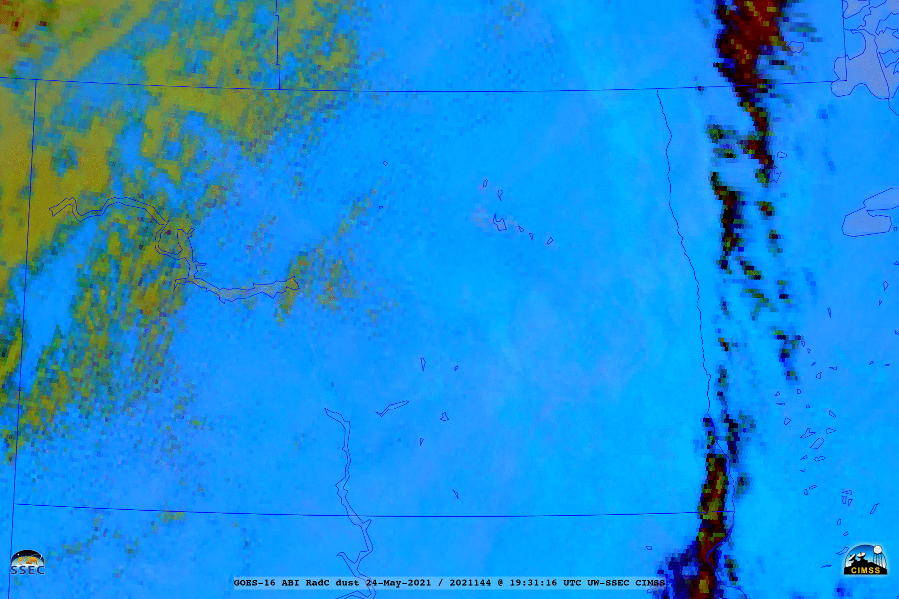
GOES-16 Dust RGB images [click to play animation | MP4]
Plenty of backscatter thanks to the dust pic.twitter.com/bQDpSIwXry
— Aaron Kennedy (@KennedyClouds) May 24, 2021
===== 25 May Update =====
![GOES-16 Dust RGB images, with and without plots of surface reports [click to play animation | MP4]](https://cimss.ssec.wisc.edu/satellite-blog/images/2021/05/210525_goes16_dustRGB_ND_MN_blowing_dust_anim.gif)
GOES-16 Dust RGB images, with and without plots of surface reports [click to play animation | MP4]
GOES-16 True Color RGB images (below) once again showed the hazy signature of blowing dust.
![GOES-16 True Color RGB images [click to play animation | MP4]](https://cimss.ssec.wisc.edu/satellite-blog/images/2021/05/210525_goes16_trueColorRGB_ND_SD_MN_blowing_dust_anim.gif)
GOES-16 True Color RGB images [click to play animation | MP4]