Using NUCAPS lapse rates to evaluate atmospheric stability

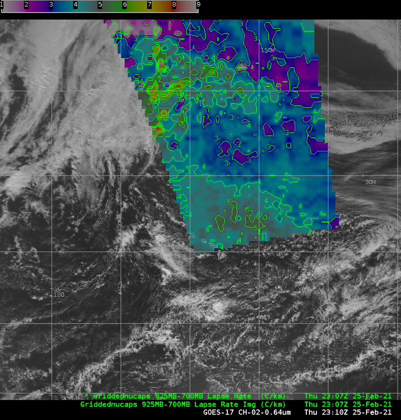
GOES-17 Visible Imagery (2300 UTC), NOAA-20 NUCAPS-derived lapse rate (925 – 700 mb, 23:03 UTC) and NUCAPS sounding points (2249 UTC) on 25 February 2021 (Click to enlarge)
NUCAPS profiles derived from CrIS and ATMS data on NOAA-20 provide model-independent estimates of atmospheric thermodynamics globally, including, for this case over the central Pacific Ocean, in regions otherwise bereft of data. NUCAPS lapse rates show a minimum in stability in low-levels in between two cloud features; the region includes mostly ‘green’ NUCAPS retrieval points: where infrared and microwave retrievals have both converged. It is difficult in the case above to relate differences in cloud features to differences in the diagnosed stability.
Four minutes later (shown below), NOAA-20 was closer to the Pole on this ascending pass and the diagnosed stability does relate well to differences in cloud structures. In particular, the change from lapse rates around 5 C/km northeast of Hawai’i to lapse rate closer to 2 or 3 C/km even farther northeast aligns with a boundary between cloud types.

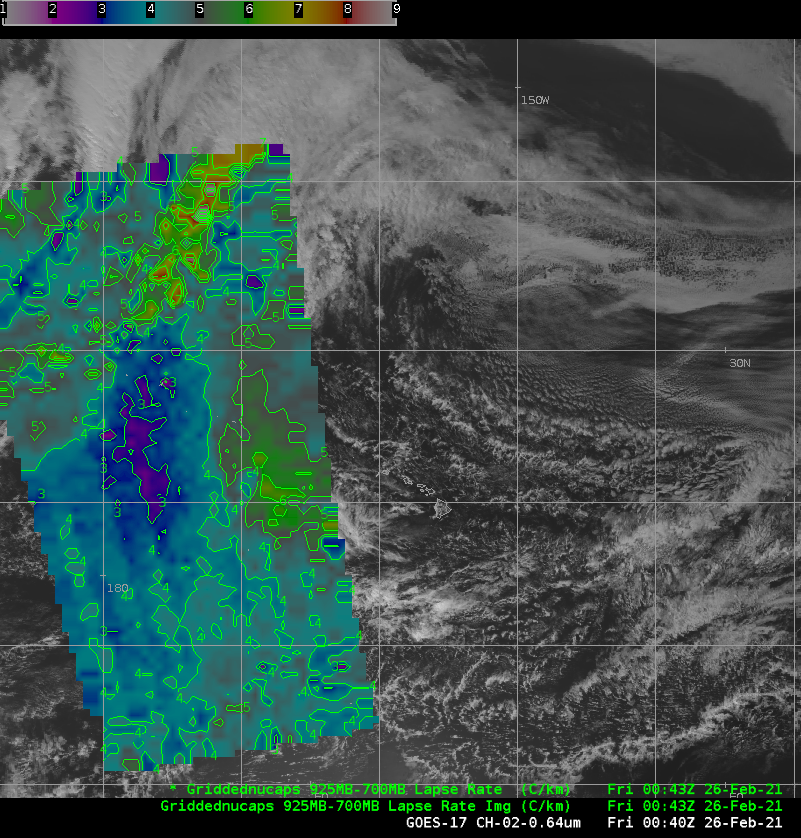
GOES-17 Visible Imagery (2310 UTC), NOAA-20 NUCAPS-derived lapse rate (925 – 700 mb, 23:07 UTC) and NUCAPS sounding points (2249 UTC) on 25 February 2021 (Click to enlarge)
The subsequent NOAA-20 pass was west of the main Hawai’ian Island chain. Again, differences in lapse rates are related to cloud features in the visible imagery. Stable air — with lapse rates between 3 and 4 C/km — overlies a region of very little cumuliform development. A region of larger lapse rates over the eastern 1/3rd of the pass, just to the west of the Hawai’ian Islands is accompanied by cumulus development. NUCAPS thermodynamic fields, even though they have limited resolution in the vertical (at most 10 layers in the enter tropopause), can give useful information on stability over the ocean that can help in the real-time diagnosis of the atmosphere.