Long-range transport of California wildfire smoke across the Upper Midwest
![GOES-16 True Color RGB images [click to play animation | MP4]](https://cimss.ssec.wisc.edu/satellite-blog/images/2020/08/200824_goes16_trueColorRGB_CA_wildfire_smoke_anm.gif)
GOES-16 True Color RGB images [click to play animation | MP4]
Images of 532 nm and 1064 nm lidar attenuated backscatter collected and processed by the University of Wisconsin Lidar Group at Madison from 00 UTC on 24 August to 00 UTC on 25 August (below) indicated that this smoke existed within altitudes between 2 km and 6 km.
![532 nm and 1064 nm lidar attenuated backscatter during 24 August at Madison, Wisconsin [click to enlarge]](https://cimss.ssec.wisc.edu/satellite-blog/images/2020/08/200824_532backscatter_1064backscatter_Madison_WI_anim.gif)
532 nm and 1064 nm lidar attenuated backscatter over Madison, Wisconsin [click to enlarge]
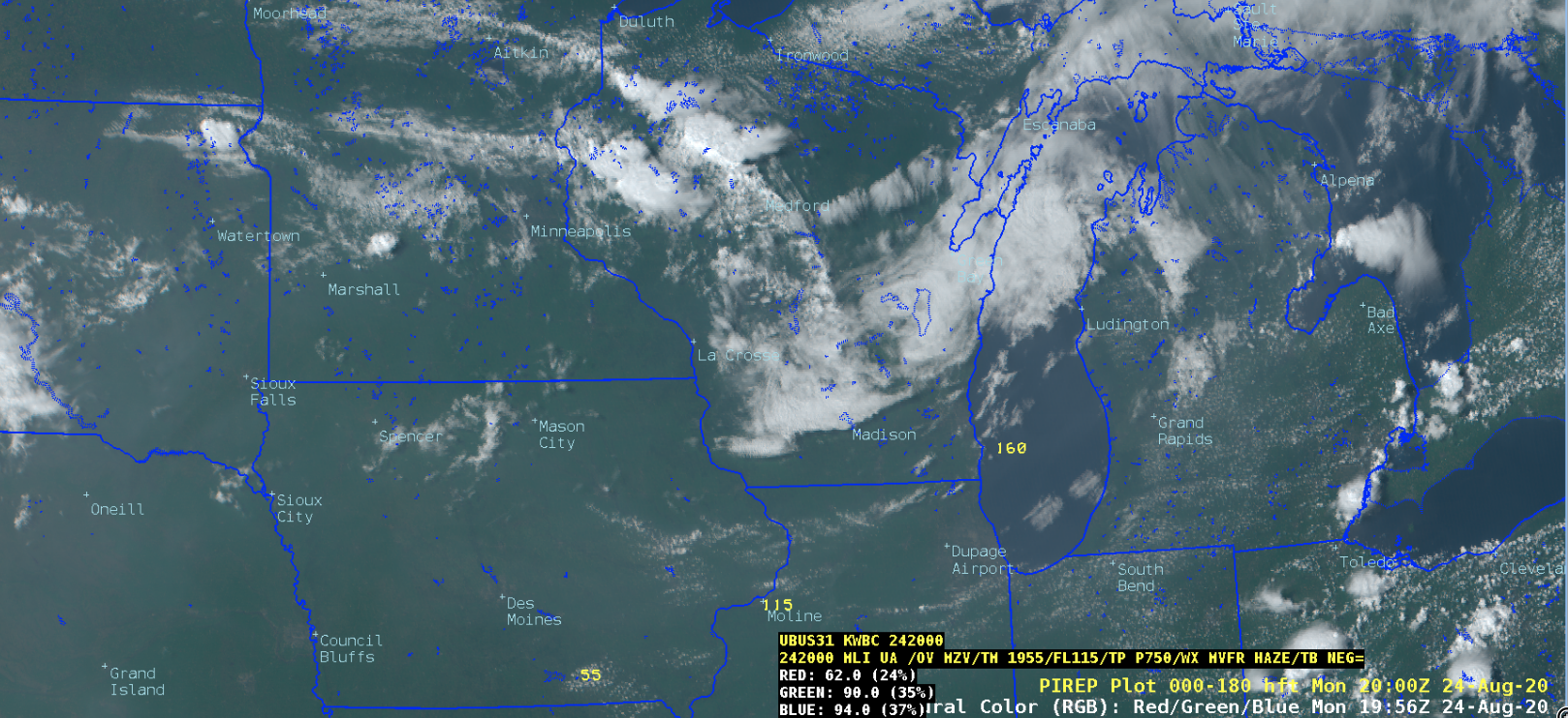
![CIMSS Natural Color RGB images, with plots of Pilot Reports [click to play animation | MP4]](https://cimss.ssec.wisc.edu/satellite-blog/images/2020/08/200824_goes16_cimssNaturalColorRGB_pireps_Upper_Midwest_smoke_anim.gif)
CIMSS Natural Color RGB images, with plots of Pilot Reports [click to play animation | MP4]