Snow squalls across the Upper Midwest
GOES-16 “Red” Visible (0.64 µm), “Clean” Infrared Window (10.35 µm) and Day Cloud Phase Distinction RGB images [click to play animation | MP4]
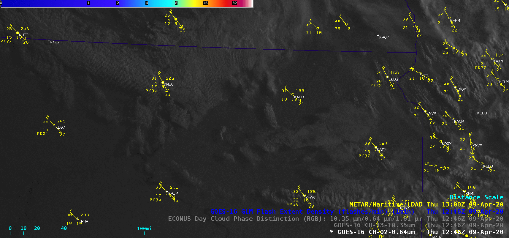
Farther to the south and east, NWS Sioux Falls also issued a Snow Squall Warning — similar signatures of convective elements were seen in the GOES-16 imagery (below), including the glaciation of some of the cloud tops. Snowfall amounts were generally light (around 0.1 inch), but surface visibility was reduced to zero in some of the snow squalls.
![GOES-16 "Red Visible (0.64 µm), "Clean" Infrared Window (10.35 µm) and Day Cloud Phase Distinction RGB images [click to play animation | MP4]](https://cimss.ssec.wisc.edu/satellite-blog/images/2020/04/200409_goes16_visible_infrared_dayCloudPhaseDistinction_FSD_snow_squalls_anim.gif)
GOES-16 “Red” Visible (0.64 µm), “Clean” Infrared Window (10.35 µm) and Day Cloud Phase Distinction RGB images [click to play animation | MP4]
![GOES-16 "Red Visible (0.64 µm), "Clean" Infrared Window (10.35 µm) and Day Cloud Phase Distinction RGB images [click to play animation | MP4]](https://cimss.ssec.wisc.edu/satellite-blog/images/2020/04/200409_goes16_visible_infrared_dayCloudPhaseDistinction_DLH_snow_squalls_anim.gif)
GOES-16 “Red” Visible (0.64 µm), “Clean” Infrared Window (10.35 µm) and Day Cloud Phase Distinction RGB images [click to play animation | MP4]
A snow squall warning continues until 9:45 AM CDT for US-12, US-281 near Aberdeen, SD. pic.twitter.com/Mth1pPxq5d
— NWS Aberdeen (@NWSAberdeen) April 9, 2020
A snow squall warning is in effect until 11:00 AM CDT for I-29, US-14 near Brookings, SD. pic.twitter.com/u0LuYBJ2WR
— NWS Sioux Falls (@NWSSiouxFalls) April 9, 2020
A snow squall warning is in effect until 8:30 AM CDT for I-35 near Cloquet, MN and I-35, I-535, US-2, US-53 near Duluth, MN–WI. pic.twitter.com/mz3R9UBjsy
— NWS Duluth (@NWSduluth) April 9, 2020
Important aspects of the boundary layer across the Upper Midwest were revealed by plots of rawinsonde data from Aberdeen, South Dakota and International Falls, Minnesota (below) — steep low-level lapse rates (surface – 3 km values of 7ºC per km) with ample moisture, and strong winds. The upper portion of the shallow convective layers were within the important -12 to -18ºC dendritic growth zone.
![Plots of 12 UTC rawinsonde data from Aberdeen, South Dakota and International Falls, Minnesota [click to enlarge]](https://cimss.ssec.wisc.edu/satellite-blog/images/2020/04/200409_12UTC_KABR_KINL_RAOBS.GIF)
Plots of 12 UTC rawinsonde data from Aberdeen, South Dakota and International Falls, Minnesota [click to enlarge]