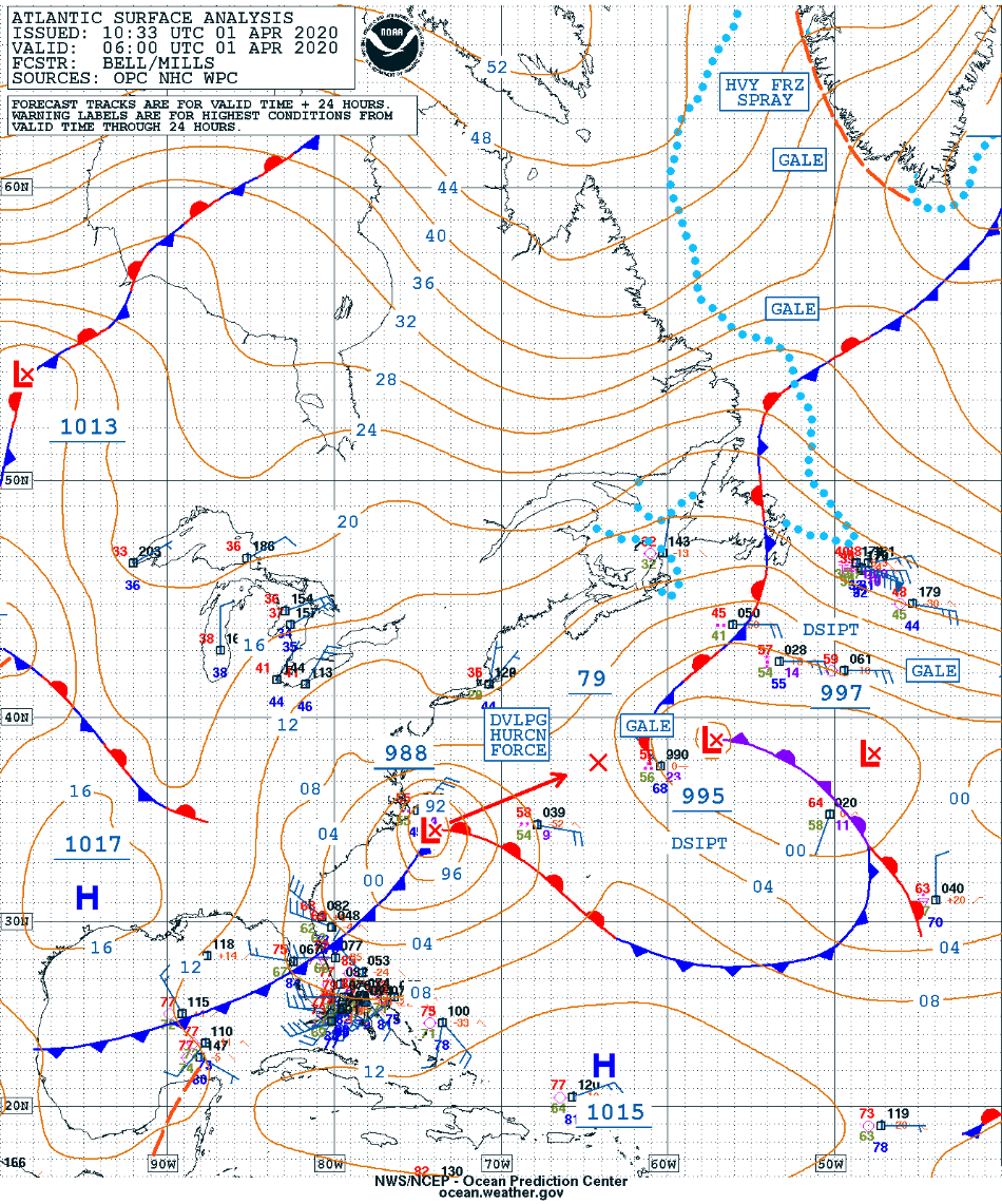
Hurricane Force low pressure system off the US East Coast
![GOES-16 “Red” Visible (0.64 µm), Mid-level Water Vapor (6.9 µm) and Air Mass RGB images [click to play animation | MP4]](https://cimss.ssec.wisc.edu/satellite-blog/images/2020/04/200401_goes16_visible_waterVapor_airMassRGB_Atlantic_storm_anim.gif)
GOES-16 “Red” Visible (0.64 µm), Mid-level Water Vapor (6.9 µm) and Air Mass RGB images [click to play animation | MP4]
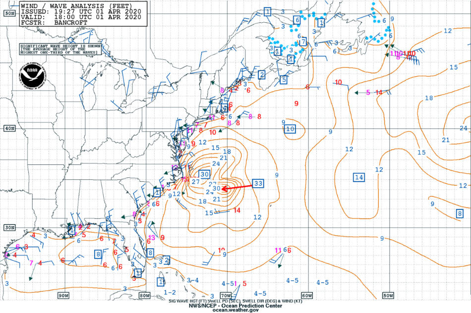
The hurricane-force winds at the surface were creating seas as high as 33 feet. The milky/hazy signature of a highly-agitated sea surface + sea spray — immediately south of the convection around the core of the storm — was evident in GOES-16 True Color RGB images, created using Geo2Grid (below).
![GOES-16 True Color RGB images [click to play animation | MP4]](https://cimss.ssec.wisc.edu/satellite-blog/images/2020/04/200401_goes16_trueColorRGB_W_Atlantic_Hurricane_Force_low_anim.gif)
GOES-16 True Color RGB images [click to play animation | MP4]
![GOES-16 “Red” Visible (0.64 µm), Mid-level Water Vapor (6.9 µm) and Air Mass RGB images [click to play animation | MP4]](https://cimss.ssec.wisc.edu/satellite-blog/images/2020/04/200401_goes16_visible_glmFlashExtentDensity_East_Coast_storm_anim.gif)
GOES-16 “Red” Visible (0.64 µm) images with an overlay of GLM Flash Extent Density [click to play animation | MP4]
![Suomi NPP VIIRS Day/Night Band (0.7 µm) and Infrared Window (11.45 µm) images [click to enlarge]](https://cimss.ssec.wisc.edu/satellite-blog/images/2020/04/200401_0627utc_suomiNPP_viirs_dayNightBand_infraredWindow_W_Atlantic_anim.gif)
Suomi NPP VIIRS Day/Night Band (0.7 µm) and Infrared Window (11.45 µm) images [click to enlarge]