Stereoscopic views of Tropical Storm Olga in the Gulf of Mexico
GOES-16 (left) and GOES-17 (right) Red Visible (0.64 µm) imagery, 1230 – 2350 UTC on 24 October 2019. To view in three dimensions, cross your eyes until 3 images are apparent, and focus on the image in the middle (Click to animate)
GOES-16 (left) and GOES-17 (right) Red Visible (0.64 µm) imagery, 1240 – 2350 UTC on 25 October 2019. To view in three dimensions, cross your eyes until 3 images are apparent, and focus on the image in the middle (Click to animate)
GOES-16 and GOES-17, although separated by 60 of longitude, can be combined to create stereoscopic imagery in the Gulf of Mexico. The top-most animation, from 24 October 2019, shows the disturbance in the southwest Gulf of Mexico that ulimately becomes Tropical Storm Olga. The bottom animation is from 25 October, a day when the low-level circulation of the storm is apparent.
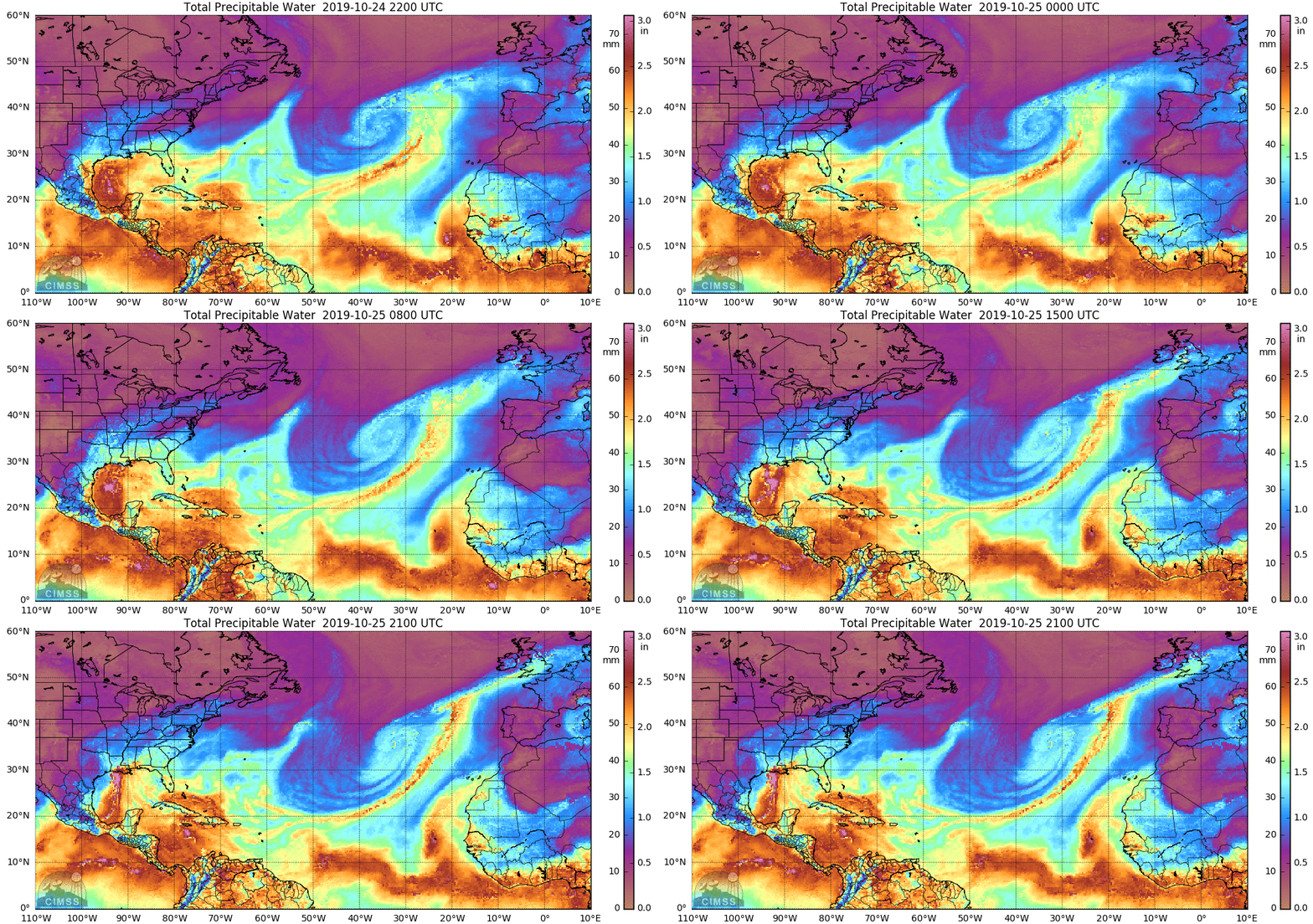
Tropical Storm Olga is at the northern edge of a very moist airmass as determined from Microwave measurements. The MIMIC animation, below, from this site, shows the extent of the moist region. (The moisture associated with Pablo is also apparent) Dry air moving into the Gulf of Mexico from Texas is restricting the horizontal extent of the moisture. That front moving into the Gulf is expected to overtake Olga as it transitions to an extratropical storm. Heavy rains with this system have already moved into Louisiana and Mississippi.

Microwave-derived Total Precipitable Water, hourly for the 24 hours ending at 21 UTC on 25 October 2019 (Click to enlarge)
For more information on Tropical Storm Olga, refer to the website of the National Hurricane Center. Interests along the Gulf Coast and inland should pay attention to this storm.

